The March 27, 1964, Great Alaska Earthquake remains the second-largest ever recorded in the world. Each earthquake releases energy when rock ruptures after accumulating strain. The energy release from the 1964 quake was so large because 600 miles of fault ruptured at once and moved up to 60 feet.
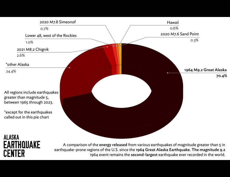
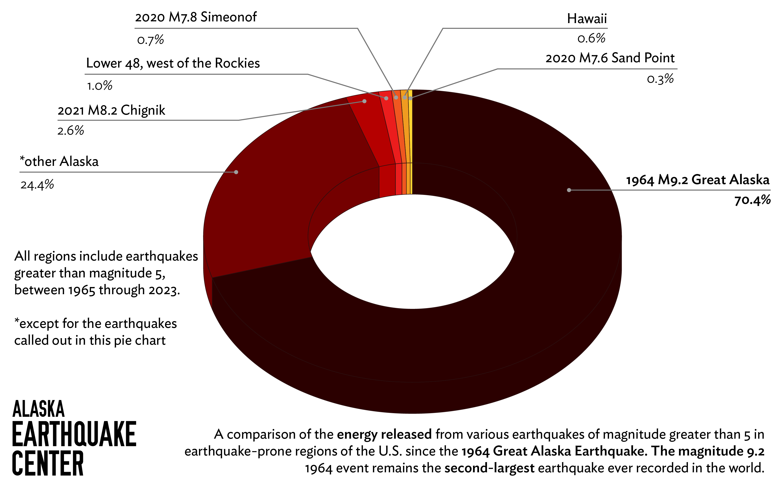
Alaska Earthquake Center Senior Scientist Natalia Ruppert converted the magnitudes of various sets of earthquakes across the U.S. since 1964 to their released energy and compared them to the 1964 quake.
The 1964 event dwarfs all subsequent U.S. quakes. Of all individual and combined earthquakes greater than magnitude 5, 70.6% of the energy released was from the Great Alaska Earthquake.
On March 27, 1964, at 5:36 p.m. local time, an earthquake of magnitude 9.2 initiated in the Prince William Sound region of Alaska.
The earthquake’s scientific impacts were monumental in shaping understanding of plate tectonics and subduction-zone earthquakes, as well as shaping approaches to understanding and modeling tsunamis. The earthquake generated tsunamis by shifting land and by causing landslides. They caused damage as far south as California, and the tectonic tsunami even reached Antarctica.
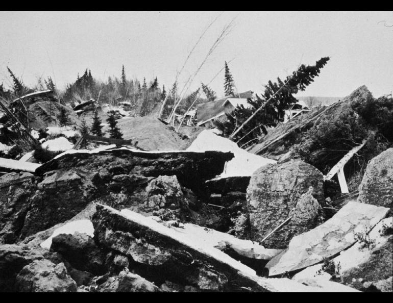
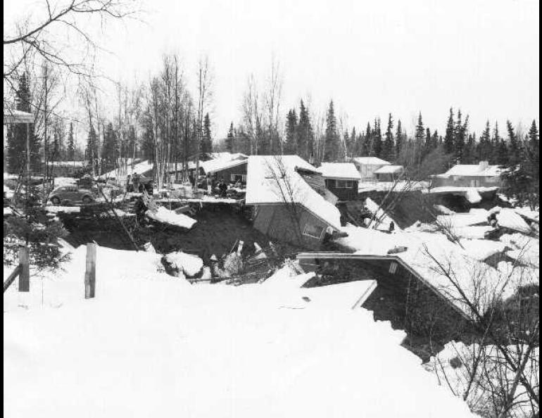
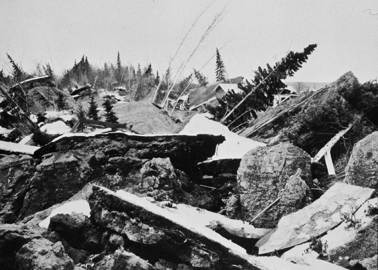
Shaking from the 1964 earthquake lasted about five minutes. Sustained intense shaking caused countless landslides. Land shifted significantly and the landscape of southcentral Alaska was permanently changed.
Damage from the earthquake was widespread, but fatalities were fairly small for an event of this size. Societal impacts were also immense, not only in the communities directly impacted by the event but also across Alaska.
More on the 1964: tsunami: https://storymaps.arcgis.com/stories/c146aa74a3694059b4c0e5db33559a49
Photo archive: https://ready.alaska.gov/64Quake/Photos