Albedo change about to alter Alaska
You can see it on the mountains—a clean, platinum finish that wasn’t there yesterday. It’s in the forecast for here in the lowlands, too. Snow. Our world is about to change.
We knew it was coming, right? The day I’m writing this, Sept. 21, is the average date at least a trace of snow shows up at the Fairbanks International Airport. So says my friend, National Weather Service hydrologist and fan-of-the-cold Ed Plumb.
Sept. 21 is also the date of the earliest measureable snowfall in Anchorage. The average date that snow endures for the winter in Anchorage is Oct. 16. Those in Barrow have already seen the white blanket; their average first date of measureable snowfall is Aug. 26.
Whatever the day, when snow appears and sticks, warmish temperatures usually don’t make a comeback. A good case study for this was the abbreviated autumn of 1992 in Interior Alaska. Here in Fairbanks, about eight inches of snow fell on Sept. 13. You can still see some birches bent in an arc they assumed that day, when wet snow weighed down branches still adorned with leaves.
“When we had this early snowcover (in 1992), we had a lot of calendar days with low temperature records set,” said Ted Fathauer, a forecaster since the 1970s at the Fairbanks Forecast Office of the National Weather Service.
That month became the September with the lowest average temperature for Fairbanks, with a low of 3 degrees Fahrenheit on Sept. 30. More than 24 inches of snow fell in September 1992, and the early snowfall made things cooler, Fathauer said.
“The incoming (solar) radiation was effectively reflected by the snowpack,” he said. “It’s the quality that physicists have dubbed ‘albedo.’”
Albedo, or reflectivity, has its roots in the Latin word albus, or white. Snow reflects as much as 95 percent of the solar radiation that strikes it. With that new white coating and a sun angle that decreases with the day, winter settles into Alaska for good, with a punch like no other place in America.
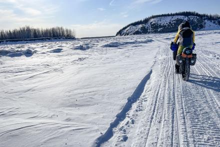
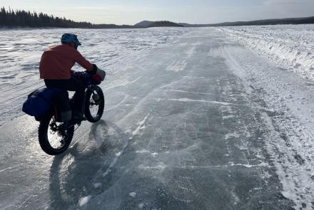
Soon, cold air will ooze into the quiet valleys, rivers will steam until they freeze, and lowland bogs will solidify, increasing Alaska’s navigable terrain by a wide margin.
And it all starts with snow, which reflects sunlight so well that climbers on Denali’s Kahiltna Glacier can simultaneously ski and develop sunburn on the roofs of their mouths as they gasp for air.
That same physical property of extreme reflection is why decreasing amounts of sea ice floating on the northern oceans are a big deal. The less ice, the more dark water that absorbs energy from the sun, and the less ice that forms. On it goes.
Here, a bit farther south than the sea ice zone, the season of white is once again returning. Celebrate if you’re a dog musher, and ask yourself what you are doing here if you don’t like snow. For up to seven months, and at least portions of the coldest three months, the entire state can be blanketed from the top of Denali—which is white on the hottest day of the year—to Annette on the far south end of the Panhandle, which manages an enduring snow cover even though it doesn’t feature a month with an average temperature below freezing.


