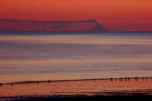
Augustine volcano as tsunami generator
On October 6, 1883, someone wrote this entry in the Alaska Commercial Company logbook at a trading post at English Bay, Alaska, about 50 miles northeast of Augustine volcano:
“This morning at 8:15 o’clock, 4 tidal waves flowed with a westerly current, one following the other . . . the sea rising 20 feet above the usual level. At the same time the air became black and (foggy), and it began to thunder . . . it began to rain a finely powdered brimstone ash.”
Augustine, which erupted explosively at the beginning of 2006, also erupted in 1883 but with a dramatic difference: part of the mountain tumbled into the sea in a giant landslide. That landslide caused a tsunami that crossed lower Cook Inlet and hit the southernmost Kenai Peninsula.
Because the tsunami happened at low tide in an area with some of the largest tidal ranges on Earth, the 20-foot high wave flooded areas only slightly above the high tide line. Researchers think the damage from the 1883 tsunami was limited: some low-lying shelters flooded, and a few kayaks floated away.
The 1883 eruption of Augustine and the resulting tsunami intrigue Jim Beget, a scientist with the Geophysical Institute at the University of Alaska Fairbanks and the Alaska Volcano Observatory. He traveled to Augustine volcano as recently as last summer to gather evidence of the 1883 event he read about in the old logbook.
On the island, Beget found driftwood scattered high on shore above the beaches, beyond the point where severe storms might deposit wood. Using that wood and deposits of marine mud, sea shells, and beach sand found within the soil of the island, Beget figured that the 1883 waves on Augustine Island reached a maximum height of more than 50 feet near where the giant volcanic landslide entered the sea. Traveling around Cook Inlet, Beget found deposits from the 1883 tsunami along the coast near Mt. Illiamna, the village of Nanwelak (formerly the English Bay of the Alaska Commercial Co. journal), and the town of Homer.
The 1883 tsunami happened because the north side of the mountain that is Augustine volcano collapsed into the sea. Since then, the volcano has healed the scar, filling it with lava during eruptions in 1935, 1963, 1976, 1986, and again in 2006.
“Augustine gets higher and higher and higher with each eruption,” Beget said. “In 2006, it added another new dome.”
Some active volcanoes accumulate enough material that they get to a collapse point. That’s what happened to Augustine in 1883, and has happened to a few other volcanoes over time. Though have been about a dozen recorded collapses of Augustine in the last 2,000 years, people didn’t think of giant landslides from volcanoes as much of a hazard until 1980.
“When St. Helens collapsed, it was a big surprise to most people,” Beget said. “Now we realize it’s not that surprising.”
Scientists at the Alaska Volcano Observatory now watch Augustine and other Alaska volcanoes for signs of a pending implosion, such as earthquakes and changes in shape of the mountain they can detect with global positioning system receivers cemented into its flanks.
Beget and Zygmunt Kowalik of the Institute of Marine Sciences at UAF recently authored a paper in which they confirmed travel times of an Augustine-generated tsunami calculated by computer model. The model calculated that a tsunami would reach Homer in about 75 minutes. Travel time to Anchorage would be around four hours, but only small waves would reach that far up Cook Inlet. Beget and Kowalik also found that because of sea floor characteristics, tsunamis would be larger along the Illiamna coastline and near Nanwelak, Homer, and Anchor Point.
Depending on the state of the daily tides in Cook Inlet, a tsunami from Augustine would either be catastrophic or an interesting footnote to another eruption.
“If it happens at low tide, we’ll consider ourselves lucky,” Beget said.


