December's Wild Weather
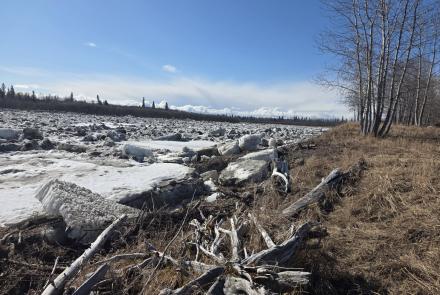
I don't know how it went for you, but by the fourth time I shovelled out the wretched car during the recent holiday season, I had just plain had it with snow. And, yes, science was slipping too: I had this vision of a wicked witch of the north with a gigantic vacuum cleaner. She was sitting atop Denali, pulling wet air out of the Gulf of Alaska and freezing it solid just inland of Nome, and all Alaskans were being buried under tons of white crud.
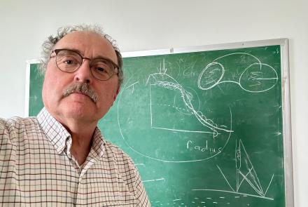
I've been able to shape a more accurate picture of what went on during December's closing days, thanks to Hiroshi Tanaka. He's an assistant professor of physics and climate expert here at the Geophysical Institute, and he gave me a short report explaining what's been going on with our weather.
He took December 21---our warm, wet winter solstice---as an example. Interior Alaska was indeed warm that day, with temperatures close to the freezing (or melting) point. That's 40°F above normal for the day. Nenana had rain; at the Fairbanks International Airport, a snowfall of 9.2 inches was recorded.
Meanwhile, Seattle, San Francisco, and points south were enduring a cold wave. Tanaka explained that this was no coincidence. It's all part of what we are coming to understand as our fully interconnected planet. The West Coast's chill and our wet warmth illustrate teleconnection of the atmosphere.
Earth's atmosphere is heated in the tropics, from incoming sunshine, and cools in the high latitudes, through radiation to space. If there were no exchange between high and low latitudes---no meridional heat transport, as the climatologists put it---the tropics would get hotter and hotter, the polar regions colder and colder. We're saved from that unlivable arrangement because the atmosphere isn't stable. When the temperature difference between Earth's tropical and high-latitude air masses reaches a certain critical value, the atmospheric instability is expressed in turbulent exchanges between the areas. (The critical difference is not clearly defined, Tanaka noted, but it's near 70°on the Celsius scale. Plus thirty over the tropics, minus forty over the high latitudes, sets up the potential for turbulent exchange.) That is, high- and low-pressure systems appear in the midlatitudes, and on the daily weather charts. If you think of these as gigantic waves, which they actually are, then the scale of these waves is typically about 4000 kilometers (close to 2500 miles) from peak to peak---high pressure cell to high pressure cell or low to low.
Sometimes these waves reach true planetary scale, 10,000 kilometers or more. Planetary waves in the atmosphere are amplified by Earth's topography; they react with the Tibetan Plateau and with the Rocky Mountains, for example. The topography can work with the weaker atmospheric instability as well as scale-interaction processes to generate a high-pressure ridge on the western side of these massive sections of high ground. Our recent weather troubles came from just such a situation: the high-pressure ridge developed an ominous stability off the Pacific Northwest coast. It became a so-called blocking high, be cause it blocked the normal flow of the main westerly jet stream.
And that's just what it looked like on the computerized weather images shown by unhappy-looking forecasters on television. It seemed as if the jet stream was dragging wet, warm air up into Alaska, frigid polar air down along the Canadian and contiguous U.S. Pacific coasts.
Pushed and pulled, the December weather may have seemed weird, but it wasn't witchcraft. Abnormal weather patterns appearing simultaneously at great distances are simply examples of atmospheric teleconnection, and this recent pattern was merely an exceptionally clear example.
Or so Tanaka has assured me. But somehow, I still hear faint but evil cackling every time I look at that dratted snow shovel.