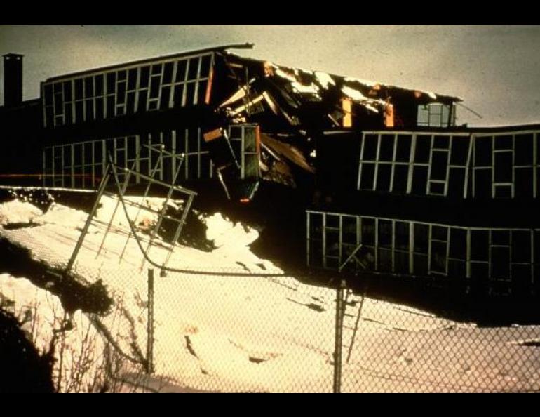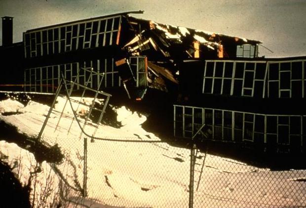
Forty years since the big one
On the phone from the Kodiak Senior Center, Eddie Opheim Sr. remembered back to the day 40 years ago when he felt the rumble of the Great Alaska Earthquake.
“I knew the earthquake was going to come because I felt the tremor,” said Opheim, 93. “I told my family there was an earthquake coming, and to hang on.”
Opheim, his wife, and four children lived on Spruce Island north of Kodiak when the largest earthquake in the written history of North America struck on March 27, 1964. After riding the bucking ground for what seemed like forever, Opheim and his family headed for high country in his Jeep. Later, in the darkness of night, he heard the monstrous groans and pops of his buildings as a giant wave known as a tsunami swept away everything he had.
“We lost a sawmill, both boat shops, our barn and cattle and our home,” Opheim said. “We lived in an Army tent for awhile until I built shacks out of scrap lumber that was left on the beaches.”
Opheim and his family survived the second-largest earthquake recorded in modern times, the magnitude 9.2 that occurred on March 27, 1964 at 5:36 p.m. Alaska time. One hundred fifteen Alaskans died as a result of the earthquake and the tsunamis that followed, as did 16 people in Oregon and California.
On that day 40 years ago, Alaska shook for about four minutes, about as long as it takes to listen to a song on the radio. During that time, the gargantuan Pacific plate slid under the North American plate an average of about 30 feet. The earthquake rupture began at the meeting place of the two plates about 15 miles deep under College Fiord.
The Alaska earthquake released 100 times as much energy as the 1906 San Francisco earthquake, and the only larger earthquake ever recorded was a 1960 magnitude 9.5 in Chile. Seismic waves traveled through the planet for weeks as Earth rang like a bell from the shock of the Alaska earthquake, wrote Doug Christensen, associate director of the University of Alaska’s Geophysical Institute. Water sloshed in lakes and harbors as far away as Louisiana, and water levels jumped in wells as far away as South Africa.
During the earthquake, more than 100,000 square miles of Alaska broke, twisted, tilted, dropped and rose. Seward moved about 47 feet south; Cordova migrated 46 feet southeast. Parts of Montague Island rose more than 30 feet; areas around Portage dropped nine feet. According to a National Academy of Sciences study commissioned by President Lyndon Johnson in 1964, the earthquake also killed 90 percent of the mussels in Prince William Sound, stopped the flow of Ship Creek in Anchorage for 18 hours, and shortened the intervals between eruptions of Old Faithful geyser in Yellowstone National Park.
The greatest loss of life during the earthquake occurred at Valdez, where the earthquake caused a chunk of the town’s waterfront to slide into the sea; the collapse of a dock and waves generated from the underwater landslide killed 32 people there.
The tilted floor of the Gulf of Alaska caused tsunamis that ate shorelines like rapidly rising tides, reaching 100 feet above sea level in Shoup Bay near Valdez and 60 feet at Kodiak. The tsunami destroyed 158 houses in and around Kodiak and killed eight people there. Tsunamis killed 12 people in Seward and Whittier, 23 in the village of Chenega, and destroyed the waterfronts of Homer, Cordova, and other coastal towns. In Crescent City, California, more than 1,500 miles from Alaska, tsunami waves washed over five streets parallel to the beach, killing 12 people there.
Another 1964-type earthquake is certain to happen, but the question is when, according to Jeff Freymueller, a research associate professor at the Geophysical Institute. Geologic studies suggest that an earthquake like 1964 may repeat every 500-600 years for Prince William Sound, but magnitude 8 earthquakes strike Kodiak much more often, about once a century.


