Lakes hold signs of past earthquakes
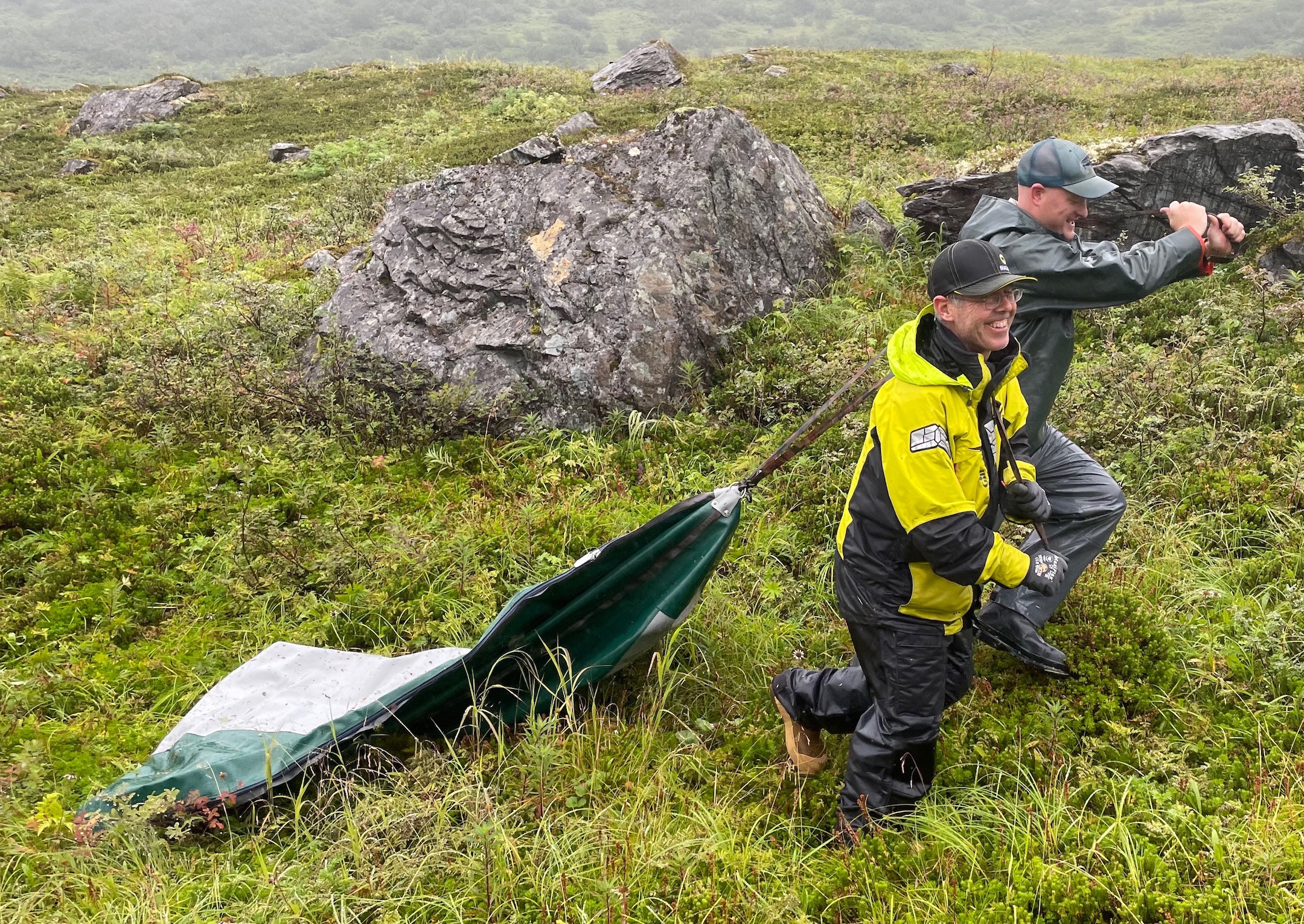
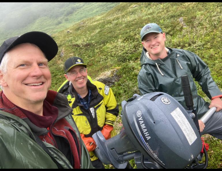
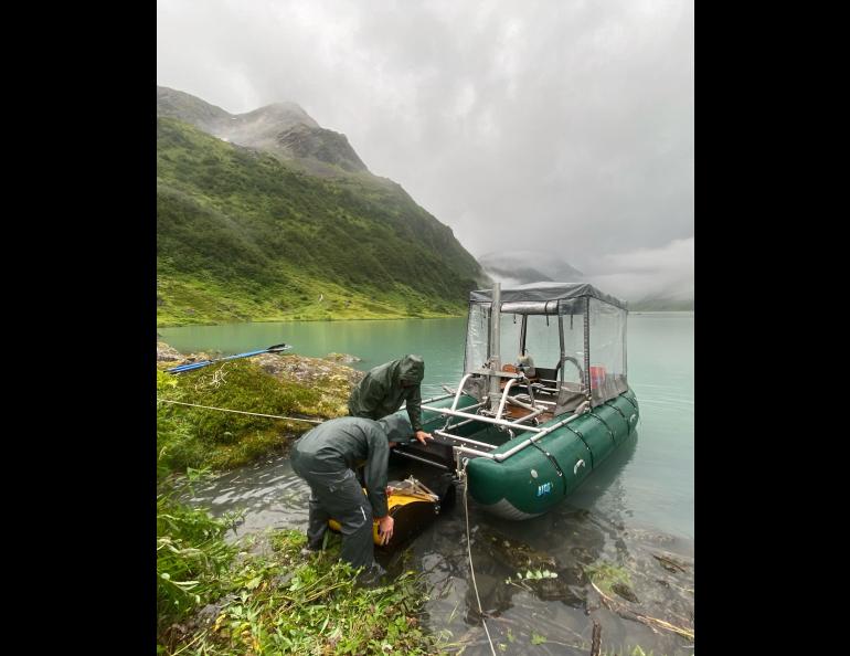
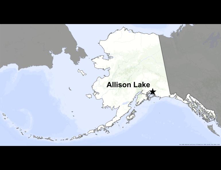
ALLISON LAKE, ABOVE VALDEZ — Three men dressed in full raingear crept like ants across a bumpy green landscape on Aug. 25, 2023. Using a metal pole that was part of a boat frame, together they lugged a four-stroke outboard motor that seemed to float above the wet greenery.
The three men were scientists who were curious about what a nearby lake could tell them about past earthquakes. Rainy weather had transformed them into pack mules.
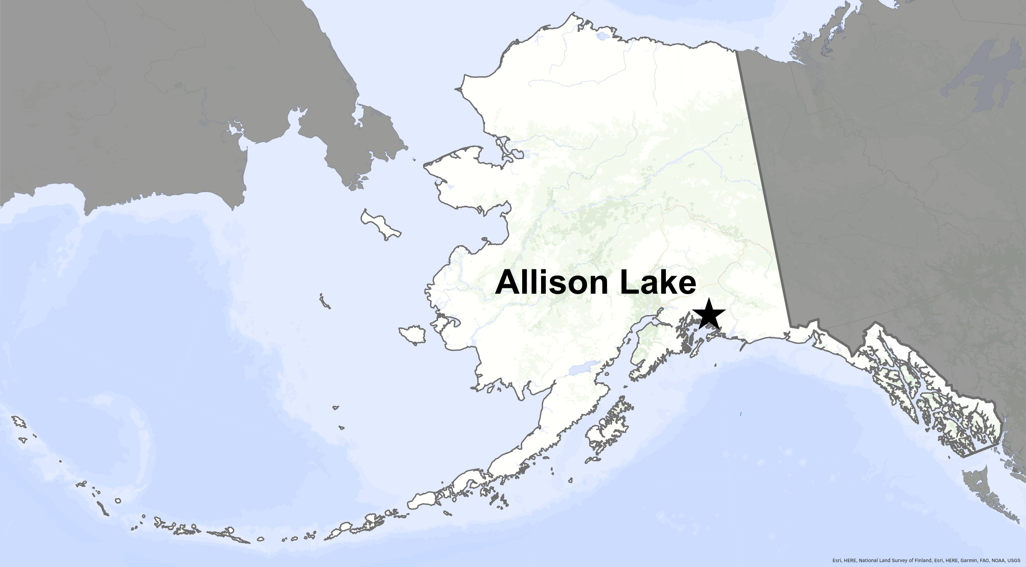
They had hoped to charter a helicopter from the town of Valdez, less than 10 miles away, to shuttle their weighty equipment by sling load from a gravel road that ended one-quarter mile from Allison Lake.
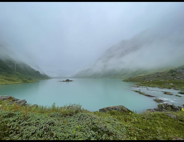
They had targeted the lovely mountain lake because another scientist’s work made them confident its depths held the granular evidence of large earthquakes that have rattled this alpine landscape many times in the past.
But a day before, each time Peter Haeussler had squinted outside the flap of their Arctic Oven tent, he saw nothing but gray fuzz in the V cut by Allison Creek. A few miles beyond where the creek flowed into the salt water of Port Valdez, a helicopter waited at the airport.
Along with what the scientists were seeing beyond the tent, the weather forecast promised no holes in the clouds for days.
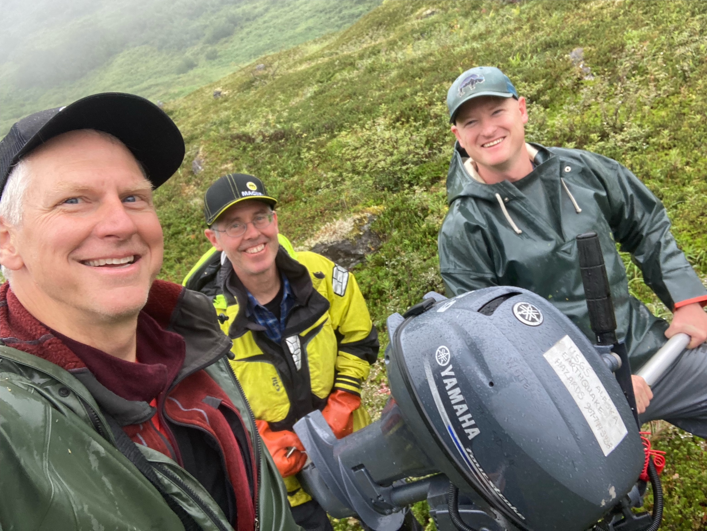
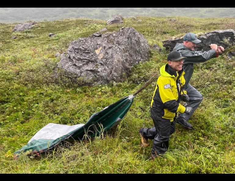
That prompted Haeussler, Drake Singleton and Gerry Hatcher to hump 700 pounds of pontoon boat, sound-wave producing instrument, portable generator and gas cans one-quarter mile from their campsite to the lake edge.
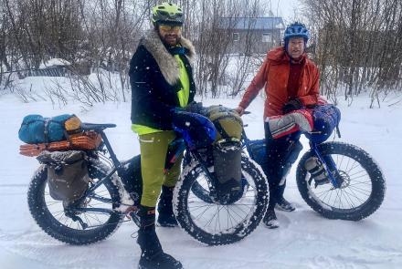
Haeussler is a geologist and Alaska coordinator for the Earthquake Hazards Program of the U.S. Geological Survey. He had driven a truck and a trailer loaded with equipment from his headquarters at the USGS Alaska Science Center in Anchorage to near this lake 1,300 feet high in the Chugach Mountains. Riding with him were two men who know a lot about finding old earthquake evidence underwater and how to design and fix equipment. Singleton and Hatcher both work at the USGS office in Santa Cruz, California.
At the end of their carry, the trio gently set the 9.9-horsepower motor down on a green plateau steps from the lake. They exchanged wet high-fives. The heaviest piece of their puzzle was where it needed to be.
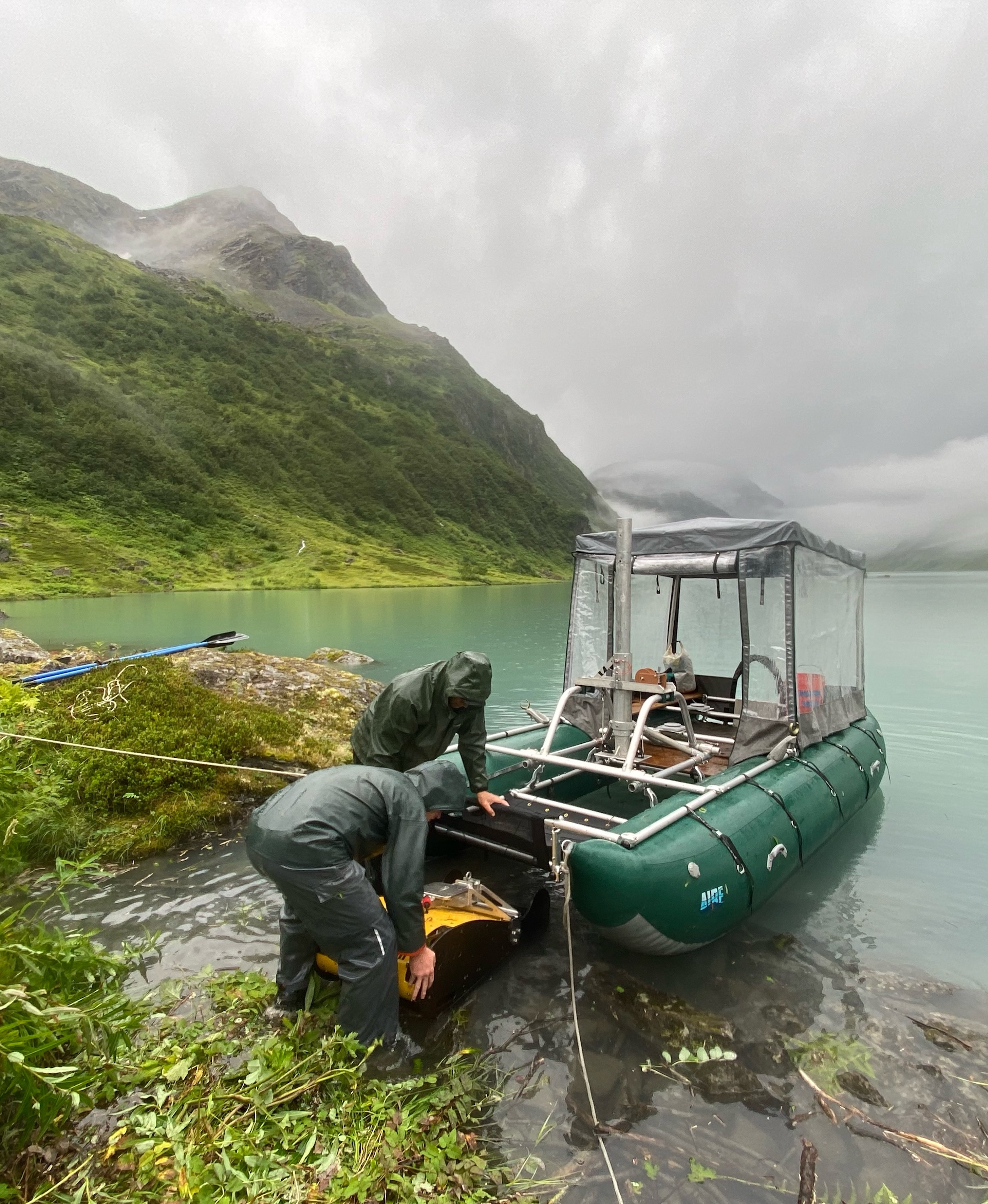
A day-and-a-half later, after absorbing near-constant rainfall on many round trips, they had succeeded in assembling a boat that floated on two pontoons, each the length of a pickup truck.
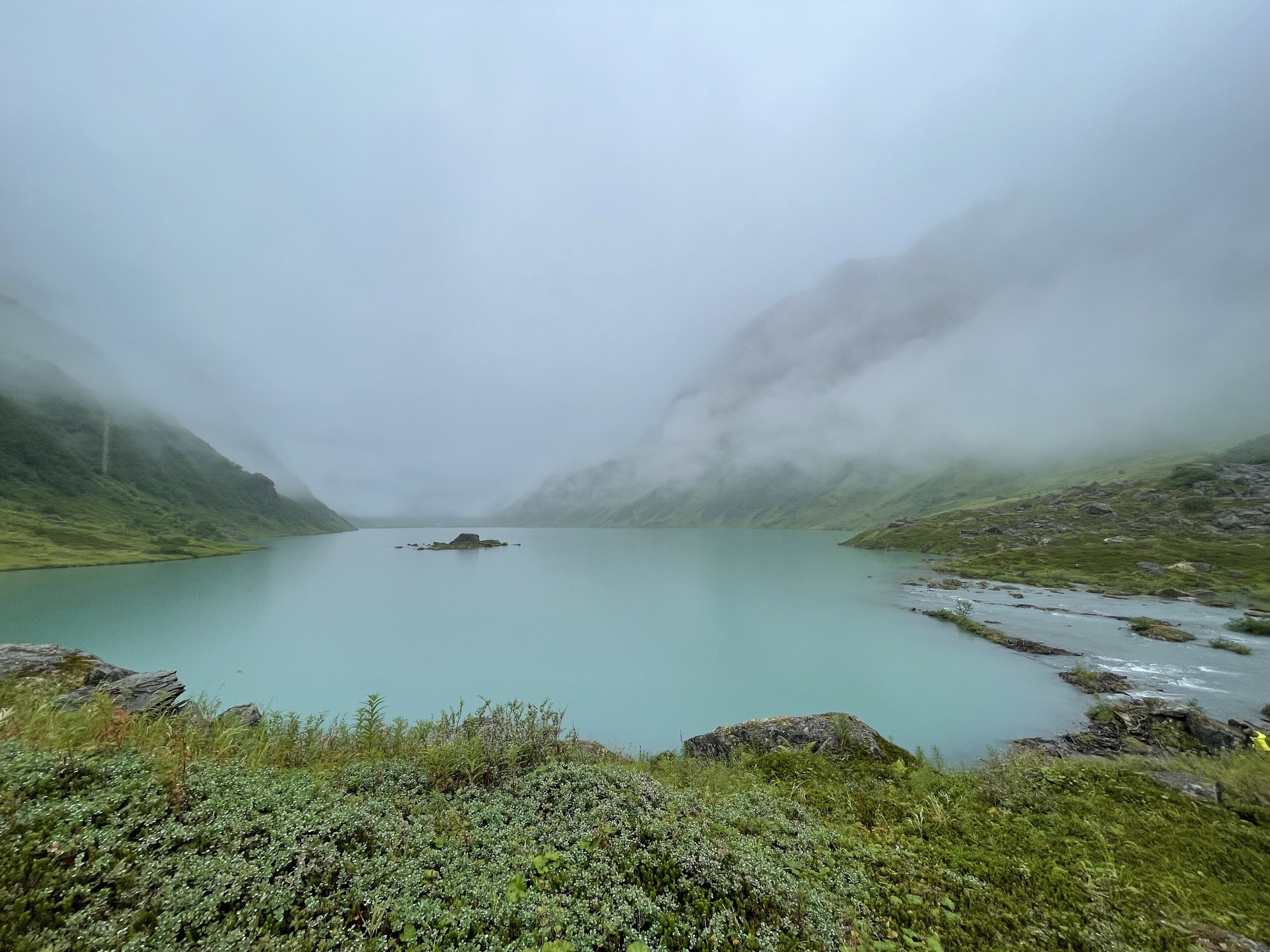
They launched the craft on glacier- and rainfall-fed Allison Lake, which has the shape of a bathtub and is more than 100 feet deep.
With Haeussler steering the boat in a tight grid back and forth over the lake surface, Singleton monitored the sound waves that bounced off the bottom and penetrated the sediment of the lake.
His computer screen generated a real-time map of the lake floor and what was beneath it. On it, Singleton saw evidence of underwater landslides caused by earthquakes shaking the basin. Those were the nuggets they were hoping to pan: “lacustrine slump deposits.”
This earthquake-detection technique is fairly new. Haeussler has spent much of his long career on quiet mountainsides and Alaska islands looking for more visible evidence of past earthquakes, such as ancient rips in the surface and offset streambeds. A little more than a decade ago, he attended a conference in Chile at which other scientists showed how “turbidites,” distinctive layers of sediment shaken to the bottom of lakes by earthquakes, were a valid record of past shakes.
Those lake deposits sometimes show a record of “intraslab” earthquakes, such as the 2018 magnitude 7.1 earthquake that rocked Anchorage. Those earthquakes, often damaging to structures and roads, don’t leave the surface wound of megathrust or crustal earthquakes, making them much harder to detect after the event. Knowing where and when they struck in the past helps scientists predict how often large earthquakes happen in a region, which is useful information when formulating building codes.
Intrigued, Haeussler recruited Rob Witter, whom he met at the Chile conference, to join his team at the USGS Alaska Science Center in Anchorage. (Witter was to be part of the team at Allison Lake but suffered a broken collarbone in a recent mountain bike crash).
At Allison Lake, after acquiring a “fantastic grid” of mini seismic data all over the lake, the scientists hiked back to their Arctic Oven for the night.
The rain did not stop. It got so heavy that Haeussler’s Valdez contact called him and recommended his team leave their campsite as soon as possible. The steep gravel road to the highway was eroding so much it would become undriveable soon, he warned.
With night falling, Haeussler and the team decided to leave the next morning after securing their gear by the lakeside for retrieval later.
The next day, creeping along in the truck, they made it back to the Valdez highway, and after seven hours, back to Anchorage. With them was a laptop with information about the old and ancient earthquakes that rocked Allison Lake and maybe all of Prince William Sound.
With that evidence, and that from other lakes they have probed such as Eklutna and Skilak, they are writing a history of Alaska earthquakes, old and new.