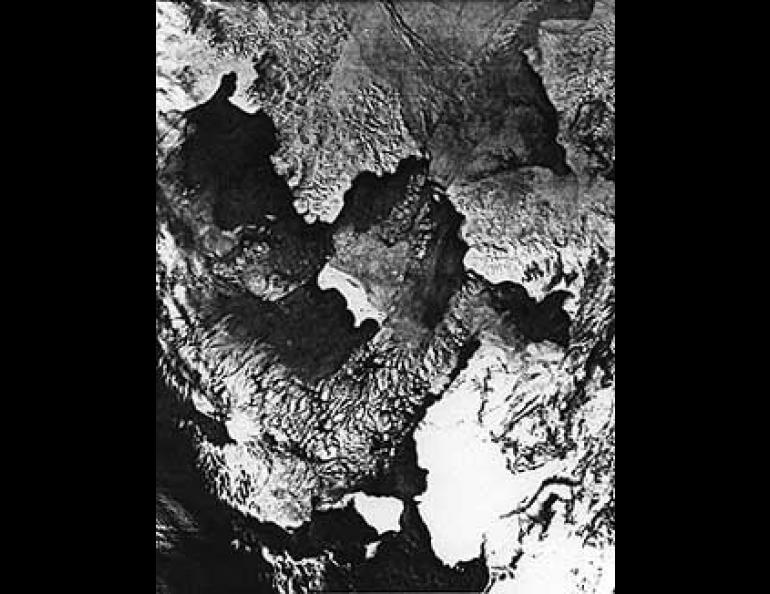
Open Water in the Ice Pack
Envision this: midwinter on the Bering Sea. The temperature is 40 below. The ocean is sealed beneath a lid of ice--almost. At a handful of places, the Bering Sea has peculiar patches of open water. These watery holes are called "polynyas."
Although at first glance that might look like another word to describe a Goody Twoshoes, it is actually a Russian word that means "open places in the ice." Scientists who study ocean ice use it to refer to irregularly shaped openings with sides that could not be refitted to form a uniform sheet of ice (to distinguish them from fracture openings such as "leads"--cracks that fortuitously open or close in tales of Arctic adventure). In other words, they do not create chunks that you could fit back together like the pieces of a jigsaw puzzle.
In the Bering Sea, polynyas tend to occur winter after winter in just about the same places. The most persistent of these appear south of Point Hope, the Seward Peninsula and, most conspicuously, St. Lawrence Island. The principal mechanism for their formation is the winter wind direction. Although the ocean currents are flowing north toward the Arctic Ocean, the currents are met by a persistent wind blowing south from the Arctic. While the ice forms continuously, the wind blows it off just as stubbornly from the leeward side of islands and promontories, creating ice-free areas on the southern or down-wind side. When winds are from the south, they usually bring clouds, shielding the scene from the satellite which might well observe that the polynyas had closed.


