Surface Faulting in Alaska
Almost everyone has seen pictures of the famous San Andreas fault in California cutting across the countryside. After some earthquakes there, photographs have been taken of highways, fences and even buildings that don't square up the way they're supposed to, because the ground to either side of the fault has moved in opposite directions. This makes the fault line easy to observe.
We don't often see this in Alaska, even though the state experiences far more earthquakes than California. There are a number of reasons for this. One reason is that the faults responsible for the majority of Alaska's largest earthquakes lie offshore. During the great earthquake of 1964, a gash was created from Prince William Sound to south of Kodiak Island, but it was mostly under water. The cracks that dropped Anchorage streets and buildings far below the original ground level were due to local slumping. The actual fault was far away to the east.
Large earthquakes also happen in the Alaskan Interior. In most cases, however, the faults that generate earthquakes are so deeply buried by glacial sediment and alluvium that they rarely reach the surface.
Further, because faults generate weak zones in the earth's crust, a fault zone becomes quickly weathered and provides a natural course for rivers and glaciers to follow. This is why there is a surprising tendency for large earthquakes to happen near cities--people settle near rivers, and rivers tend to follow fault lines. A case in point is the Tanana River from near Delta Junction to Fairbanks. This zone is extremely seismically active. Studies have shown that this line almost surely represents a fault, but the overlying river obscures any trace at the surface.
The Denali fault, which runs along the midline of the Alaska Range, lies in a miles-wide trough that has formed along its course, but a distinct scarp can be seen at a few locations. The fault passes beneath the Richardson Highway near Black Rapids and beneath the Parks Highway near Cantwell. You can't pick it out at Black Rapids because it is covered by the famous "galloping" Black Rapids Glacier, and at Cantwell it is hidden by a thick layer of sediment.
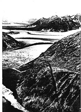
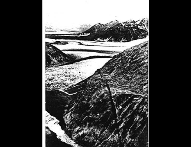
But there is one fault in the state that is easily recognizable on the ground. That is the Fairweather fault in the Southeast panhandle. Over most of its length it is obscured by fjords and glaciers in a channel which the fault itself has created, but it is easily identifiable when it emerges to pass over mountain ridges.
The latest breakage on the Fairweather fault occurred during a magnitude 8.0 earthquake in 1958. As western California gradually migrates toward Alaska, strain accumulates in the crustal rocks. The strength of the rocks was overcome in 1958 and the strain was released when the Pacific floor jumped tens of feet to the northwest. That earthquake resulted in five deaths, including two from a spectacular landslide-generated sea wave in Lituya Bay. Fortunately, the area of the portion of the fault that broke--roughly from Glacier Bay to Yakutak--is almost completely uninhabited.
It may take a few decades or a few hundred years, but it is certain that another major earthquake will happen there. In the meantime, the Fairweather remains one of the freshest and best documented of Alaska's active faults.