Trees as Earthquake Fault Indicators
Seismologists are eager to grasp at any straw that might help identify active faults and the dates when motion has occurred along them. At least minor successes have been accomplished by examining the shape and condition of trees and the annual growth ring asymmetries in trees along known faults.
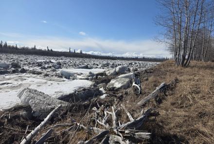
When a fault splits a tree in half, the effect is obvious. Where the ground motion is particularly violent, within a few feet of the surface trace of the breaking fault, limbs are broken from trees and the trunks of tall trees break off, typically some intermediate distance above ground. A swath of dead, tilted and broken trees now makes obvious the trace of the Fairweather fault that broke in July 1958 to devastate Lituya Bay and nearby parts of southeastern Alaska.
Sagging or tilting of the ground along a fault trace causes trees there to tilt or even fall. If these trees continue to grow, their new annual rings show an extreme asymmetry--the rings on the down-tilted side of the tree are much wider than on the up side. This difference leaves a record that can be read by making multiple core drillings around the tree. Then using tree ring dating methods, it may be possible to date earthquakes occurring before historical records were kept. The ability to identify and date very large earthquakes occurring within the past thousand years is important in establishing earthquake risk and for predicting future earthquakes.
Another dating method is referencing ring patterns in earthquake killed trees to those of trees that have lived through the event and which can be accurately dated. Trees along faults often are killed by drowning because the faults tend to collect normal drainage water. In some instances, there are widespread tree kills caused by general subsidence. Killed by sinking caused in the great 1964 Alaskan earthquake, firmly stark forests of dead trees stand guard around the shore of upper Turnagain Arm, near Portage, Alaska.