Skip to main content
Shop
Donate
UA Directory
Intranet
Quick Links
Geophysical Institute
Main navigation
Home
About
Contact Information
Contact
UAF Directory
Visitor Information
About the GI
Community
GI Publications
Timeline
GI Quarterly
People
Leadership
Researchers
Graduate Student Researchers
Emeriti
Research
Atmospheric Sciences
Remote Sensing
Seismology & Geodesy
Snow, Ice & Permafrost
Space Physics & Aeronomy
Tectonics & Sedimentation
Volcanology
Facilities & Labs
Services
Design & Printing
GI Human Resources
Education Outreach
Instrument Development
Keith B. Mather Library
Research Computing Systems
News & Info
News
Alaska Science Forum
Alaska Science Pod
Science for Alaska
Aurora Forecast
Visitor Information & Tours
Events
Community
Student Info
Intranet
Search
Breadcrumb
Home
/
News
Filter By Year
- Any -
2026
2025
2024
2023
2022
2021
2020
2019
2018
2017
2016
2015
2014
2013
2012
2011
2010
Article Type
- Any -
Read
Explore
Research Group
- Any -
Atmospheric Sciences
Remote Sensing
Seismology & Geodesy
Snow, Ice & Permafrost
Space Physics & Aeronomy
Tectonics & Sedimentation
Volcanology
Facility/Lab
- Any -
Alaska Center for Unmanned Aircraft Systems Integration (ACUASI)
Alaska Climate Research Center (ACRC)
Alaska Critical Minerals Collaborative (ACMC)
Alaska Earthquake Center (AEC)
Alaska Satellite Facility (ASF)
Alaska Space Grant Program (ASGP)
Alaska Volcano Observatory (AVO)
Advanced Instrumentation Laboratory (AIL)
Arctic Coastal Geoscience Lab (ACGL)
College International Geophysical Observatory (CIGO)
Geochronology Laboratory (Geochron Lab)
Geographic Information Network of Alaska (GINA)
Geophysical Institute Permafrost Laboratory (GIPL)
High-frequency Active Auroral Research Program (HAARP)
Hyperspectral Imaging Laboratory (HyLab)
Poker Flat Research Range (PFRR)
Wilson Alaska Technical Center (WATC)
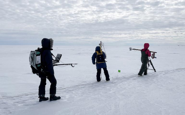
Utqiagvik, where there’s still snow in June
June 20, 2022
A group of University of Alaska Fairbanks faculty, students and staff has been conducting Arctic fieldwork in Utqiagvik since mid-April to...
Read more
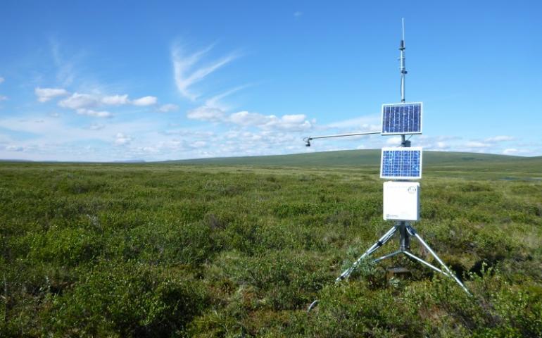
UAF scientists find new indicators of Alaska permafrost thawing
June 6, 2022
More areas of year-round unfrozen ground have begun dotting Interior and Northwest Alaska and will continue to increase in extent due to climate...
Read more
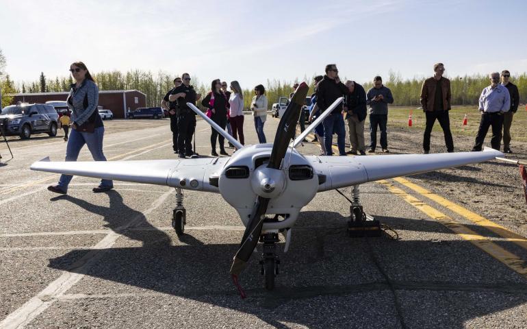
UAF makes Alaska’s first large drone flight from international airport
May 23, 2022
An unmanned aircraft owned and operated by the University of Alaska Fairbanks flew from the general aviation area of Fairbanks International...
Read more
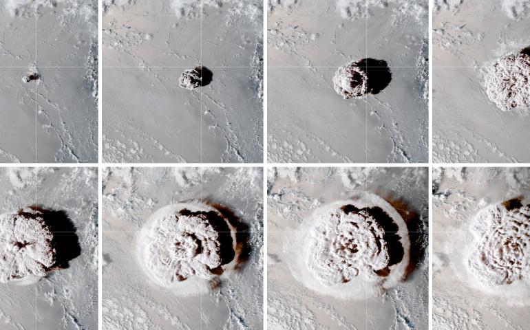
Hunga volcano eruption provides an explosion of data
May 12, 2022
The massive Jan. 15, 2022, eruption of the Hunga submarine volcano in the South Pacific Ocean created a variety of atmospheric wave types...
Read more
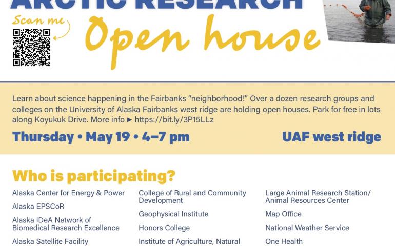
Annual UAF Arctic Research Open House set for May 19
May 10, 2022
Come learn about the incredible research happening at the University of Alaska Fairbanks during the 2022 Arctic Research Open House from 4-7 p.m...
Read more
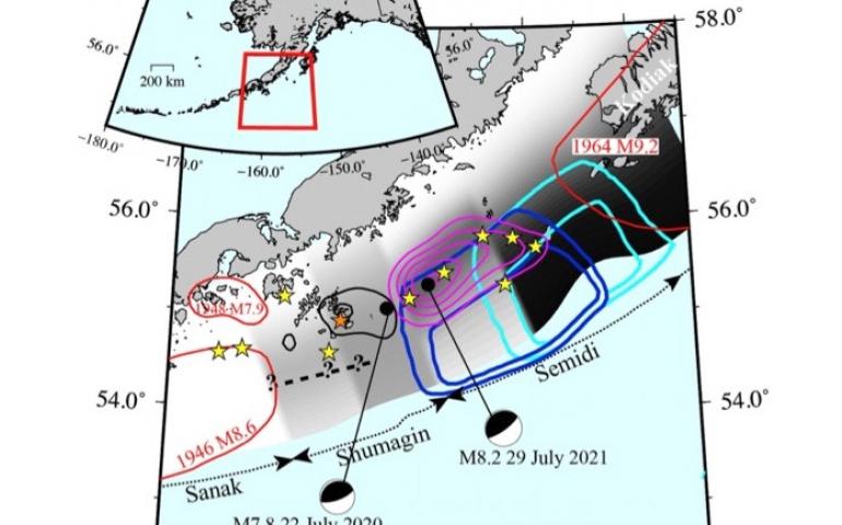
Major 2020 Alaska quake triggered neighboring 2021 temblor
May 4, 2022
A study of two powerful earthquakes in adjacent areas off the Alaska Peninsula in 2020 and 2021 shows a connection between the two. It also...
Read more
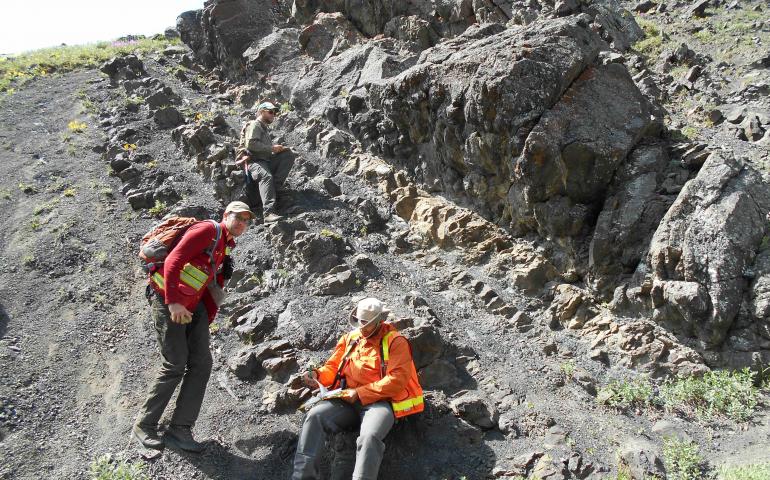
Precipitation helped drive distribution of Alaska dinosaurs
April 29, 2022
Precipitation more than temperature influenced the distribution of herbivorous dinosaurs in what is now Alaska, according to new research...
Read more
Earth’s atmosphere may be source of some lunar water
April 27, 2022
Hydrogen and oxygen ions escaping from Earth’s upper atmosphere and combining on the moon could be one of the sources of the known lunar water...
Read more
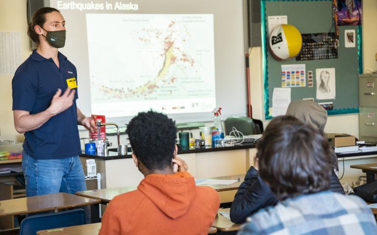
UAF student gets K-12 classrooms jumping with seismology project
April 8, 2022
In Quinhagak, a village nearly 600 miles from Fairbanks in Southwest Alaska, a small seismometer sits on a corner counter in the classroom of...
Read more
Load More