Skip to main content
Shop
Donate
UA Directory
Intranet
Quick Links
Geophysical Institute
Main navigation
Home
About
Contact Information
Contact
UAF Directory
Visitor Information
About the GI
Community
GI Publications
Timeline
GI Quarterly
People
Leadership
Researchers
Graduate Student Researchers
Emeriti
Research
Atmospheric Sciences
Remote Sensing
Seismology & Geodesy
Snow, Ice & Permafrost
Space Physics & Aeronomy
Tectonics & Sedimentation
Volcanology
Facilities & Labs
Services
Design & Printing
GI Human Resources
Education Outreach
Instrument Development
Keith B. Mather Library
Research Computing Systems
News & Info
News
Alaska Science Forum
Alaska Science Pod
Science for Alaska
Aurora Forecast
Visitor Information & Tours
Events
Community
Student Info
Intranet
Search
Breadcrumb
Home
/
News
Filter By Year
- Any -
2026
2025
2024
2023
2022
2021
2020
2019
2018
2017
2016
2015
2014
2013
2012
2011
2010
Article Type
- Any -
Read
Explore
Research Group
- Any -
Atmospheric Sciences
Remote Sensing
Seismology & Geodesy
Snow, Ice & Permafrost
Space Physics & Aeronomy
Tectonics & Sedimentation
Volcanology
Facility/Lab
- Any -
Alaska Center for Unmanned Aircraft Systems Integration (ACUASI)
Alaska Climate Research Center (ACRC)
Alaska Critical Minerals Collaborative (ACMC)
Alaska Earthquake Center (AEC)
Alaska Satellite Facility (ASF)
Alaska Space Grant Program (ASGP)
Alaska Volcano Observatory (AVO)
Advanced Instrumentation Laboratory (AIL)
Arctic Coastal Geoscience Lab (ACGL)
College International Geophysical Observatory (CIGO)
Geochronology Laboratory (Geochron Lab)
Geographic Information Network of Alaska (GINA)
Geophysical Institute Permafrost Laboratory (GIPL)
High-frequency Active Auroral Research Program (HAARP)
Hyperspectral Imaging Laboratory (HyLab)
Poker Flat Research Range (PFRR)
Wilson Alaska Technical Center (WATC)
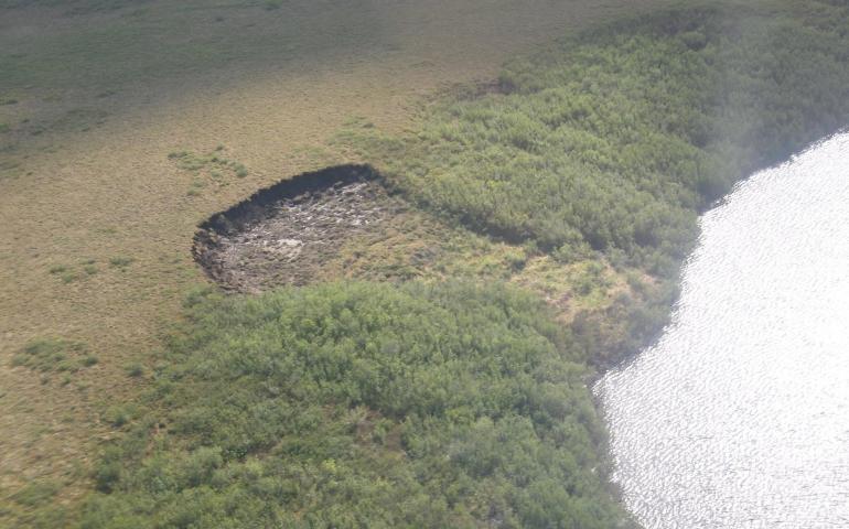
Thawing Arctic hillsides are major climate change contributors
August 12, 2022
Thawing Arctic hillsides release a significant amount of organic carbon that has been locked in frozen ground for thousands of years but which...
Read more
HAARP to hold public open house Saturday, Aug. 27
August 11, 2022
The public will have the opportunity to learn about how scientists study the Earth’s ionosphere, the region between Earth's lower atmosphere and...
Read more
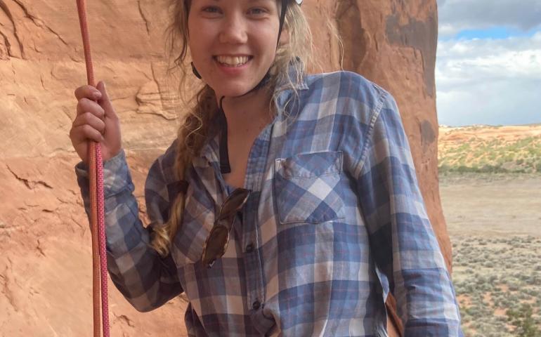
Geophysical Institute announces 2022 Schaible fellowship recipients
August 4, 2022
One student from Alaska and one from Switzerland have been selected as this year’s recipients of a Geophysical Institute Schaible Fellowship...
Read more
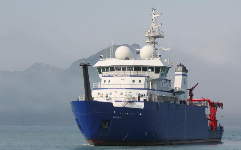
Scientists to set sail in search of Bering Sea’s stormy past
July 26, 2022
A team of scientists will soon head to the Aleutian Islands aboard the research vessel Sikuliaq on a voyage to reconstruct the region’s ancient...
Read more
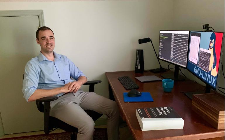
New method can improve explosion detection
July 22, 2022
Computers can be trained to better detect distant nuclear detonations, chemical blasts and volcano eruptions by learning from artificial...
Read more
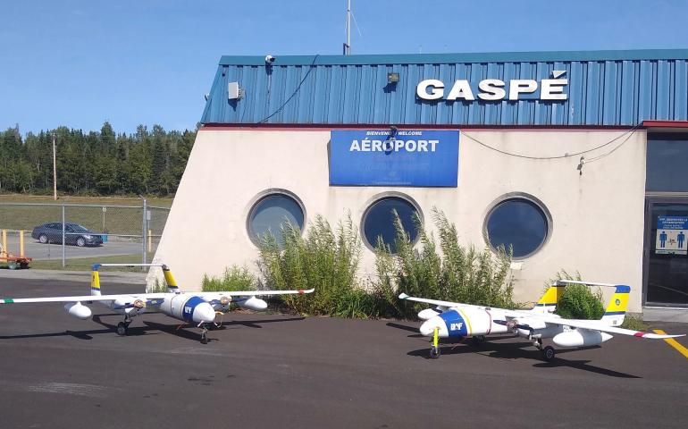
UAF crew, unmanned aircraft help protect endangered right whales
July 21, 2022
The Alaska Center for Unmanned Aircraft Systems Integration is back in Canada to help prevent endangered North Atlantic right whales from...
Read more
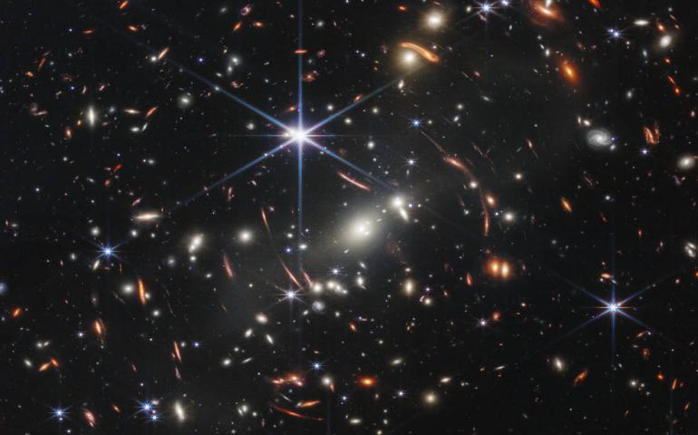
GI scientist proud of his work on Webb telescope
July 12, 2022
NASA has rolled out several images gathered by the new James Webb Space Telescope , the largest and most powerful space observatory ever built...
Read more
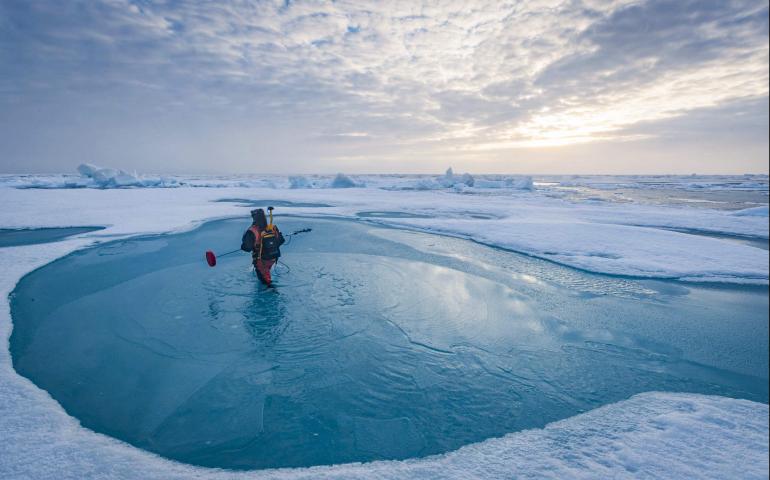
Research shows need to improve prediction of Arctic melt ponds
June 30, 2022
New research shows two widely used computer models that predict summer melt pond formation on sea ice greatly overestimate their extent, a key...
Read more
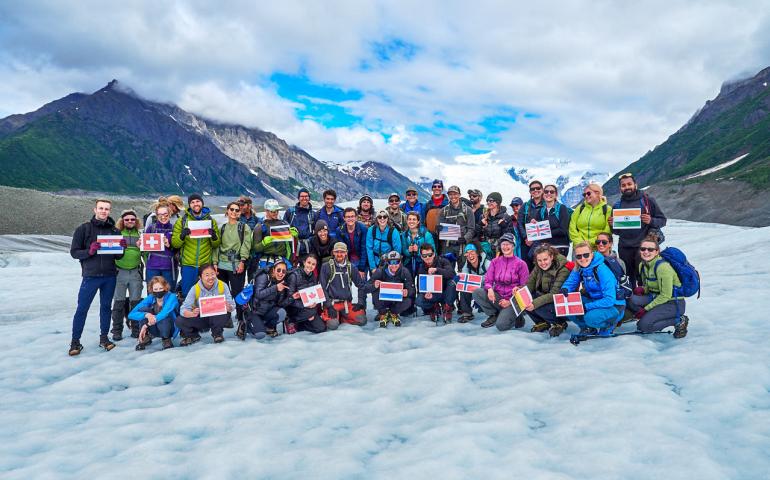
Ph.D. glaciology students get lessons at a great Alaska venue
June 28, 2022
The mountains of Wrangell-St. Elias National Park and Preserve made this no ordinary summer school. Nearly 30 early Ph.D. students gathered for...
Read more
Load More