Skip to main content
Shop
Donate
UA Directory
Intranet
Quick Links
Geophysical Institute
Main navigation
Home
About
Contact Information
Contact
UAF Directory
Visitor Information
About the GI
Community
GI Publications
Timeline
GI Quarterly
People
Leadership
Researchers
Graduate Student Researchers
Emeriti
Research
Atmospheric Sciences
Remote Sensing
Seismology & Geodesy
Snow, Ice & Permafrost
Space Physics & Aeronomy
Tectonics & Sedimentation
Volcanology
Facilities & Labs
Services
Design & Printing
GI Human Resources
Education Outreach
Instrument Development
Keith B. Mather Library
Research Computing Systems
News & Info
News
Alaska Science Forum
Alaska Science Pod
Science for Alaska
Aurora Forecast
Visitor Information & Tours
Events
Community
Student Info
Intranet
Search
Breadcrumb
Home
/
News
Filter By Year
- Any -
2026
2025
2024
2023
2022
2021
2020
2019
2018
2017
2016
2015
2014
2013
2012
2011
2010
Article Type
- Any -
Read
Explore
Research Group
- Any -
Atmospheric Sciences
Remote Sensing
Seismology & Geodesy
Snow, Ice & Permafrost
Space Physics & Aeronomy
Tectonics & Sedimentation
Volcanology
Facility/Lab
- Any -
Alaska Center for Unmanned Aircraft Systems Integration (ACUASI)
Alaska Climate Research Center (ACRC)
Alaska Critical Minerals Collaborative (ACMC)
Alaska Earthquake Center (AEC)
Alaska Satellite Facility (ASF)
Alaska Space Grant Program (ASGP)
Alaska Volcano Observatory (AVO)
Advanced Instrumentation Laboratory (AIL)
Arctic Coastal Geoscience Lab (ACGL)
College International Geophysical Observatory (CIGO)
Geochronology Laboratory (Geochron Lab)
Geographic Information Network of Alaska (GINA)
Geophysical Institute Permafrost Laboratory (GIPL)
High-frequency Active Auroral Research Program (HAARP)
Hyperspectral Imaging Laboratory (HyLab)
Poker Flat Research Range (PFRR)
Wilson Alaska Technical Center (WATC)
Asteroid impacts create habitats for life, study suggests
November 18, 2016
Around 65 million years ago, a massive asteroid crashed into the Gulf of Mexico. The impact and subsequent effects wiped out about 75 percent of...
Read more
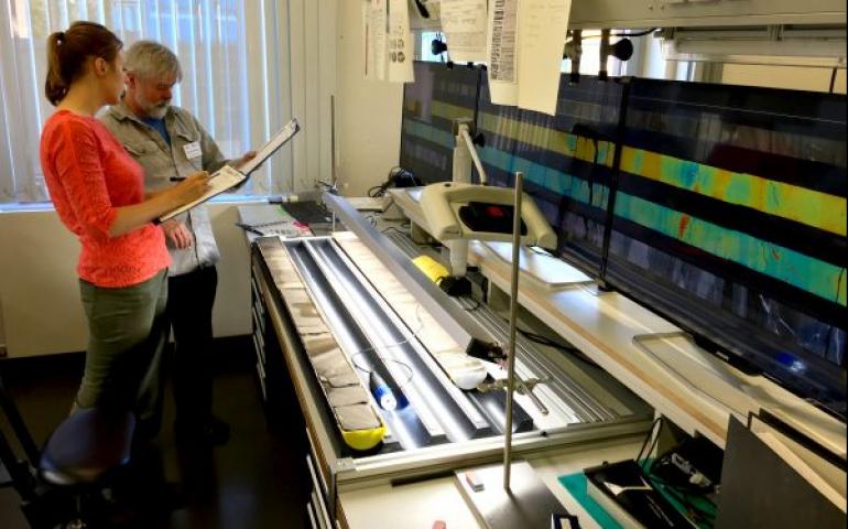
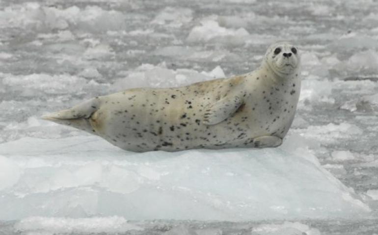
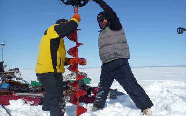
Project tests method for monitoring ice conditions
November 16, 2016
Along Alaska’s southern coast, harbor seals use icebergs from tidewater glaciers as platforms to give birth, nurse, molt and avoid predators. As...
Read more
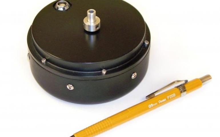
Patent received for improved infrasound sensors
August 9, 2016
Jeffrey Rothman, supervisor of the electronics shop at the University of Alaska Fairbanks Geophysical Institute, has received a U.S. patent for...
Read more
UAF’s Mölders blends interests in science, style
July 6, 2016
When Geophysical Institute atmospheric scientist Nicole Mölders was growing up in West Germany, women older than 50 were all supposed to look the...
Read more
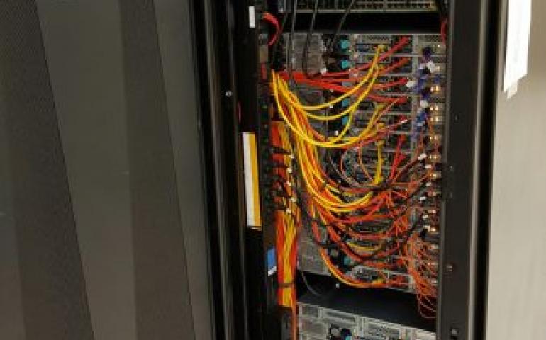
Murdock grant awarded for new computing system
June 22, 2016
The University of Alaska Fairbanks has received a two-year grant for an energy-efficient, high-performance computing cluster. The new Penguin...
Read more
Permafrost thawing below shallow Arctic lakes
June 16, 2016
New research conducted by scientists at the University of Alaska Fairbanks, the U.S. Geological Survey, the University of Wyoming and other...
Read more
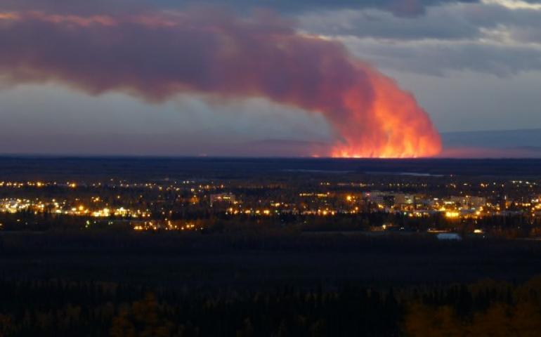
Satellites, drones can help predict path of wildfire smoke
April 26, 2016
University of Alaska Fairbanks atmospheric scientists are developing ways to help forecast air quality in areas downwind from wildfires. Nicole...
Read more
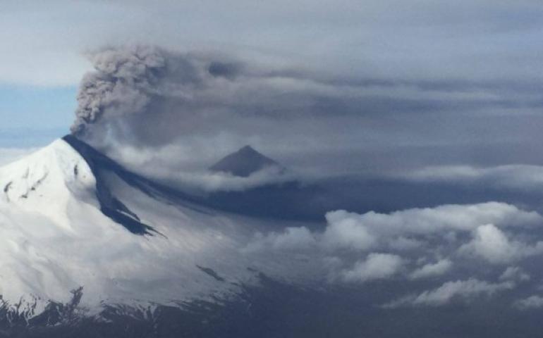
Alaska volcano researchers refine ‘hearing’ to find eruptions
April 4, 2016
Seismologists at the University of Alaska Fairbanks Alaska Volcano Network have developed a refined set of methods that allows them to detect and...
Read more
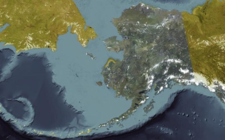
New Alaska satellite image map released
March 30, 2016
A University of Alaska Fairbanks partnership with the Alaska Department of Natural Resources has made the first high-resolution satellite image...
Read more
Load More