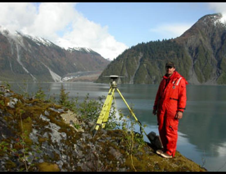
Geophysical Institute research assistant Adam Bucki stands next to a GPS antenna at one of 76 spots in Southeast Alaska. Scientists are using the sites, such as this one in Lituya Bay, to find that Southeast is one of the fastest-rising areas on Earth. Ned Rozell photo.
Alaska a hot topic in San Francisco
SAN FRANCISCO—More than 11,000 scientists have traveled here to attend the fall meeting of the American Geophysical Union. That's a lot of humanity for a guy who just got off a plane from Fairbanks, but some of the conference rooms at the Moscone Center feel just like home. Images of Alaska show up on dozens of lecture-hall screens and glossy posters here, with more than 200 presentations about Alaska. Here's some bits and pieces from my notebook:
- Jeff Freymueller of UAF's Geophysical Institute gave a talk on how Global Positioning Receivers can perhaps speed up warnings issued for tsunamis generated by the largest earthquakes. Eleven minutes after the great Sumatra earthquake of December 2004, scientists with the Pacific Tsunami Warning Center registered the magnitude of the undersea earthquake at 8.0, a number they revised to 8.5, 45 minutes later, Freymueller said. Scientist now believe the magnitude is somewhere near 9.2. The difference between the magnitude numbers is vast and important for predicting the size of a tsunami. Freymueller told the conference hall attendees that GPS receivers set up in networks around the world's subduction zones—areas where Earth's giant plates are grinding past one another, such as along Alaska's southern coast and the Aleutians—would allow tsunami warning centers to measure ground displacement faster than the conventional method of waiting for earthquake surface waves to reach distant seismometers.
- Alaska's wildfires might be helping melt glaciers and sea ice, said Yongwon Kim of the International Arctic Research Center in Fairbanks. Kim presented his research about Alaska wildfires producing soot particles that waft down on glaciers and sea ice. Those tiny specks of black may darken the surface of ice, making the surface absorb more sunlight. With 2004 and 2005 ranking as two of the top three fire years recorded in Alaska, the soot fallout on ice was significant, Kim said. He hopes to get funding in 2006 to set up soot-catching devices on sea ice north of Barrow, on Alaska Range glaciers, and on the UAF campus.
- Ice cores pulled from near the 14,163-foot summit of Mount Wrangell show traces of Asian dust, sulphate (possibly from factory exhaust in China or Korea), and nitrate (maybe from dry, fertilized fields in Asia), according to Teppei Yasunari, a graduate student from Hokkaido University who was part of a team that included University of Alaska researchers. Most of the dust from Asia seemed to arrive on high-speed winds at Mount Wrangell in early spring.
- Since the day of George Washington's inauguration, shorelines along the coast of Southeast Alaska have risen more than 15 feet, an oddity in a time when the sea makes headlines for eating the coastline of western Alaska villages. Chris Larsen of the Geophysical Institute reported results here from six years of GPS observations at 80 sites throughout Southeast. Around Glacier Bay, Earth's crust is uplifting at rate from more than one-quarter inch to more than one inch per year, because of a process known as glacial rebound.
- Since George Vancouver sailed by a massive glacier face at what is now the entrance to Glacier Bay, the bay has lost enough ice to raise the world's sea level about one-quarter inch, said Roman Motyka of the University of Alaska Southeast. Motyka has walked the shorelines of the bay, flown over it, and has spent weeks boating Glacier Bay to calculate the epic loss of ice there since 1750. The ice loss, which is in part triggering the rebound of Earth's elastic crust (the fastest rate of such rebound measured in the world), is greater than the volume of ice lost from all of Alaska and neighboring Canada glaciers from 1955 to 2002, Motyka said.


