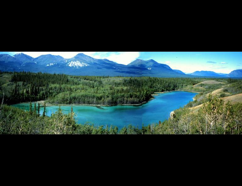
Jellybean Lake in the Yukon Territory holds a sediment record that tells Lesleigh Anderson of the USGS in Denver that the interior of the Yukon is the driest it's been in 5,000 years. Photo by Lesleigh Anderson.
Even more Alaska news from San Francisco
When a person searches the word “Alaska” in the computer abstracts for the recent fall meeting of the American Geophysical Union in San Francisco, that person gets 265 hits. Many scientists are studying Alaska. Here’s what some are finding:
- About 47 percent of ground underlying the Interior—the land between the Alaska Range and the Brooks Range—has permafrost beneath it, according to a survey done by Torre Jorgenson of Alaska Biological Research, Inc. and Tom George of Terra-Terpret. In a Cessna 185, George flew at 5,000 feet above ground level east to west over the Interior and took digital photographs that Jorgenson analyzed for terrain features that suggested permafrost. In a preliminary count, Jorgenson also calculated that 7 percent of the Interior showed signs of thawed permafrost. In those areas, he saw evidence of thermokarst—collapsed ground often filled with water or covered with mats of floating vegetation.
- Engineers and oceanographers sailing near Goodnews Bay in Southwest Alaska in summer 2005 saw anomalies on the ocean floor that hint at possible deposits of platinum, according to Thomas Oommen of UAF’s College of Engineering and Mines. The area is close to the Salmon River drainage, the primary platinum-producing region in America until about 1980. Prospectors first found platinum in the region in the 1920s, and the village of Platinum, Alaska, is nearby.
- Though Minnesota’s license plates have “10,000 Lakes” on them, Alaska’s coastal plane, north of the Brooks Range, has more than 13,000 lakes, according to Ken Hinkel of the University of Cincinnati. Many of those lakes are ellipse-shaped and seem to point in the same direction; Jon Pelletier from the University of Arizona wrote a paper recently with a new theory that the lakes formed that way because they thaw more in the downhill (toward the ocean) than uphill direction, and the lakes grow northward. At the San Francisco meeting, Hinkel said the older theory of the lakes’ formation—that perpendicular winds create eddies that eat at the banks in opposite directions—is still the better explanation.
- Two lakes in the Yukon might tell scientists something about the northland’s distant past. Lesleigh Anderson of the USGS in Denver has paddled an inflatable boat on hundreds of Yukon Territory lakes, pulling cores of sediment from the lake bottoms. She is focusing on two aquamarine lakes in the Yukon, one that gets flushed with fresh water and another that’s a closed system, gaining water through snowmelt and rainfall and losing it only to evaporation. Anderson is looking at oxygen-isotope ratios in the sediment to determine changes in rain, snow and evaporation during the past 7,500 years. Those ratios tell her something about the strength of the Aleutian Low, an Alaska weather-maker that affects the entire Pacific Northwest. The lakes show how the Aleutian Low likely changed how wet and dry the Yukon has been. “It’s dryer now in the interior than it has been in the past 5,000 years,” she said. Anderson has started coring similar lakes in northwest Colorado in hopes of finding weather patterns there that affect much of Colorado’s water supply—the snow that falls in the Rocky Mountains.
- The northeastern U.S. has some of the worst summer air quality in the country, and Alaska wildfires made it worse in 2004, reported scientists, including Carsten Warneke of the National Oceanic and Atmospheric Administration in Boulder, Colorado. Results of the New England Air Quality Study—performed with measurements from the ground, from aircraft, and from ships off the New England Coast—showed that as much as 30 percent of the carbon monoxide measured was from burned trees and tundra in Alaska and Canada and the other 70 percent were from urban emissions, mostly from New York City and Boston.


