Filling in the Alaska permafrost map
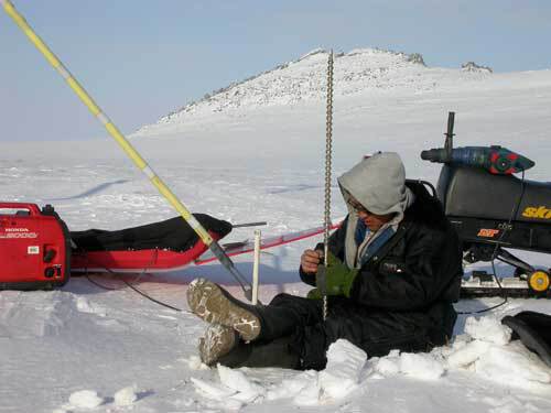
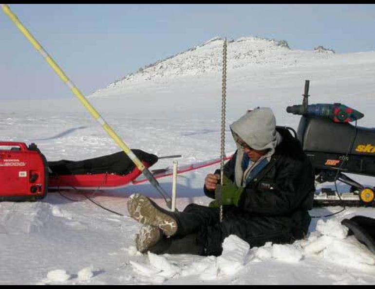
Fifteen days, 15 villages, more than 800 miles traveled by snowmachine, and Kenji Yoshikawa’s spring permafrost tour, phase 1, is complete.
From Emmonak, a village at the Yukon’s mouth where he found no permafrost, to Shishmaref, a village just south of the Arctic Circle with what he considers “cold” permafrost, Yoshikawa now has a better idea of what lies beneath western Alaska. This understanding is just in time to help other permafrost researchers flesh out a permafrost map of Alaska in time for a summer conference here in Fairbanks.
For the record, Yoshikawa found no permafrost where he drilled in villages at the mouth of the Yukon—Emmonak and Kotlik. Farther north, in Stebbins and St. Michael, he found permafrost, including “very warm” permafrost at St. Michael.
“This will be a perfect location to watch for changes in the next 10 to15 years,” he said of St. Michael.
Continuing up the coast of Norton Sound and beyond, Yoshikawa found permafrost—ground or any other below-ground substance frozen for more than two years (a relic of the deep cold of the last ice age)—in Unalakleet, Shaktoolik (where our hands almost became permafrost in a big wind), Koyuk, Teller, Brevig Mission, Wales, and Shishmaref. He didn’t find permafrost in the villages of Elim and White Mountain, maybe because both villages are on south-facing slopes and don’t have much soil above bedrock.
Villages north of Nome seem to always have permafrost, Yoshikawa said, while south of Nome the permafrost is more hit-and-miss, with the Yukon River delta and lower Yukon having many villages with no apparent permafrost and “islands” of permafrost in the Kuskokwim River delta, including Bethel.
Yoshikawa is not yet done. He will return to northwest Alaska in the next week to continue on a snowmachine from Kotzebue to Kivalina, Noatak, and villages on the Kobuk River. A map of his travels in the past year covers a large chunk of Alaska from the village of Tanana westward.
A team of researchers measuring the snow pack in the Yukon’s Kluane National Park has reported that Tweedsmuir Glacier recently advanced into the Alsek River, but has not yet blocked the river. As Chris Larsen of UAF’s Geophysical Institute reported last October, the glacier had surged to within 1,000 feet of the river, which flows from the Yukon Territory through northern British Columbia, and into the Gulf of Alaska at Dry Bay.
Surging glaciers like the Tweedsmuir are not growing; they just get up and go after long periods of inactivity, then grind to a halt. Larsen said the glacier reaching the river this spring is interesting for several reasons—one, surging glaciers typically don’t rush forward for a whole year, and two, if the glacier dams the river, it would be an amazing event, as would be the inevitable outburst flood that would follow.