Rogue glacier again getting people's attention
With the return of summer, many natural cycles have resumed up north — visiting birds have invaded tundra and forest, salmon torpedo in loose formation up rivers, and Hubbard Glacier again threatens to pinch off a fiord.
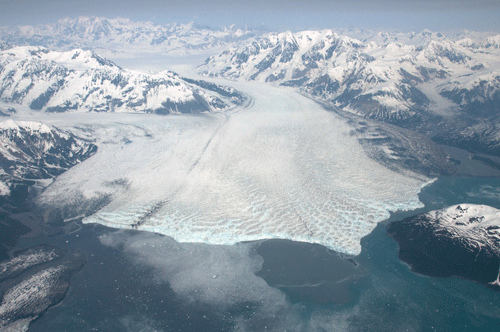
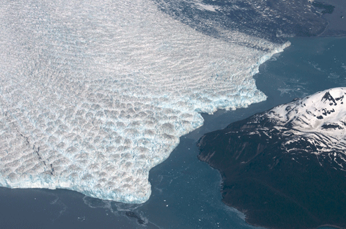
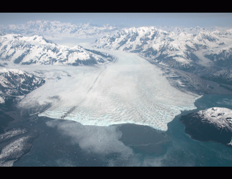
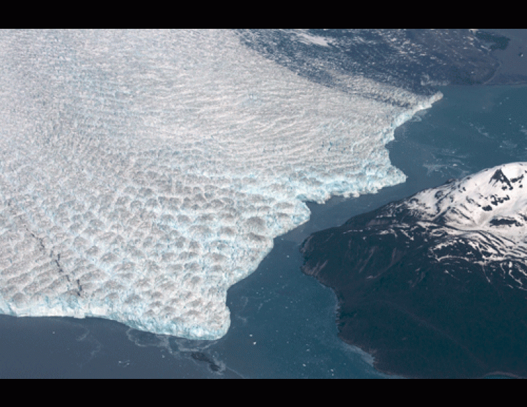
The giant glacier, located where the Southeast panhandle meets the rest of Alaska, advances toward Gilbert Point every year at about this time. In 1986 and 2002, the ice rammed the point with sufficient strength to turn Russell Fiord into Russell Lake; the lake endured for four months in 1986 before the ice dam broke.
On June 14, Hubbard’s wall of ice was about 300 feet from Gilbert Point, according to a laser-measuring device set in place by scientists from the U.S. Army Cold Regions Research and Engineering Lab (http://www.glacierresearch.com/).
“Compared to last year, it looks way closer to Gilbert Point,” said Gordon Hamilton of the University of Maine’s Climate Change Institute, who recently placed GPS devices on the upper glacier to help determine its flow. “When you fly through the gap in a helicopter, it looks really close.”
Chris Larsen of the University of Alaska Fairbanks’ Geophysical Institute captured a few images of Hubbard’s advance while returning on a research flight to other area glaciers in late May. The ice front resembles a bulldozer blade rumbling toward a pile of gravel.
“It gets close many years at this time,” Larsen said. “This is closer than usual, but, on the other hand, there have been predictions made before about it closing off and it did not. When it does close, and if it stays closed, then that will be a very big deal and a real bummer for a lot of people.”
The closure of Russell Fiord would be bad news to the 600 or so residents of Yakutat, who guide fishermen from all over the world to steelhead trout in the Situk River, about eight miles southeast of town. If Hubbard Glacier rams against Gilbert Point long enough, rainfall and glacial melt could fill Russell Lake until it reaches about 132 feet above sea level, as it did in the late 1800s. Then, the water would spill over into an old channel of the Situk River, and flow from the river to the Gulf of Alaska. The Situk, now a clear-running stream with the highest population of wild steelhead in Alaska, would become a milky glacial stream. More than 80 percent of Yakutat’s fishing economy depends upon fish in the Situk River; scientists once estimated that a flood from Russell Lake could reduce steelhead population in the Situk for perhaps 50 years.
Hubbard Glacier, the largest tidewater glacier outside the polar regions, is unique for its relentless advance in a period when most glaciers are receding. Hubbard keeps shoving forward because of its ample supply of ice produced in the towering icefields of the St. Elias Mountains, fed with moisture from the Gulf of Alaska.
“It’s got this enormous catchment basin with a huge snowfall rate every winter,” Hamilton said. “It’s a nearly inexhaustible supply of mass, and a lot of area at high elevations and not much at low.”
Though Hubbard is again creeping close to Gilbert Point, experts say a 2011 closure is not a sure thing.
“Ocean temperatures and currents through the gap are the agents that keep the advance at bay,” said Roman Motyka, a Geophysical Institute researcher based in Juneau who has studied Hubbard for years. “It looks like a classic battle between the advancing ice and undercutting of the ice cliff by warm ocean water currents. Personally, I think the ocean will win again this year, but that's just a guess.”