A shaky September in Yakutat Bay
More than a century ago, eight prospectors were panning the glacial sands near Hubbard Glacier when the earth starting shaking and never seemed to stop. A few days later, they had survived a natural phenomenon that probably should have left them dead.
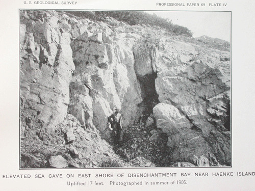
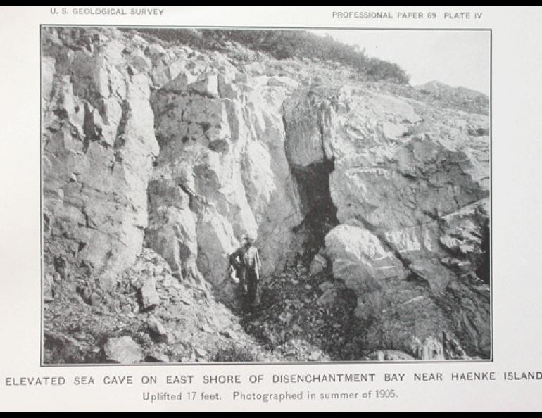
Geologists Ralph Tarr and Lawrence Martin, in the area a few years later to study the marvelous glaciers, saw things like mussels “resembling clumps of blue flowers” on rocks 20 feet above the ocean. They saw so much evidence of a giant earthquake they interviewed a few prospectors in Yakutat and included their stories in a 1912 government paper, “The earthquakes at Yakutat Bay, Alaska, in September, 1899.”
When Tarr and Martin arrived in Yakutat, prospector A. Flenner was working as a carpenter there six years after the series of large earthquakes, the biggest being a magnitude 8 that happened on Sept. 10, 1899. Flenner had been panning for gold in the area that day.
“Mr. Flenner stated in 1905 that after the first shock on September 3 they rigged up a homemade seismograph, consisting of hunting knives hung so that their points touched and would jingle under a slight oscillation,” Tarr and Martin wrote. “With this instrument (rude, perhaps, but more delicate than their own perception) they counted 52 shocks on September 10, up to the time of the heavy disturbance (the magnitude 8 earthquake) that caused so much damage.”
Another miner, L.A. Cox, was also at the scene.
“About 9 a.m. on the 10th we had a very severe shock (what the U.S. Geological Survey later calculated as a magnitude 7.4 foreshock) so violent that one could hardly keep his feet,” Cox said. “The low alder brush shook and bent like reeds in a gale of wind. (Then, at) 1:30 p.m., we got the king bee of them all.”
The king bee was a massive earthquake that shattered glaciers, lifted areas of shoreline 47 feet out of the water, and caused “the death of millions of individuals,” Tarr and Martin wrote. Those individuals were fish and crabs deposited on land, and barnacles, mussels and other rock-clinging organisms thrust high above the water level.
The prospector Cox further described the big earthquake:
“The ground (was) cutting some of the queerest capers imaginable. In addition to the circular motion of the preceding heavy shock, it was waving up and down like the swells of the sea, only with considerably more energy.”
On glacial sands that often liquefy during a large earthquake, the prospectors were lucky to survive the episode as natural forces consumed their camp and all their supplies.
“We ran from our tents, leaving everything behind, and were never able to rescue anything from it after,” prospector J.P. Fults said. “Above us about 100 yards was a lake. … This lake broke from its bed and dashed down upon our camp while we ran along the shore and escaped its fury. This deluge was almost immediately followed by one from the sea. A wall of water 20 feet high came in upon the flood from the lake and carried all debris back over the undulating morianic hills.
“We protected ourselves from being carried away by tearing up clothes and tying ourselves to the small alder trees growing on the mountainsides,” Fults said.
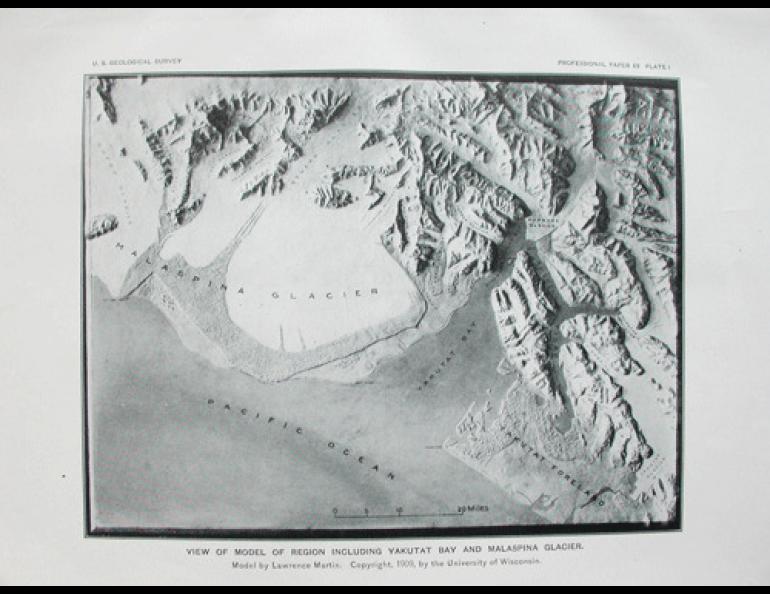
The remarkable part of this story is that no one died despite the unlucky location of the miners. Tarr and Martin attributed the earthquake to the impressive tectonic activity researchers today know as the Yakutat Block crashing into southern Alaska, giving rise to the highest coastal mountain range on Earth.
“The cause of these shocks was undoubtedly the renewal of growth in the St. Elias Range, one of the youngest and loftiest of mountain ranges,” Tarr and Martin wrote