Snow sampling from 500 feet above Alaska
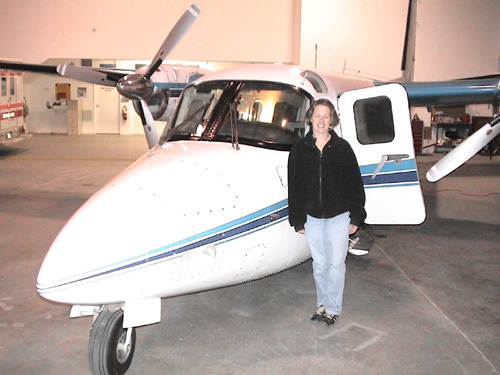
This spring, Cathy Martin spent her April mornings 500 feet above Alaska, cruising at 140 miles per hour. As she hugged the terrain of the Alaska Range and Tanana hills, caribou and moose scattered below and an instrument on her plane measured how much water was stored in the snowy landscape.
Martin is a pilot for the National Oceanic and Atmospheric Administration who visited Alaska for a few weeks to measure snowfall amounts in selected drainages. She and another NOAA pilot, Dave Savage, took turns flying a sleek, twin-engine Turbocommander AC-690 from the Brooks Range to the Kenai Peninsula while an instrument onboard calculated the water content of the snow beneath them. The information will someday help Alaska hydrologists predict the likelihood and severity of flooding on rivers and streams.
Martin lives in Minneapolis, where she and three other NOAA pilots fly similar missions around the country to help estimate the amount of water that will fill reservoirs, power hydroelectric dams, and threaten towns and cities on rivers prone to flooding.
“Alaska’s new. This is only our second season flying here,” Martin said at the Fairbanks International Airport hangar that housed the plane.
A lieutenant in the NOAA Corps, Martin underwent military-style training and worked as a deck officer on an ocean-going research ship before becoming a pilot. Her goal is to fly NOAA’s P-3 “hurricane-hunters,” but she said she enjoyed flying low over Alaska and gathering snow data. She and Savage flew a series of 10-mile routes over terrain selected by her superiors and by hydrologists at the Alaska-Pacific River Forecast Center.
A computerized box measured the gamma radiation coming from the snow-covered ground and compared it with levels that pilots obtained by flying the same paths over bare ground. The instrument combined the readings and converted them into one number representing inches of water averaged over the flight path, an area of about three square miles. The copilot also took digital photos of the landscape, and the team posted them on the Internet each night along with the snow-water content data. The water-content number helps Alaska hydrologists determine how much moisture is stored in remote watersheds of the Yukon, Kuskokwim, Kenai, Koyukuk, Tanana, and other rivers.
“In the lower 48, they use (the NOAA snow-survey system) extensively to estimate snowpack levels that bleed off over time,” said Ben Balk, a hydrologist with the Alaska-Pacific River Forecast Center. “Here, we need about 10 years of data for it to become statistically valid to use in our models.”
Because they have been flying the Alaska missions for just two years now, it might be awhile before the NOAA fliers come up with enough data for Alaska river forecasters. Alaska’s vastness and the lack of past snowfall measurements make it impossible for hydrologists to know whether the new readings are above or below average.
Today, Balk and other hydrologists with the river forecast center in Anchorage use computer models calibrated with real measurements to estimate water levels for rivers and creeks in Alaska. Much of their input data are snow-survey measurements from the Natural Resources Conservation Service. Hydrologists with the Natural Resources Conservation Service measure the spring snowpack in drainages of most of Alaska’s major rivers and issue a monthly report.
When the fliers for the NOAA Corps have flown over the remote watersheds of the state for a few more years, river forecasters will have another tool to help predict spring breakup and the flooding problems that sometimes come with it.
“It’s really valuable in the lower 48, and hopefully it becomes valuable here in the future,” Balk said. “It could work out great for a place like the Kuskokwim (River), where snowmelt runoff is one of the main factors for breakup flooding.”