
Southeast Continues to Bounce Back
After crunching the numbers from a summer of fieldwork, scientists have found that two areas in southeast Alaska are rising an inch every year.
If that doesn't sound like much, picture this: the ground at those two places will rise about one foot every 12 years. One hundred twenty years from now, those hills and shorelines will be 10 feet higher than they are today. Bays will become beaches. Beaches will become forests. Should climate warming continue, oceanfront property there has the security of rising more than 10 times faster than global sea level.
To see the probable cause of this uplift, take a kayak trip through Glacier Bay. The deep fiords into which you dip your paddle were not there 210 years ago, when a mass of ice-almost one mile thick in places-filled the entire bay out to Icy Strait. In 1794, George Vancouver saw a wall of ice at the bay's mouth that looked like the calving face of Columbia Glacier.
The ice that pressed down on Glacier Bay was unimaginably heavy, and is now gone. The crust of the Earth that supported all that weight is bouncing back in a process called glacial rebound, which is easier to understand if you picture Earth's outer crust as a water balloon. Press down on the balloon and the water moves away until it reaches a new balance. Take away that pressure by removing your hand, and the fluid will migrate back. In the case of Glacier Bay, the melting of the ice mass has relieved enough pressure that the molten rock deep beneath the surface has begun to flow back to the space it occupied before glaciers covered it.
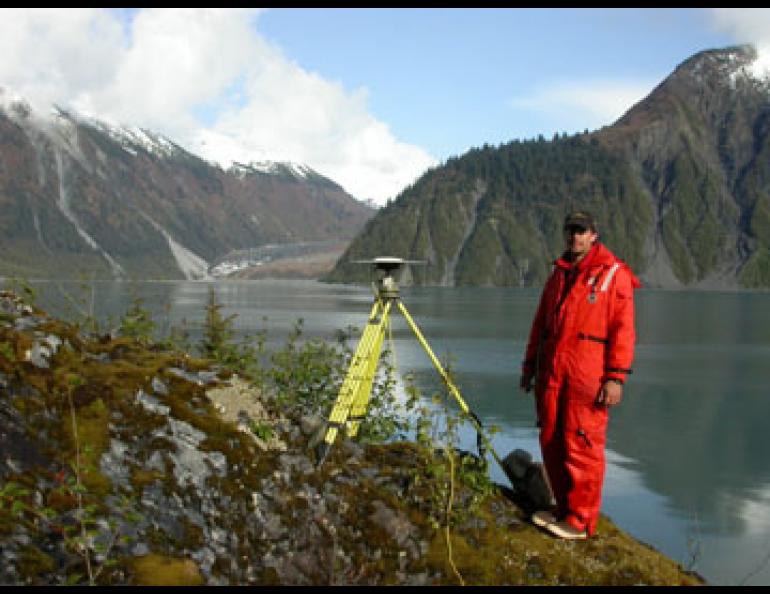
Glacier Bay and an area east of Yakutat are now two of the most dramatic examples of the glacial rebound on the planet. Chris Larsen is a postdoctoral researcher at the University of Alaska's Geophysical Institute who has spent the past few years studying glacial rebound in the area. This summer, he joined fellow researcher Roman Motyka and research assistant Adam Bucki on trips to survey 76 sites from Yakutat to Juneau with Global Positioning System receivers and antennas. By checking the precise elevations of the sites compared to measurements from the same spots in past years, Larsen has drawn a contour map of how fast areas in Southeast are rising. The two hotspots are a rock formation east of Yakutat in a melting icefield, where the uplift is 32 millimeters per year (about one-and-one-quarter inch per year), and a shoreline in Glacier Bay, which is rising at 30 millimeters (about one-and-one-eighth inch) per year.
These areas of Southeast Alaska are unique in the world because no other area has lost as much ice as Glacier Bay in the last. 250 years. Larger examples of glacial rebound are easy to find, but ancient in comparison. Hudson Bay is still recovering from the effects of a sheet of ice that melted from its surface about 10,000 years ago, and areas surrounding the massive bay have risen more than 350 feet since then. Glacier Bay and the icefields east of Yakutat probably won't gain that much elevation, Larsen said, but tree-ring cores from raised shorelines and tide-gauge studies show that Sullivan Island, between Juneau and Haines, is now 18 feet higher than it was when Vancouver sailed by 210 years ago.


