Spring breakup milder in recent years
Spring breakup just ain’t what it used to be, according to a long-time hydrologist at the Alaska-Pacific River Forecast Center in Anchorage.
Larry Rundquist has helped forecast the transition of Alaska’s rivers from solid ice to liquid water for the past 18 years. The change can be damaging for villages as large pulses of snowmelt hit river channels or huge chunks of ice form dams that back rivers up, but the past few breakups have been mild ones.
“For the first decade that I worked here, we had watches or warnings for flooding going on at several locations every day for two or three weeks as the Yukon and Kuskokwim rivers were going out,” Rundquist said. “It was a given we’d have flooding somewhere. The only question was how much damage would be done to villages.”
“In the last decade, there’s almost been a complete reversal,” he said. “The number of threats due to ice jamming and snowmelt have reduced to the point where during one year we put out no flood (warnings or watches) and several years we’ve put out just a handful.”
The month of May is when most river breakups occur in Alaska, according to the forecast center, which lists some average dates on the web. The Yukon at Eagle breaks up around May 6, while at the river’s mouth at Alakanuk the average date is May 23. For those betting on the Nenana Ice Classic, the average date for the Tanana River breakup is May 2.
In a forecast issued in late March 2005, the hydrologists predicted an average spring flood potential for most Alaska rivers and a below-average potential for the Kenai Peninsula. Thick ice on the upper Yukon near Eagle and heavy snowpack in many areas of Alaska are ingredients that lead to spring floods, but the forecasters are predicting an average breakup because computer model projections call for a warm spring. April and May weather is the most important factor in determining the severity of river breakup, Rundquist said.
An example of what Rundquist calls a “bad extreme” is a cold April followed by a very warm May, which occurred in Fairbanks in 1992. A cold early spring didn’t allow much snow to melt and the snowpack increased until mid-May. In late May, temperatures rose into the 70s, and much of the water stored in the snowpack of the upper Chena River basin became liquid in a few days, prompting the engineers at the Chena River Lakes Flood Control Project to divert much of the Chena’s flow through the massive flood channel toward the Tanana. Spring 1992 was the only time Chena water has reached the Tanana through the channel.
In the milder breakup extreme, which has lately been more typical, warm and sunny Aprils have bled out the snowpack over a longer time frame.
“We call them ‘thermal breakups’ or ‘mushouts’ because the ice gets rotten and mushy before it begins to move and has very little threat of jamming,” Rundquist said.
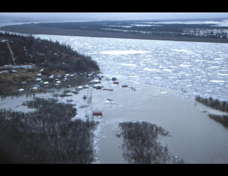
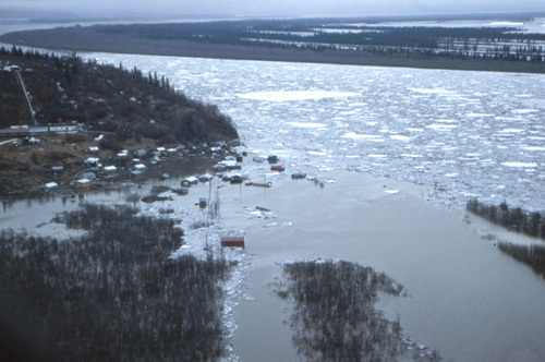
Dramatic breakups, where huge rafts of ice converge to create dams, have not been as prevalent as when Rundquist flew in a Cessna over Russian Mission on the Yukon River in spring of 1989. That year, a dam created by jammed ice backed the river into the village for one week.
The river forecasting team has flown the Yukon and Kuskokwim drainages less frequently in the past several years because breakup has been gentler.
“We’ve definitely been in a different regime the last five to 10 years,” Rundquist said. “I don’t know if it’s global warming or what, but we’ve seen pretty nice spring weather for several years now. But people on the rivers shouldn’t let their guard down. There will very likely be some flooding this year in some flood-prone villages.”
For the most current forecast of the spring flood potential in Alaska, go to http://aprfc.arh.noaa.gov/


