A springtime journey on the arctic coastal plain
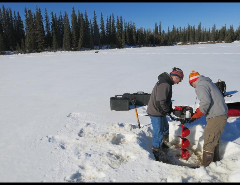
Cold water the color of iced tea wets the boots of Chris Arp as he yanks a power auger from the hole he just drilled in this quiet lake, a few miles from his office at the University of Alaska Fairbanks.
A whiff of sulfur, a sign there’s not much oxygen in this pond born when ancient frozen ground thawed wafts upward as Ben Gaglioti clears slush from the hole with a shovel. Gaglioti, a graduate student and USGS student intern, and Arp, an ecologist with the university’s Water and Environmental Research Center, are on the snow-covered ice here to teach me how to gather water samples.
Starting the week of April 7, bottling lake water will be my duty as I join a caravan of snowmachining scientists on the white plains and foothills north of the Brooks Range. The water samples will end up as far away as Worcester, Mass. at Clark University, in the labs of scientists who want to learn more about arctic lakes, which take up as much space as land in northern Alaska.
I’ll pull water samples from lakes so the scientists on the trip Arp, Guido Grosse of the Alfred Wegener Institute of Potsdam, Germany and UAF’s Geophysical Institute and Ben Jones of the USGS Alaska Science Center in Anchorage can poke corers into frozen soil, measure methane levels under ice and check the thickness of lake ice, among other duties.
Jones invited me on his annual spring journey to 60 lakes that are among the thousands that pock the map of northern Alaska, making it resemble a slice of Swiss cheese. For the third straight year, Jones and three partners will drive snowmachines over the trackless country from Toolik Lake to Teshekpuk Lake and back, covering the distance from New York to Chicago in three weeks.
Powering over that blue-white landscape, we’ll stop in some established camps at Umiat, Teshekpuk Lake and Inigok Creek and will sleep in an Arctic Oven tent on tundra within the National Petroleum Reserve-Alaska. Near each stopping point, the scientists will drill holes in frozen lakes to perform the same measurements they have the past few years. Among other things, they want to measure the thickness of lake ice, which has decreased from about seven feet in the 1970s to about five feet on recent traverses.
Because permafrost-thaw lakes cover so much of Alaska and the circumpolar north, funders at the National Science Foundation have decided the lakes are important enough for a detailed look. Jones and his colleagues, including Kenneth Hinkel of the University of Cincinnati, have probed the same lakes both in April and August of the past few years. Hinkel’s team travels overland out of Barrow to cover lakes closer to Alaska’s farthest north town. Jones and his team will start at the Dalton Highway and work northwest to the coast.
Why should anyone care about icy ponds in country that’s bitter in winter and just about impenetrable in summer?
These lakes few people will ever see are great indicators of change in a place that has been frozen and stable for thousands of years, the scientists say.
If lake ice continues its thinning trend, more lakes won’t freeze to the bottom. This will make the lakes more useful for creatures like fish, which will be able to overwinter, and people, who can use the water to make ice roads and perhaps pump it for other purposes. The downside of more free water in winter is that its heat can thaw lake bottoms, cause more shoreline erosion and maybe release trapped methane, a greenhouse gas.
For the rest of April, I will send columns back from the wild country of Alaska’s north slope of the Brooks Range. I’ll also update trip progress at alaskatracks.blogspot.com and the scientists will maintain a trip blog at arcticlakes.org/calon-blog.html. Thanks for coming along.


