

Thaw scars widespread across the northland
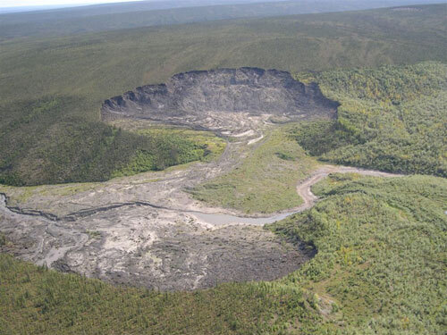
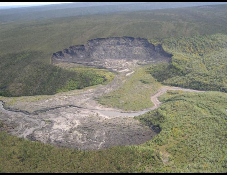
One month ago, I wrote about a dramatic landscape feature in western Alaska called the Selawik Slump. The slump, caused by thawing permafrost, looks like a bomb crater leaking mud from the boreal forest into a clear northern river. There are dozens of them in northern Alaska, though none as big as the one on the Selawik River.
There are also many of these beacons of change in the Yukon Territory, according to Doug Davidge of Whitehorse, who read the Selawik column in the Yukon News. A few years ago Davidge was flying over the Peel River country east of Eagle Plains for work when he saw a gaping wound on a hillside. Scientists once described these features as “tundra mudflows.” They now call them retrogressive thaw slumps.
“We flew over some very dramatic looking retrogressive thaws, and we could pick out other ones as we flew along,” he said.
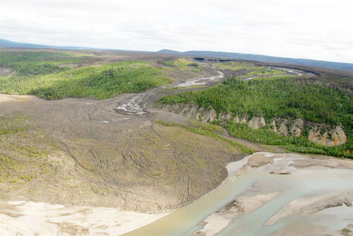
Davidge snapped a photo of the largest thaw slump he and the pilot noticed, near a drainage called Bonnet Plume. Though not as large, it looks similar to the feature that is now clouding the Selawik River. Retrogressive thaw slumps form when warm air eats at permafrost that contains large bodies of ice. The features often develop when a river cuts into a frozen bank on an outside bend.
As ice and frozen soil thaw back into a bank or hillside, more and more of the ground collapses in on itself, leaving a crater of churned soil backed by a steep, frozen headwall. That wall retreats over time, mud flows downhill and often into rivers, and the slump grows.
Though it’s not part of Davidge’s job for Environment Canada, the giant scar on the landscape intrigued him enough to send him to Google Earth on his own time to search for more of the characteristic scoops missing from hillsides along the remote Peel River drainage. He found a lot of them.
“I don’t have the total count in front of me,” he said from his office in Whitehorse. “I keep adding them to the list, but it’s probably in the range of 200 or so . . . There are many other huge ones out there.”
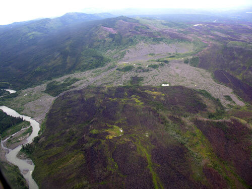
Yukon Geological Survey Geologist Panya Lipovsky has studied the retrogressive thaw slumps for a few years in central and southern Yukon. One of the more interesting ones she’s encountered is 60 miles north of the town of Ross River on the South MacMillan River; it’s known as the Surprise Rapids Slide.
“That’s the biggest one I’m aware of,” she said, also from her office in Whitehorse. “It’s about (2,300 feet) wide and has traveled up to about (one-and-one-half miles from the hillside to the river). It may have been triggered by a forest fire in the 1870s and still hasn’t stabilized in more than 100 years. The headwall keeps melting back.”
Some of the slumps she has observed are recent and some date back more than a century. They may be related to forest fires, intense rainfall, meandering rivers, and/or warming air temperatures, she said. One of the more active periods for the Surprise Rapids Slide happened in the 1940s, when the central Yukon had record high early summer temperatures, according to Brent Ward of Simon Fraser University.
Lipovsky knows of slumps that are eating into hillsides at the rate of 30 feet per year. Some have altered the flow of rivers and have clouded them up with their runoff, but she hasn’t heard of any troubling people in the Yukon, as the Selawik Slump might be affecting the people of Selawik should cloudy water damage sheefish spawning grounds.
There aren’t many scientists who are studying these eye-catching northern expressions of permafrost lost, but thaw slumps may draw more attention as they continue to express themselves on the less-frozen northern landscape.
“We’ve only just started keeping an inventory of these things in the last couple years,” Lipovsky said.