Volcanoes, permafrost, earthquakes shape Alaska
One hundred thousand glaciers, 41 volcanoes that have erupted since the 1700s, 11 percent of the world’s earthquakes: Alaska has its share of superlatives. And here’s another one—Alaska has the largest maar on Earth.
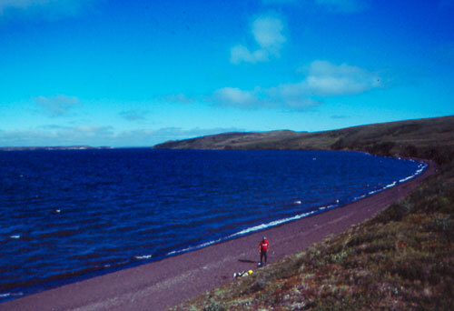
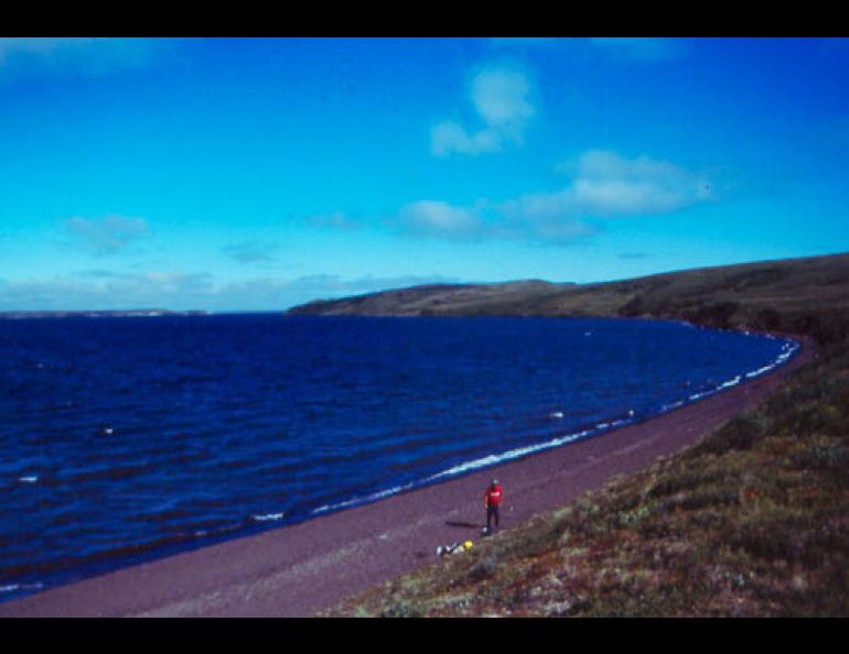
What’s a maar? It looks a lot like a lake. It’s circular and it exists because of colossal explosions that happened when molten rock met water. Jim Beget has visited the world’s largest set of maars, located on the northern horn of the Seward Peninsula east of Shishmaref.
Landforms shaped in dramatic fashion intrigue Beget, who works for the Alaska Volcano Observatory and the Department of Geology and Geophysics at the University of Alaska Fairbanks. At a recent science conference he showed a photo of the Devil Mountain Lakes maar, the largest one on Earth.
The Seward Peninsula, home to Nome, Shishmaref, Elim and other towns and villages, seems an unlikely place for volcanoes. Unlike the Aleutian Islands, the Alaska Peninsula, or the Wrangell Mountains, the Seward Peninsula has no cone-shaped, steaming peaks. But the nose of Alaska that juts into the Bering Sea has several circular lakes that hint at the area’s steamy past.
The Devil Mountain Lakes maar is about 8 kilometers (5 miles) in diameter. In a remote section of the Seward Peninsula, about 100 kilometers (62 miles) west of Kotzebue, it formed about 21,000 years ago when volcanic eruptions forced their way through permafrost. The frozen ground created the exceptional size of the maar, Beget said, because molten rock moving to the surface creates violent explosions when it meets water.
Maars form when lava hits ground water, a shallow lake, or permafrost, because water expands by 1,000 times when it turns to steam. The permafrost at the Devil Lakes site provided a steady supply of water for the rising lava, making the northern Seward Peninsula a loud place about 21,000 years ago.
“Devil Mountain was a big eruption with lots of magma, and because every bit of the ground had ice in it, it remained explosive as long as the eruption occurred,” Beget said.
The result was one of about a dozen maars in Alaska, and the largest known maar crater in the world.
Volcanoes’ interaction with permafrost results in one unusual Alaska landform, and Beget described another at the same conference—a landscape covered with boulders that a giant earthquake shook loose from a mountain.
North of Cantwell and east of the Parks highway stands Panorama Mountain, a hulk of pointy black spires. Look on the west side of the mountain, Beget said, and you see a gash from a prehistoric rock avalanche that traveled across the Nenana River. Across the river are former pieces of Panorama Mountain as large as houses.
Panorama Mountain sits on the western end of the Denali fault. The eastern portion of the fault ruptured in the magnitude 7.9 earthquake of 2002, the largest earthquake on the planet that year. Scientists are trying to find out when the fault last ripped at its western end, the part that runs beneath the Parks Highway and near Cantwell.
Beget and Mary Keskinen, also of UAF’s Department of Geology and Geophysics, have taken a close look at the lichens clinging to the rocks that fell during the Panorama Mountain slide. The oldest lichens on the rocks date back to 400 years, making the geologists think the last great earthquake on the western portion of the fault may have happened around the year 1600. Since then, the fault has been building up stress, perhaps similar to the energy that the great 2002 earthquake released on the other side of the Parks Highway.