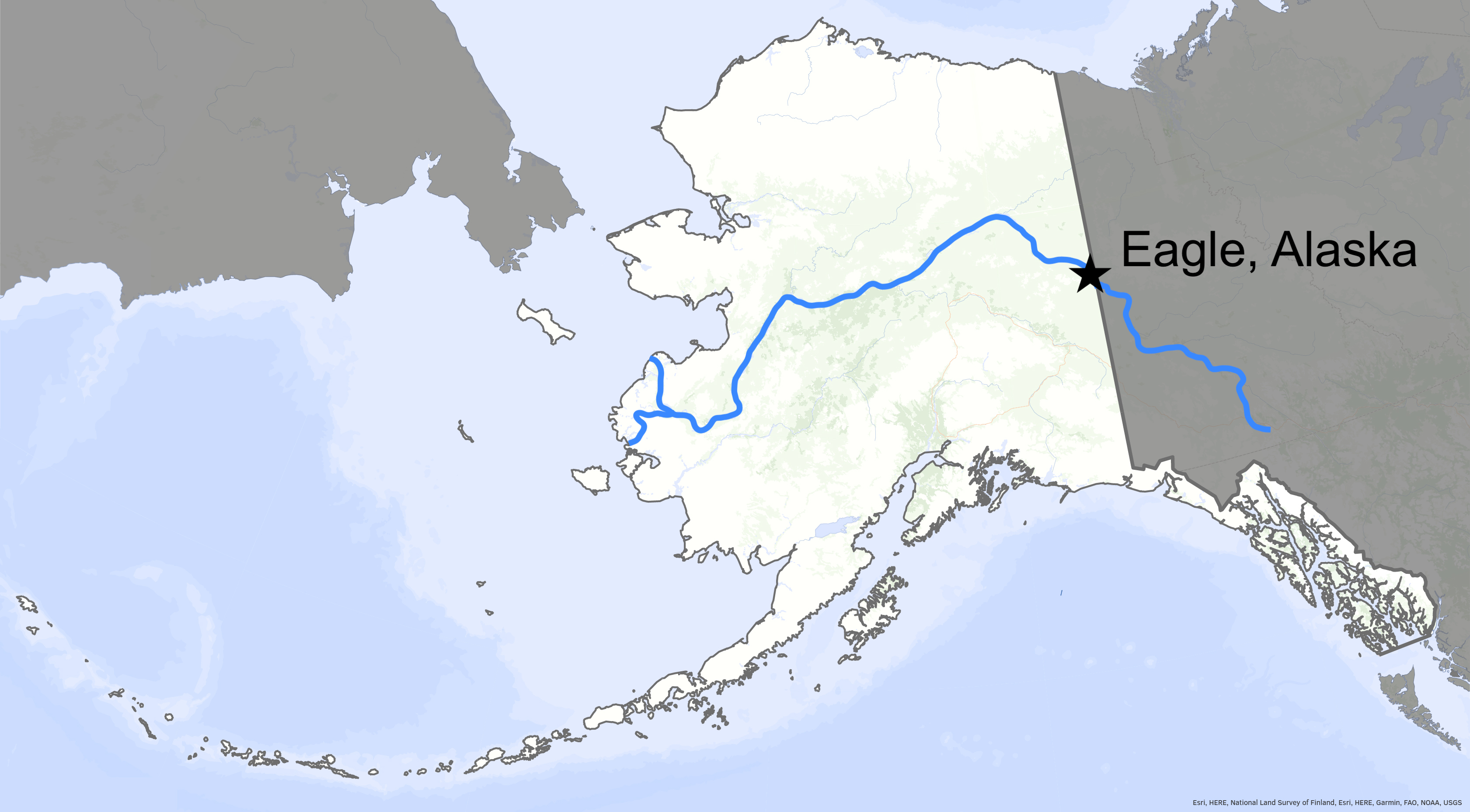
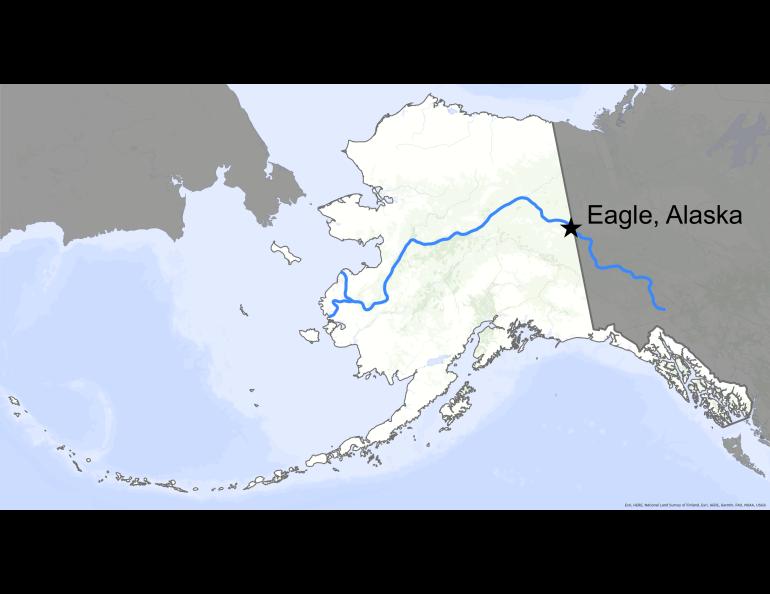
When river breakup came to Eagle
EAGLE — As the late evening sunshine poured in from the northwest, a dozen residents of Alaska’s farthest upstream town on the Yukon River watched their winter race past in floating chunks of ice.
Eaten into by the warm air of spring, the Yukon River’s solid sheets were breaking into smaller pieces. The big river was responding to the flush of frothy brown meltwater pumping in from side creeks and rivers.
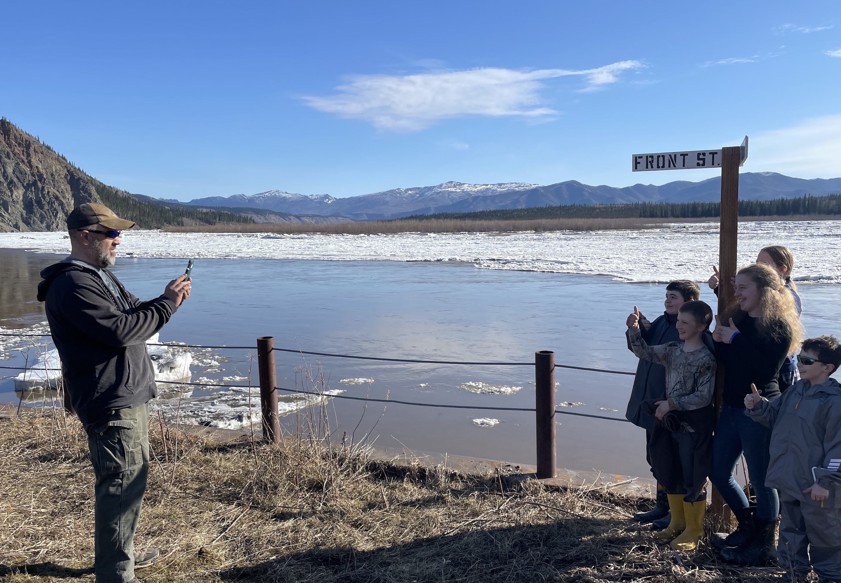
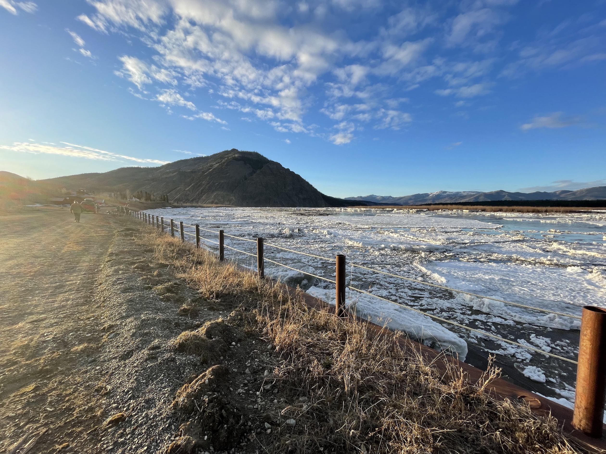
The dirty white jigsaw pieces of ice raced downstream at 10 miles per hour, bumping into the driven steel seawall protecting Front Street. Through their rubber boots, people standing at the wire railing felt earthquakes with their toes.
The ice-jam cork just downstream of town had popped an hour before, allowing the big river to move as it wished. This was much preferable to ice blocking the full channel. When that happened, water could spill over the banks, shoving schooners of ice into buildings and heating-oil tanks.
That lovely night — May 12, 2023 — a person could sense a collective exhale at the waterfront, its air refrigerated by the passing mass of ice. The townspeople — many of whom remembered the damaging floods of both 2009 and 2013 — seemed happy and relieved on that cool spring evening.
But as they creaked shut the doors of their cars and trucks to head home for the evening, longtime residents knew that things could change; they had all heard of an ice clog in the river that had created a serpentine white pile 20 miles long in Canada, about 50 miles upstream of Eagle.
That jam had backed water into the historic site of Fortymile, where the river of that name empties into the Yukon. An aerial photo showed “Sebastian’s Cabin” had ice at the level of its metal roof. The functional wood stove inside was 6 feet under cold dark water.
Those who took that photo of Fortymile — observers in a fixed-wing aircraft flying for the National Weather Service and Alaska-Pacific River Forecast Center’s River Watch team — had predicted that the jam just over the border in the Yukon Territory would soon fail. When it did, that pulse of stalled water would roll like a freshwater tsunami downriver for Eagle. Following close behind would be the 20-mile stack of ice that had paused.
Neither force had arrived when the people of Eagle headed for their beds as the sun dipped behind the mountains for the night on May 12.
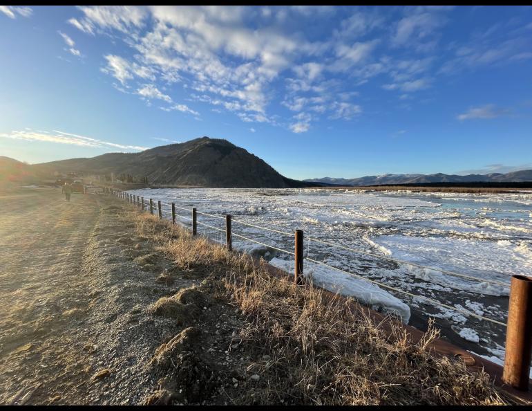
At that time, things looked peaceful enough. The one-quarter-mile wide river was mostly liquid at that point, moving smooth and dimpled and wide enough to accommodate city blocks of ice that passed with a few rude whumps at the seawall.
At 11 p.m., when the river was running almost ice-free, I was preparing to sleep on a high point of the riverbank where Han Athabaskans had lain amid fragrant sedges hundreds of years ago. After brushing my teeth, I looked down at my satellite texter. A green light blinked.
“The automated reading shows the water (rose) back up 4’ in the last hour,” wrote Crane Johnson of the Alaska-Pacific River Forecast Center, who was flying the river by day and sleeping in Fairbanks at night. “Could be a gauge malfunction?”
I told him that I would walk a few hundred yards downhill to check the river’s level in a manual fashion, by reading a measuring stick built into the Eagle seawall on Front Street.
The sky was darkening and cooling, giving a purple hue to the vast open space at this graceful bend of the Yukon. I stepped down the staired portion of the seawall that held the staff gauge, which resembles a yardstick attached to the metal wall. I was surprised at what I saw.
“River did come up!” I texted Johnson.
The automatic, internet-connected U.S. Geological Survey gauge suspended just above the muddy bottom of the river (which violent ice would later render inaccurate) was at that time still working properly. The river had indeed risen 4 feet since most people had gone home.
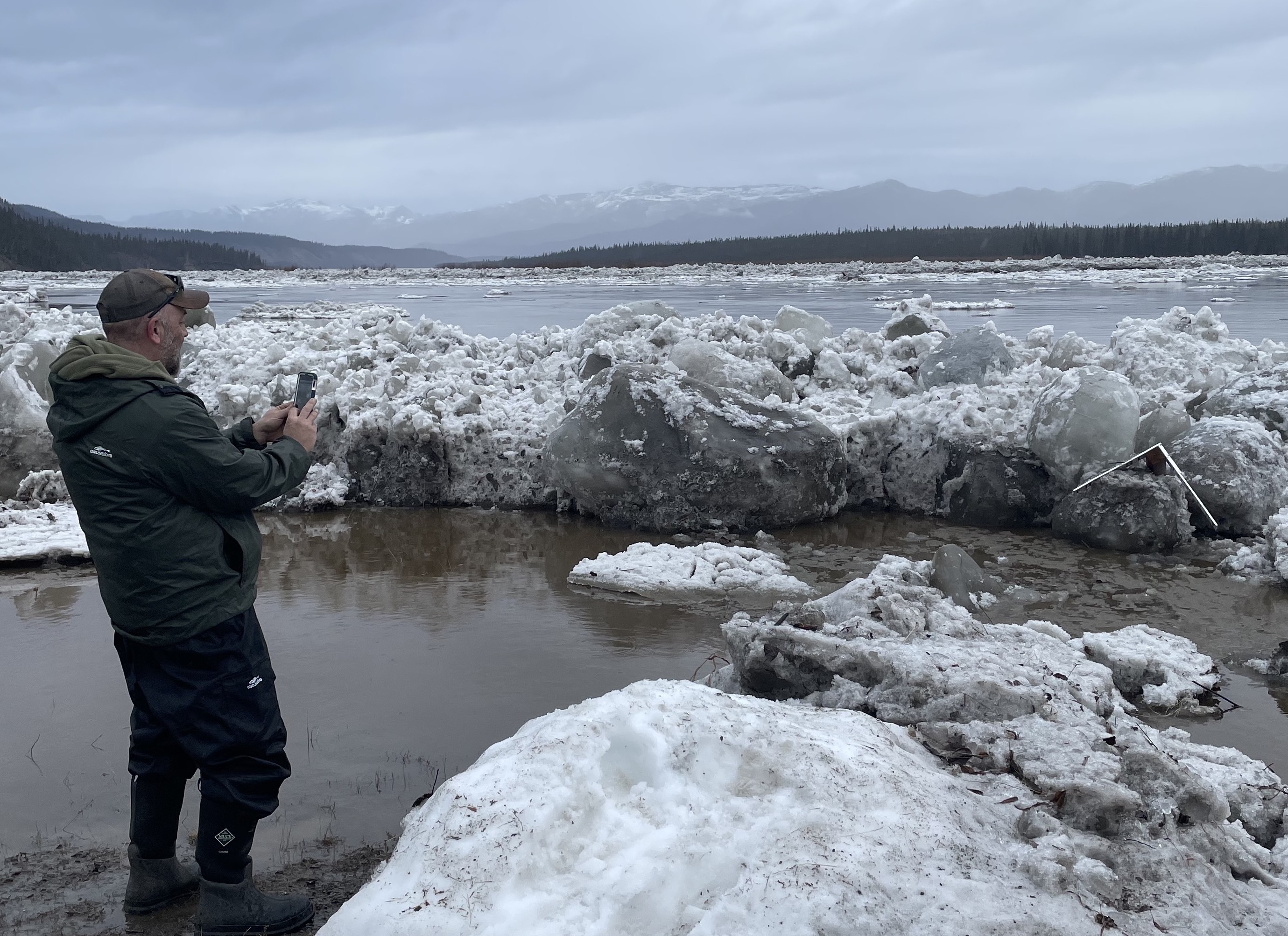
I then walked over to the waterfront to join the only person then standing above the seawall, a seasonal ranger who was there to work the summer at Yukon-Charley Rivers National Preserve. He and I watched in quiet awe as ice chunks larger and heavier than pickup trucks pounded that retaining wall of interlocking steel pilings that workers drove like nails into the floury soil long ago.
“Makes you wonder how much this wall can take,” the ranger said.
After absorbing the spectacle for another half hour, he drove away to check out the low-lying road to Eagle Village, a few miles upstream.
I hiked back up to my high spot and crawled into the sleeping bag. I fell asleep to the meaty thuds of colliding ice and the sound of frying bacon that was the constant mingling of smaller ice particles sailing downstream.
I woke a few hours later in the dim light of early morning. When I stood and squinted upstream, I blinked a few times. Where was the seawall?
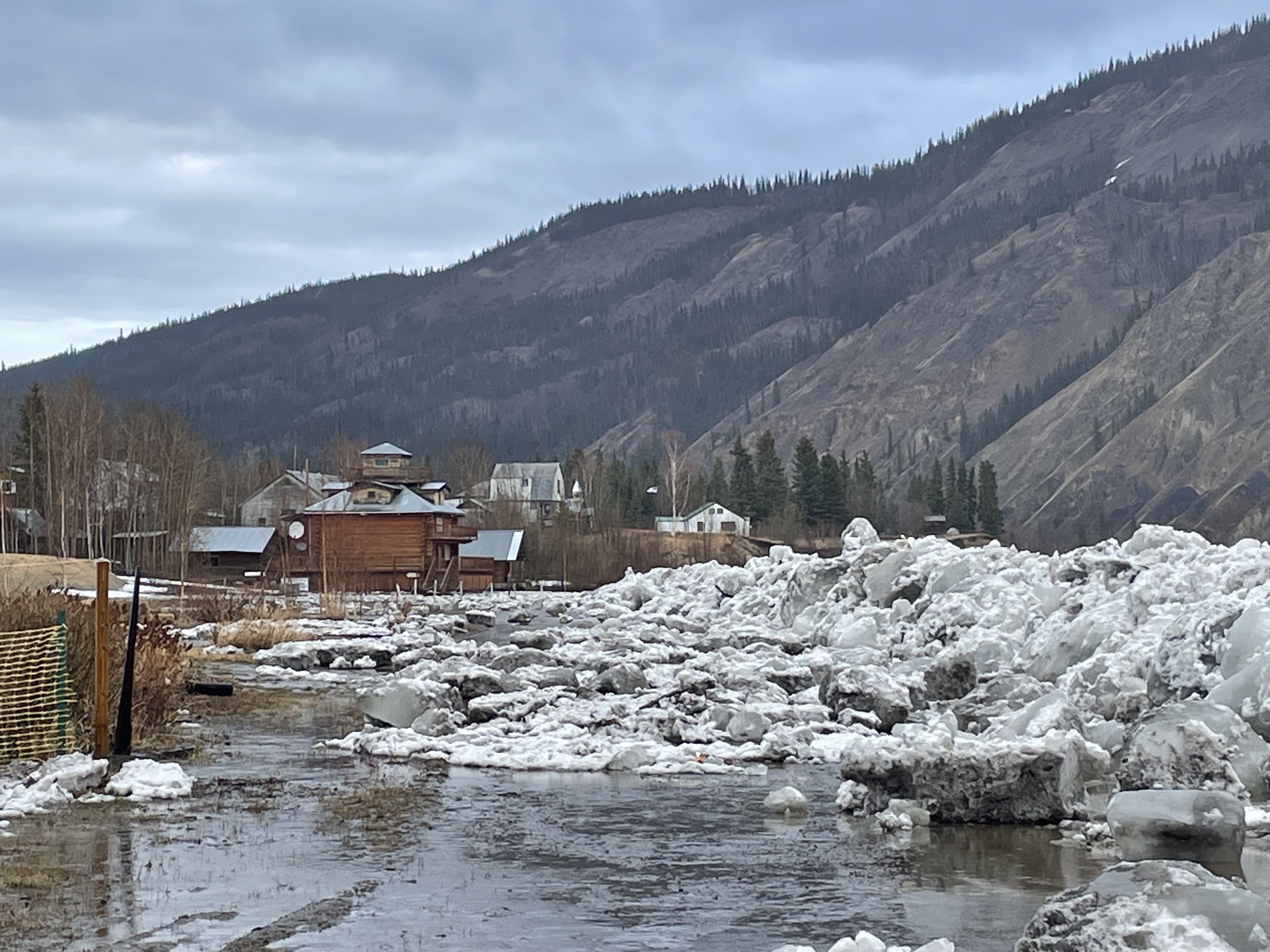
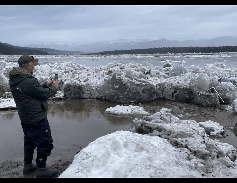
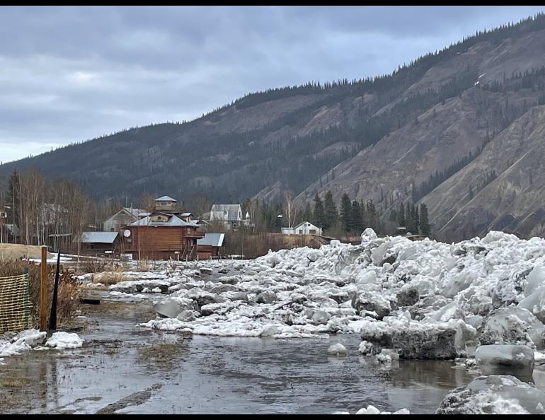
A look through binoculars showed a ridge of ice where the wall was before. The river had continued to rise and overtopped the wall (later determined to have happened at about 2 a.m.). It oozed over the metal, carrying the ice from the upriver jam onto Front Street, up to the steps of the Falcon Inn bed and breakfast.
The river had dropped a few feet since then, leaving ice boulders strewn over Front Street. There was some damage: The ice had lifted and shoved the bench with a million-dollar view right above the seawall. The view from it — now tipped on its back — was of the clouds overhead spitting rain.
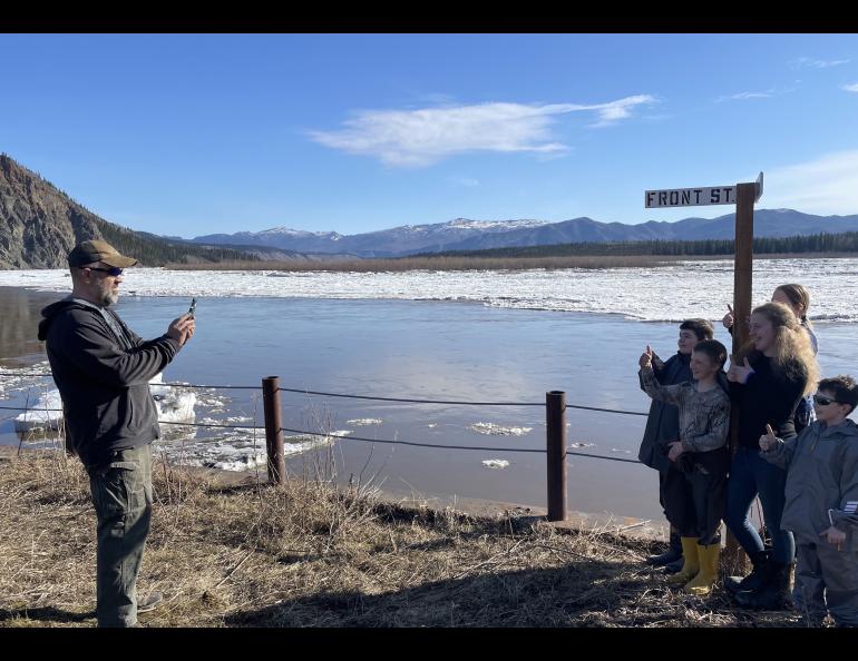
Ice had also flattened the street sign marking the corner of Lincoln and Front streets. That is where Eagle teacher Ryan Becker had taken pictures with his students each school day since January as they were on their way to take ice measurements.
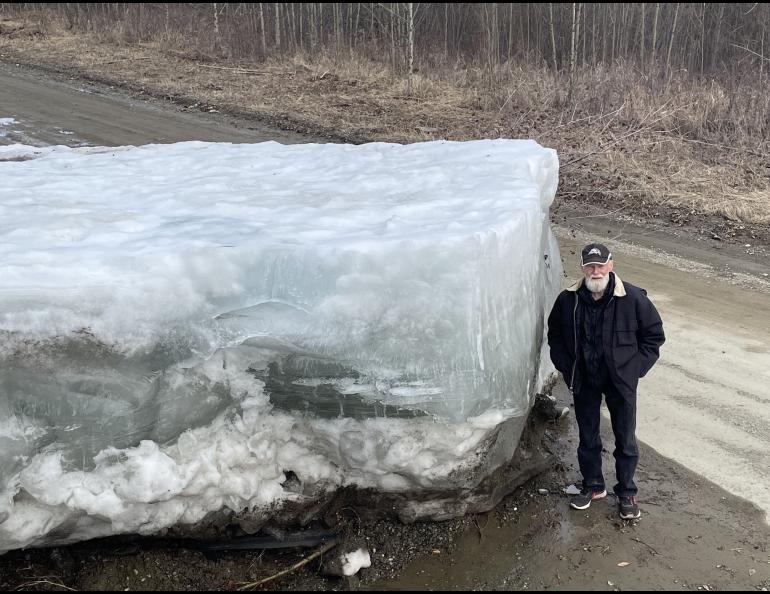
In the dead of night, the river had thrown its strongest punch. The ice sheared steel posts of the seawall. The swollen Yukon cluttered the upstream boat landing with Sherman tanks of ice that will not melt till June, if then. The road to Eagle Village was thoroughly impassable with similar blocks, though there was an alternative path for four-wheelers that connected the village to Eagle, the Alaska highway system and the rest of North America.
The river’s 2023 hit was a glancing blow to Eagle — not the floating cabins tethered by powerlines like dogs on leashes of 2009 nor the seven homes knocked off their foundations in 2013.
By late morning on May 14, 2023, the river in front of Eagle was moving fast and free. The pulse of water that damaged the seawall was cruising 160 miles downriver to the next Alaska community of Circle. There, combined with another jam, it would cause major flooding, which included the loss of power and extreme water and ice damage to homes. (At the time of this writing, officials didn’t know if it was the worst flood ever recorded there).
Eagle, though, slid through another breakup, this one of the type that came with increased risk of dynamic flooding due to a tardy spring that locked the landscape in winter cold as the days ticked on.
As it warmed to the 60s Fahrenheit, neither townspeople nor professional hydrologists knew what the river was going to do in Eagle. But Johnson had seen enough on his upriver flights to tell residents to “prepare for 2009.”
By the evening of May 14, two days after the real action had begun, most of the unimaginable tons of river ice had disappeared downstream. That was except for stranded icebergs on roads around town, and a tall ring of ice surrounding Belle Island that would calve like a glacier for the next week.
The ducks and songbirds that hadn’t seemed disturbed by all the action continued to prepare for their summer of making babies in the North. The people of Eagle thought ahead to turning over the soil in their gardens so the brown dirt could warm in the sunshine. They had made it through Yukon River’s transition from winter to summer once again.
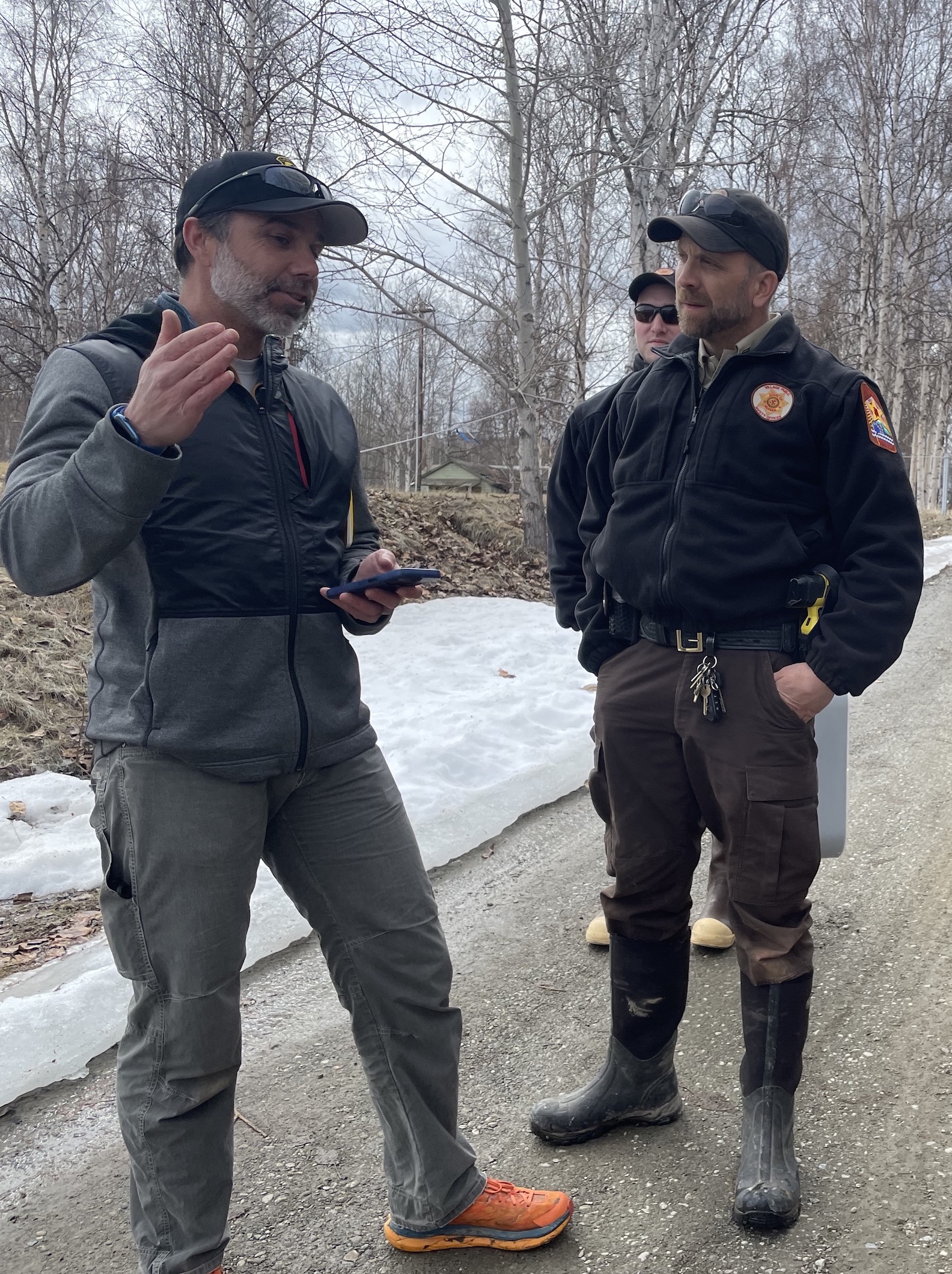
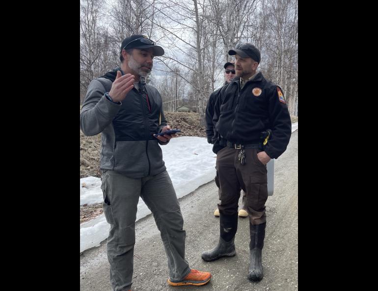
“This was a good one,” Eagle’s Village Public Safety Officer Nate Becker said to Crane Johnson near the Falcon Inn on the afternoon of May 14. “We had a lot of excitement, but nobody got hurt.”