Skip to main content
Shop
Donate
UA Directory
Intranet
Quick Links
Geophysical Institute
Main navigation
Home
About
Contact Information
Contact
UAF Directory
Visitor Information
About the GI
Diversity & Inclusion
GI Publications
Timeline
GI Quarterly
People
Leadership
Researchers
Graduate Student Researchers
Emeriti
Research
Atmospheric Sciences
Remote Sensing
Seismology & Geodesy
Snow, Ice & Permafrost
Space Physics & Aeronomy
Tectonics & Sedimentation
Volcanology
Facilities & Labs
Services
Design & Printing
GI Human Resources
Education Outreach
Instrument Development
Keith B. Mather Library
Research Computing Systems
News & Info
News
Alaska Science Forum
Alaska Science Pod
Science for Alaska
Aurora Forecast
Visitor Information & Tours
Events
Diversity & Inclusion
Student Info
Intranet
Search
News
Breadcrumb
Home
/
News
Filter By Year
- Any -
2024
2023
2022
2021
2020
2019
2018
2017
2016
2015
2014
2013
2012
2011
2010
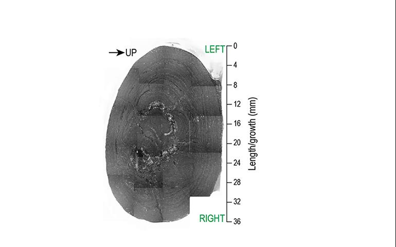
Paleomagnetism aids research on the Northern Hemisphere Glaciation
Geophysical Institute
April 14, 2023
A small piece of Pacific Ocean floor, brought up 10 years ago by a Chinese research vessel from a depth of 16,500 feet and 2,700 miles from the...
Read more
Research reveals geologic history of critical Alaska graphite deposit
Geophysical Institute
April 13, 2023
“This gives us a better understanding of how the rock evolved and how the processes affected the rocks’ texture and mineralogy over time,” said...
Read more
New hangar will make Nenana a base for drone cargo testing
Geophysical Institute
April 12, 2023
ACUASI has been using the city-owned Nenana airport regularly for test flights and wants the city to become a part of an Interior drone testing...
Read more
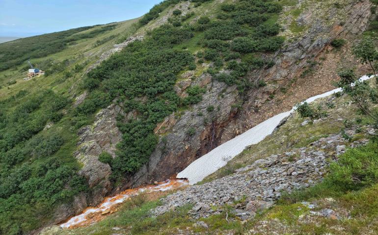
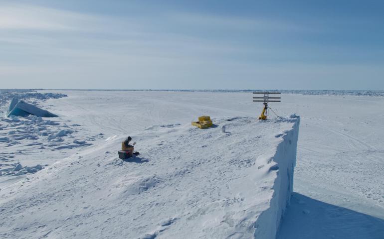
New method of monitoring shore ice could improve public safety
Geophysical Institute
March 29, 2023
Specialized portable radar could serve as an early warning system to reduce risk for humans working on shorefast sea ice, according to a recently...
Read more
‘Airborne object’ response builds on UAF, military partnership
Geophysical Institute
March 16, 2023
Robert McCoy, director of the University of Alaska Fairbanks Geophysical Institute, was driving to the movie theater in Fairbanks on a Saturday...
Read more
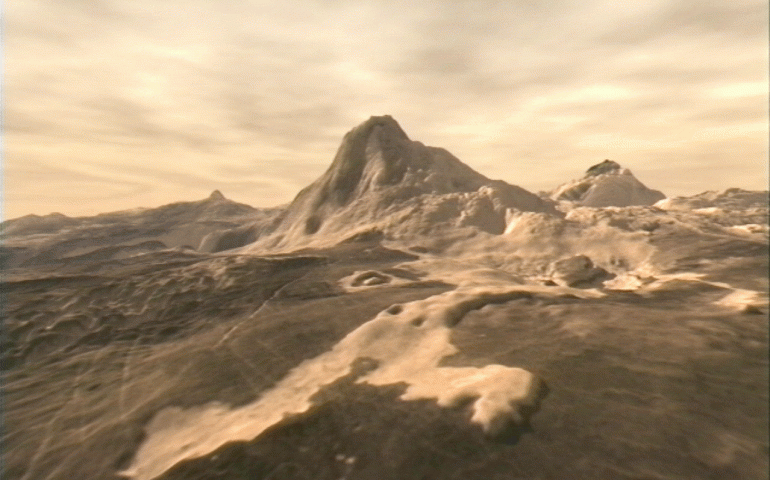
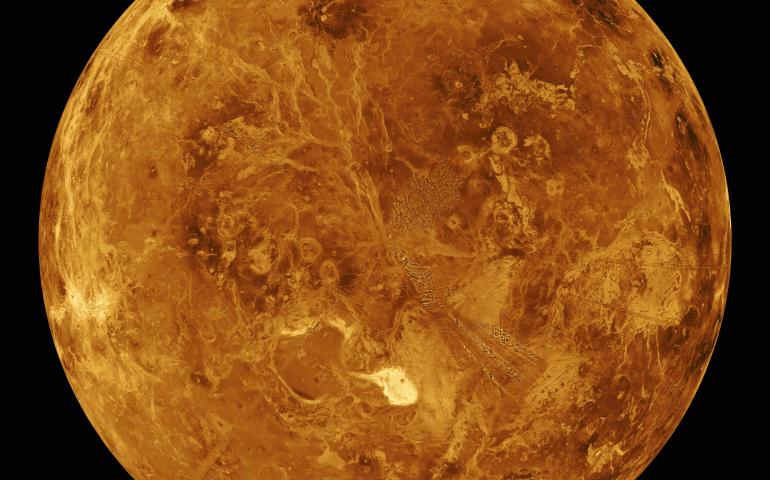
UAF scientist offers evidence that Venus is volcanically active
Geophysical Institute
March 15, 2023
Venus appears to have volcanic activity, according to a new research paper that offers strong evidence to answer the lingering question about...
Read more
UAF researchers aiding NASA in developing Venus seismometer
Geophysical Institute
February 23, 2023
Earth has earthquakes, Venus has venusquakes. Researchers at the University of Alaska Fairbanks Geophysical Institute, working with NASA, are...
Read more
For a UAF seismologist, the Turkey earthquake is personal
Geophysical Institute
February 21, 2023
No, he said, it had just struck their native Turkey and northern Syria, both 12 hours ahead of Alaska. An email alert soon arrived from the U.S...
Read more
UAF research contributes to progress on fusion energy
Geophysical Institute
February 20, 2023
Fairbanks and nuclear fusion research usually aren’t mentioned in the same sentence. But they could be. Plasma physicist David Newman at the...
Read more
Load More