


Recent Posts


New GINA satellite antenna gets lifted into place at UAF
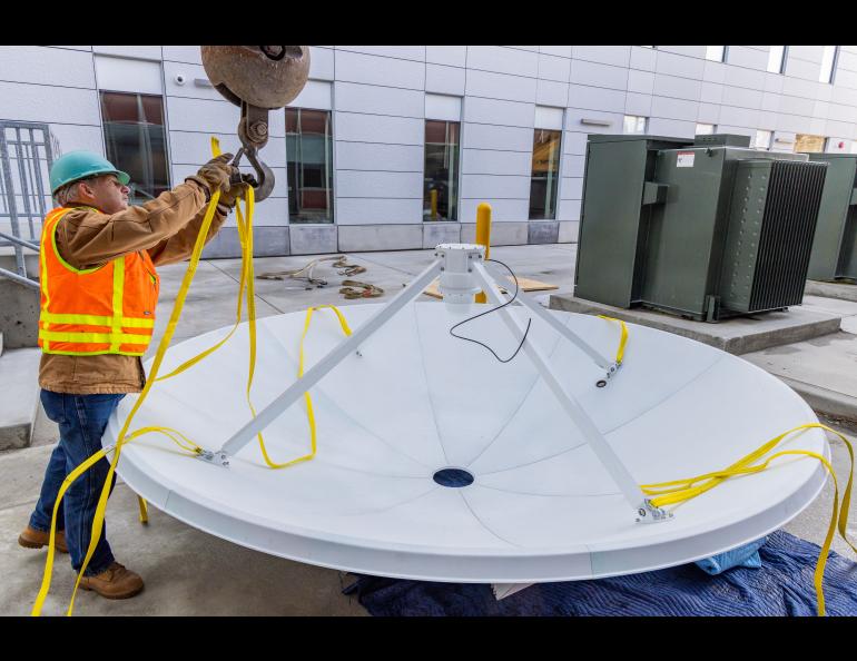
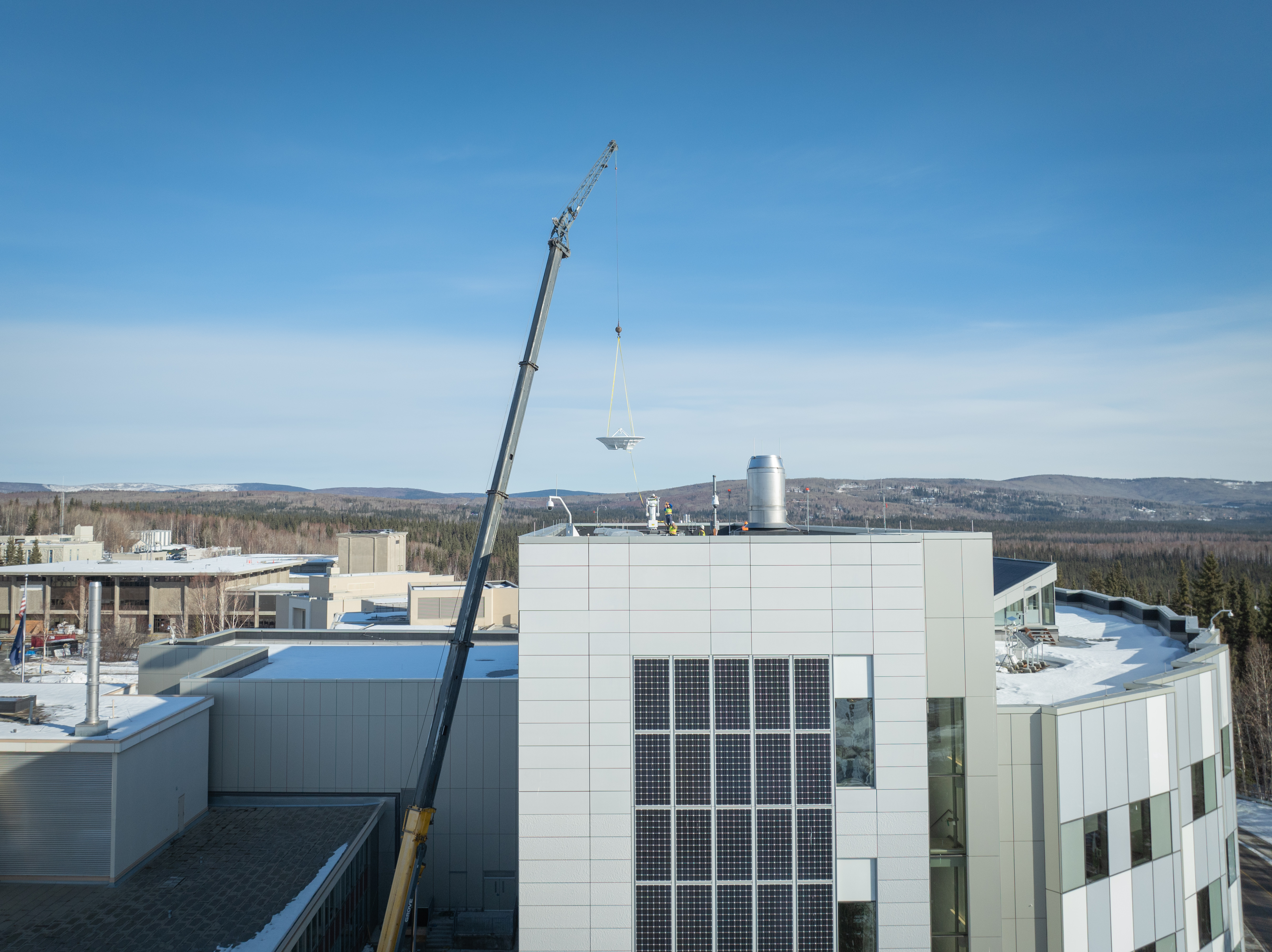
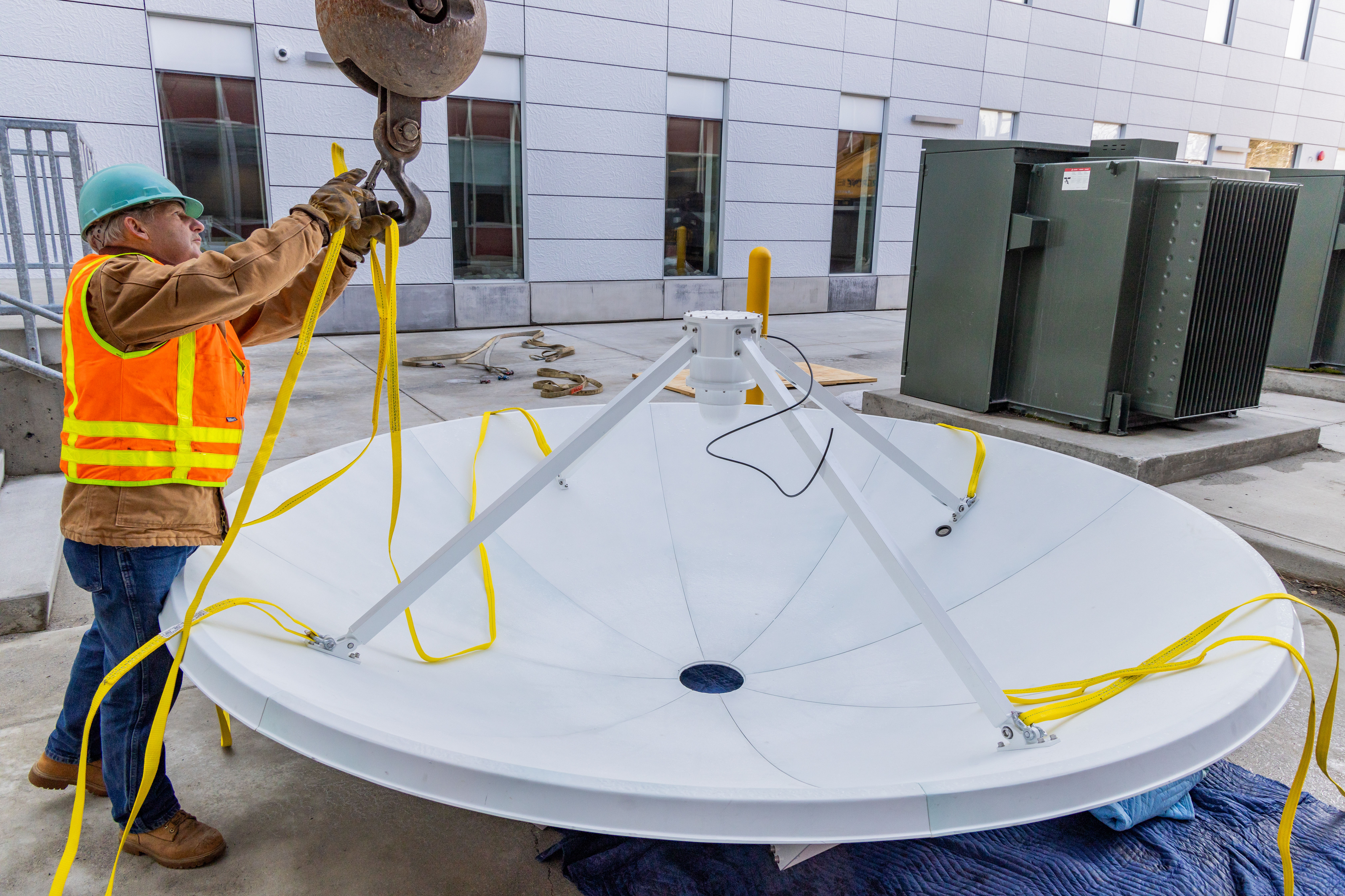
A crane hoisted a new 3-meter antenna atop the University of Alaska Fairbanks’ engineering building Saturday, increasing the capability of the Geographic Information Network of Alaska.
The new antenna will eventually replace the domed antenna on top of the Akasofu Building on the university’s West Ridge. That 23-year-old antenna will be repurposed for educational activities.
“We’re getting a new antenna with new technology, and it will have an expected lifetime of 25 years,” GINA Director Jennifer Delamere said prior to the antenna dish being placed atop the Usibelli Building.
GINA is a unit of the UAF Geophysical Institute.
“The antenna will be used to downlink data from the Joint Polar Satellite System constellation of satellites as well as satellite data from European and Japanese partners,” she said. “The new antenna will improve weather forecasting and environmental monitoring for Alaska.”
JPSS, operated by the National Oceanic and Atmospheric Administration, is vital for Alaska, Delamere said.
“These JPSS satellites and the powerful instruments they carry are the most versatile observational assets we have for weather and hazard detection in the state of Alaska,” she said. “They provide frequent coverage and cover wide areas.”
The antenna will quickly be put to work.
“We'll be testing it this week,” Delamere said. “It should be continuously taking satellite passes by the end of the week. And then we have to integrate the data into our computer processing system in the Butrovich Data Center.”
“It's so inspiring to think about a satellite flying 500 miles above us, pushing its data to a 3-meter antenna on the roof of the Usibelli Building. The data received on this antenna is the basis for incredible images that we use to monitor our environment,” she said.
In addition to the X band, the new antenna will use the L band, which is also in the microwave range but with lower-frequency signals. The antenna will function in the same manner as GINA’s antenna at NOAA’s Fairbanks Command and Data Acquisition Station at Gilmore Creek north of Fairbanks. That antenna downlinks data from 10 satellites and will do so for new satellites to be launched within the next two years.
The Akasofu Building antenna that it is replacing operates only in the X band,
A protective dome will be placed over the new antenna later in the year.
The GINA team uses satellite measurements of visible, infrared and microwave radiation from Earth to produce maps and imagery of Alaska weather, fire, oceans and sea-ice. The products are used in near real-time monitoring of the environment of Alaska and adjacent oceans.
Many government agencies use products that GINA creates, including the National Weather Service’s Alaska Sea Ice Program, Alaska Aviation Weather Unit and regional NWS forecast offices, the U.S. Bureau of Land Management’s Alaska Fire Service and the Alaska Interagency Coordination Center. Alaska Volcano Observatory, a joint program of the UAF Geophysical Institute and the U.S. Geological Survey, also uses GINA products.
• Jennifer Delamere, University of Alaska Fairbanks Geophysical Institute, 907-474-7140, jsdelamere@alaska.edu
• Rod Boyce, University of Alaska Fairbanks Geophysical Institute, 907-474-7185, rcboyce@alaska.edu