
Recent Posts
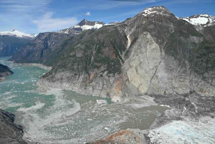


Seismologists get close-up look at hazardous Barry Arm landslide
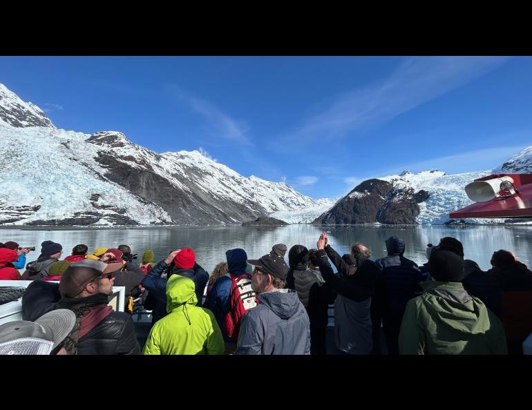
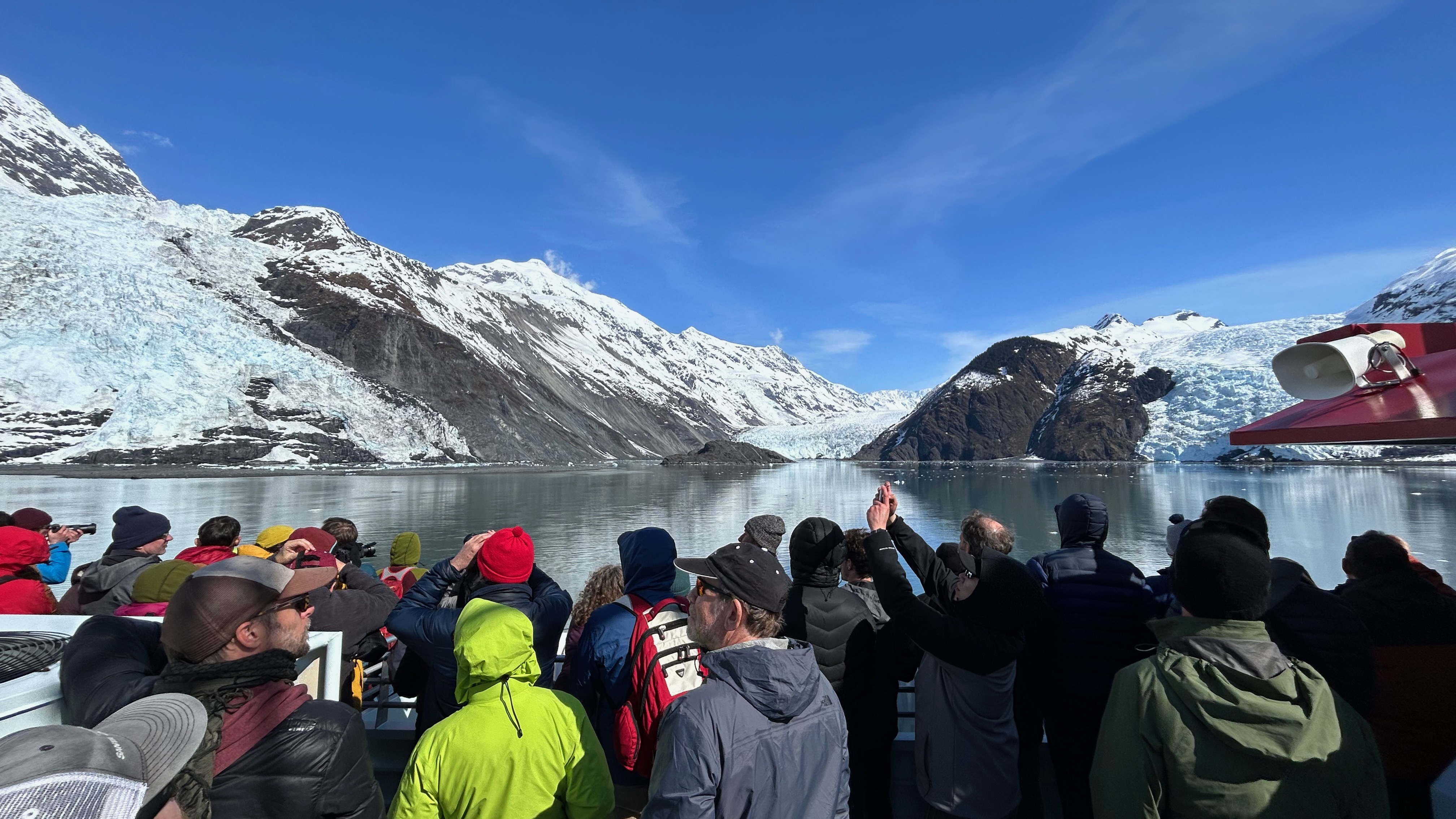
A high point for about 300 seismologists, geologists and other scientists gathering in Anchorage for a weeklong conference came Monday, April 29, on the waters of Prince William Sound with an approach to a wide and high unstable hillside that could cause a catastrophic tsunami if it rapidly collapses.
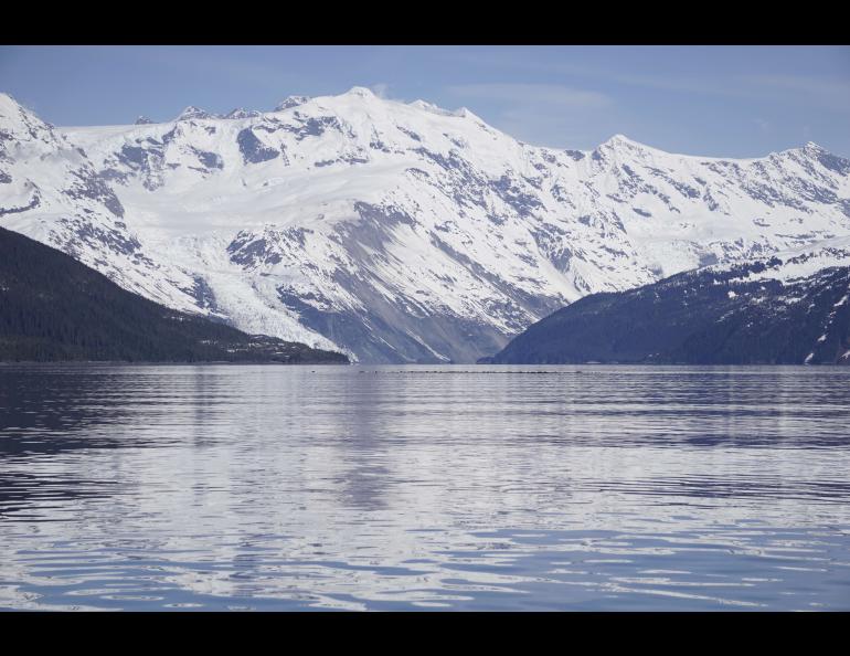
That hillside, on the southeast slope of Barry Arm in the far northwest of the sound, is heavily monitored by federal and state seismologists, including those at the Alaska Earthquake Center at the University of Alaska Fairbanks Geophysical Institute.
The landslide continues to be the subject of extensive research and had the rapt attention of researchers when their ship carrying them on this science cruise drew in for a close view of the slumping land and the receding Barry Glacier.
The science cruise, which had several discussion topics throughout its route, was one of the activities on the opening day of the weeklong Seismological Society of America annual meeting. Approximately 1,100 researchers from across the country are participating in the meeting, being held in Anchorage for the first time since 2014.
Several, including students, are from the Geophysical Institute and UAF College of Natural Science & Mathematics CNSM.
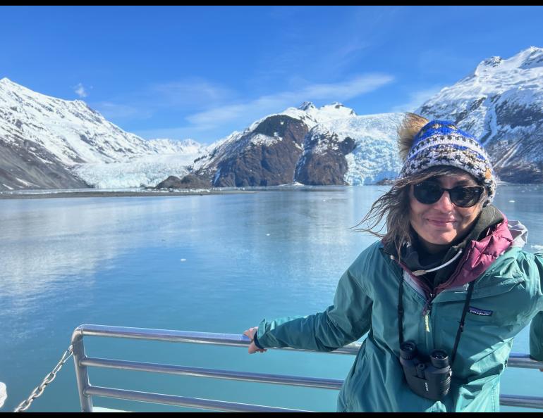
One of those is Geophysical Institute research seismologist Ezgi Karasözen, who with Earthquake Center Director Michael West developed a prototype method to remotely detect large landslides within minutes of occurrence and to quickly determine whether they are close to open water and present a tsunami hazard. Their work, which cites the Barry Arm hazard, was published Feb. 9 in The Seismic Record.
Monday’s trip was Karasözen's second viewing of the landslide area and the receding glacier, which has now left about eight-tenths of a mile of the landslide — half its width — exposed to the fjord.
“I’m always amazed by how big the landslide is and how great the hazard itself is,” Karasözen said. “The glaciers that are surrounding it look really pretty, but they also make our job a little challenging because our seismic stations carry all of these sounds from the glaciers.”
Barry Glacier has retreated and left behind an unsupported fjord wall that has slumped about 650 feet in recent decades.
The U.S. Geological Survey is leading the multifaceted interagency monitoring of the area.
The landslide has an average slope of approximately 37 degrees, with a maximum slope of over 50 degrees at its upslope, according to a field guide provided by the Seismological Society.
The slide covers approximately 1.3 square miles and is 1.7 miles wide and nearly 1 mile high from its top to the fjord surface.
A rapid collapse would, in the worst case, create waves of over 650 feet high in the northern part of Barry Arm, adjacent to the landslide source area, and would run up the opposite fjord wall more than 1,600 feet, according to the field guide.
The tsunami would reach Whittier in about 20 minutes.
“It's quite motivational to see this when you realize the hours and hours of research you spend is actually for a good cause,” Karasözen said.
• Ezgi Karasözen, University of Alaska Fairbanks Geophysical Institute, ekarasozen@alaska.edu
• Rod Boyce, University of Alaska Fairbanks Geophysical Institute, 907-474-7185, rcboyce@alaska.edu