
Recent Posts


UAF researchers use drones to test new instrument for measuring sea ice thickness and its snow cover
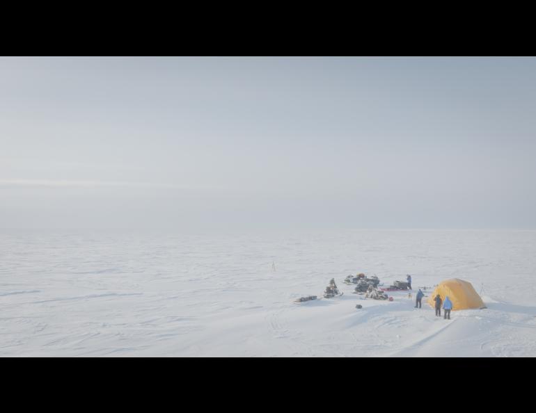
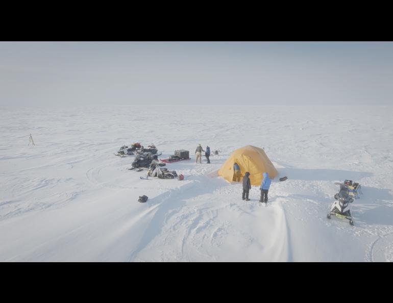
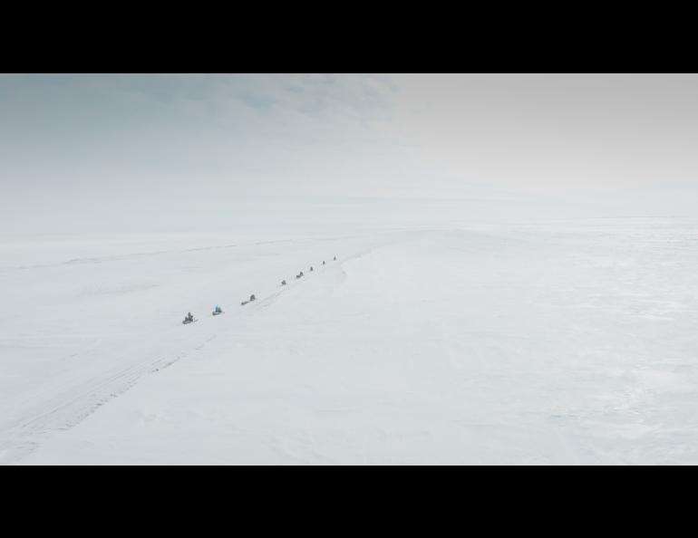
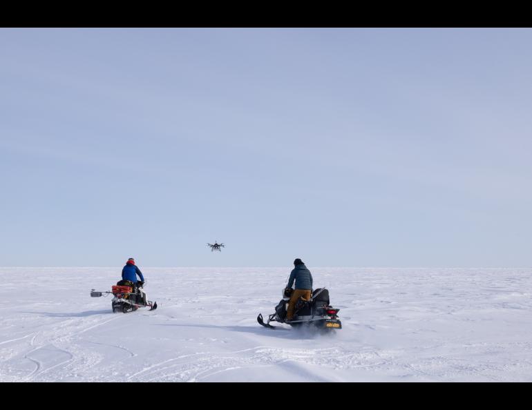
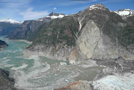
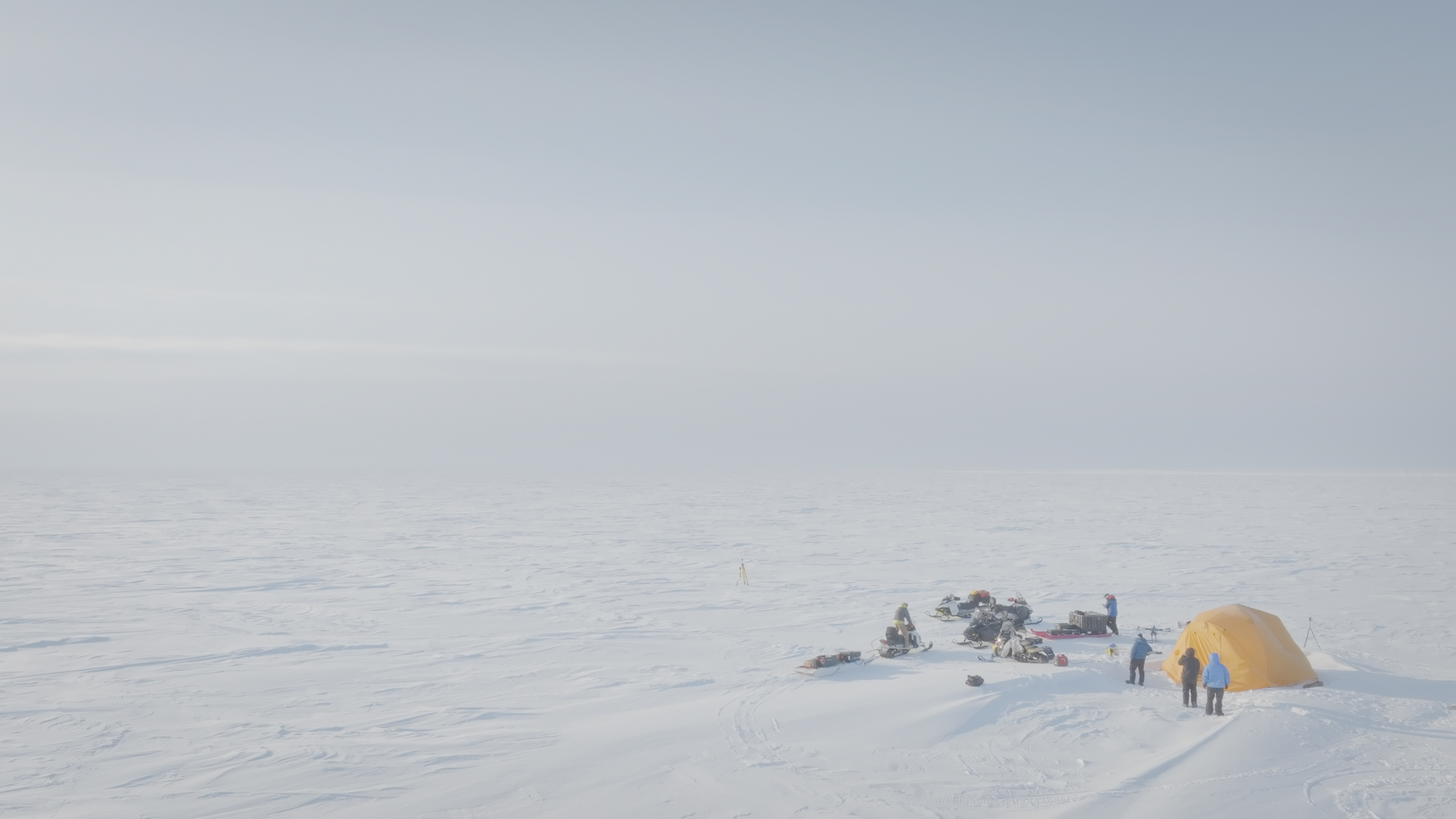
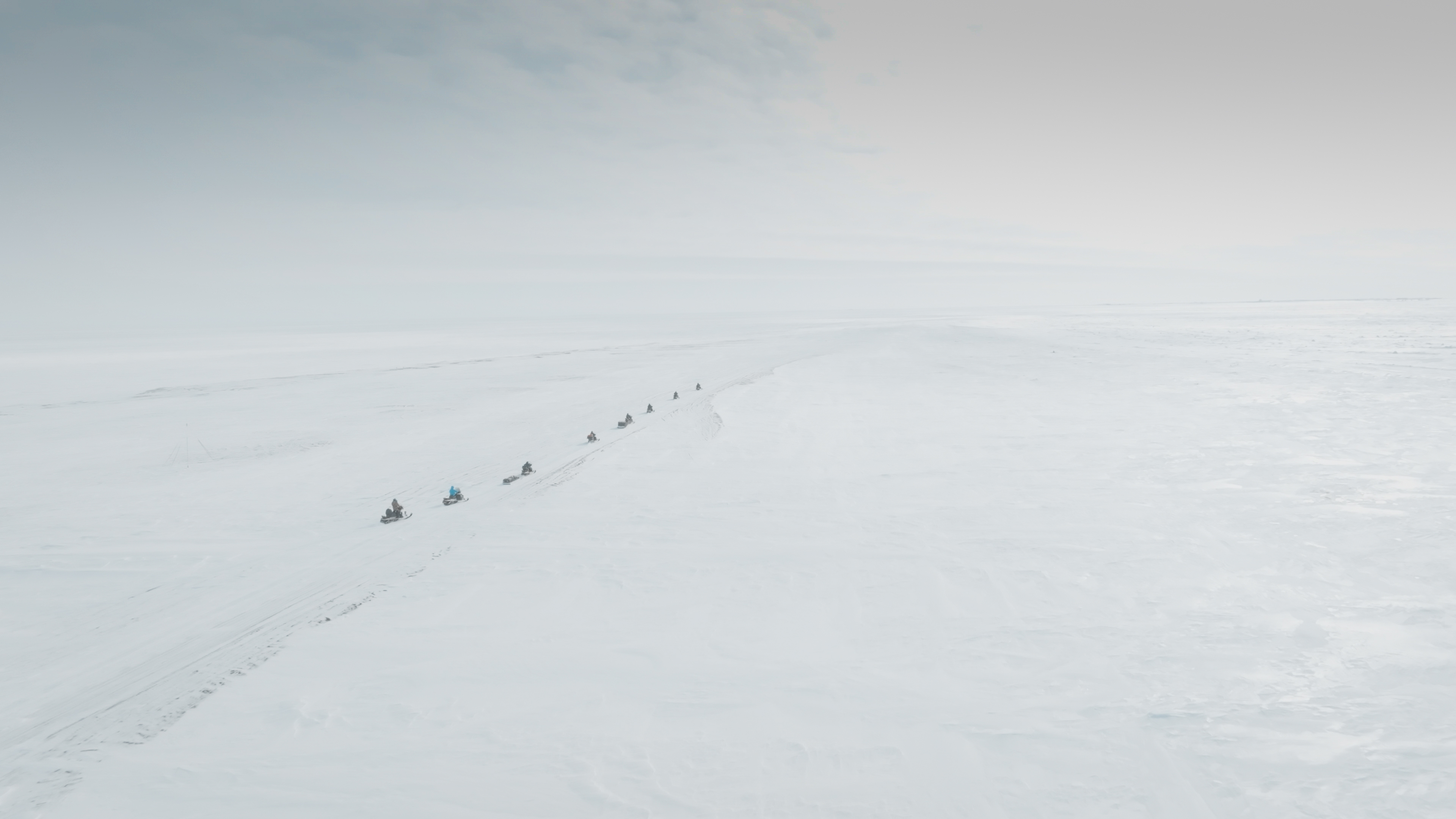
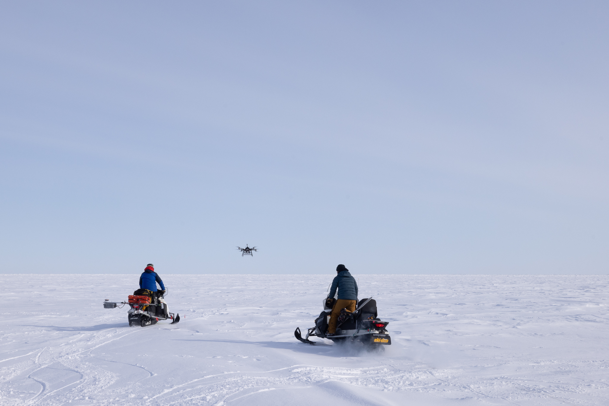
BEAUFORT SEA ICE, near Utqiagvik, Alaska — The train of 10 snowmachines snaked slowly across the snow-covered sea ice toward the small tent far ahead, a single drop of yellow paint on a textured white canvas whose edges couldn’t be seen.
The collection of University of Alaska Fairbanks scientists and technicians and participants from Boise State University drove in single file past driftwood and whale rib bones poking upward through the frozen Beaufort Sea’s near-shore reaches.
This place, just a few miles from the northernmost U.S. city of Utqiagvik, is where the remains of subsistence-harvested whales are brought to keep scavenging polar bears from town. These are the lands and waters of the Inupiat people.
A locally hired polar bear guard shadowed the science team, shotgun strapped to his snowmachine.
The weather was good on this mid-April Wednesday morning just beyond the northernmost tip of the United States, with scant wind and thin wisps of cirrus clouds strung across a nearly empty blue sky. The sun, which rose at 5:56 a.m., had been up for two hours.
A near-perfect day for science. For now.
•••
It was also near-perfect conditions for the two drones helping collect data for the Lightweight Airborne Snow and Sea Ice Thickness Observing System, or LASSITOS, project.
LASSITOS was the main effort on this day on the Beaufort Sea ice, though as often happens during fieldwork some team members were collecting data for other related projects.
The LASSITOS project is funded by the National Science Foundation and led by University of Alaska Fairbanks Geophysical Institute Research Professor Andy Mahoney. He leads the institute’s sea ice research team, which had several members on the ice.
Mahoney explained the work a day earlier when the team was working closer to town.
“We are developing an instrument package capable of being deployed by a drone that can measure both sea ice thickness and snow depth at the same time,” Mahoney said. “These are two pretty fundamental properties of Arctic sea ice.
“We're really good at telling by satellite how much sea ice is covering the ocean,” he said. “Measuring the thickness of that sea ice is more of a challenge. We're developing an instrument that will allow us to make those measurements over large areas with a drone.”
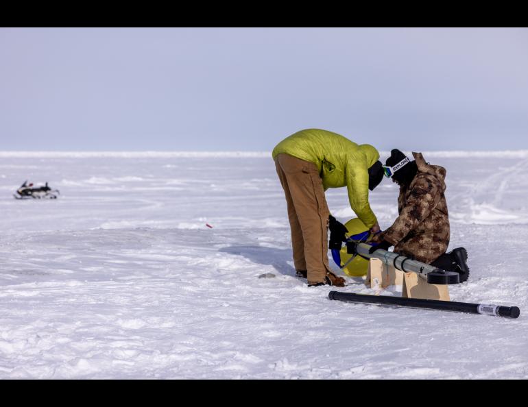
The drone work was accompanied by other “ground truth” tasks to validate the data from the airborne instruments: augering ice holes to measure ice thickness, water depth and ocean salinity; and making thousands of snow depth measurements using a device called a magnaprobe, somewhat like a modified ski pole that can measure snow depth and ice topography.
The LASSITOS project fills a knowledge gap. The project’s NSF description states that “methods of observing sea ice thickness at regional or basin scales with sufficient accuracy and resolution to capture growth and melt processes, detect hazards, or assess habitat quality are lacking.”
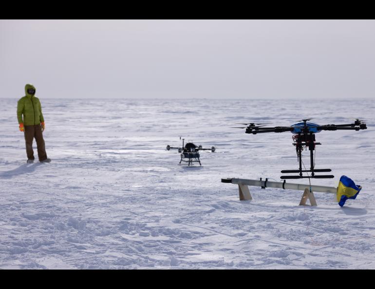
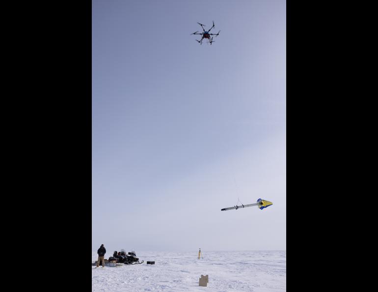
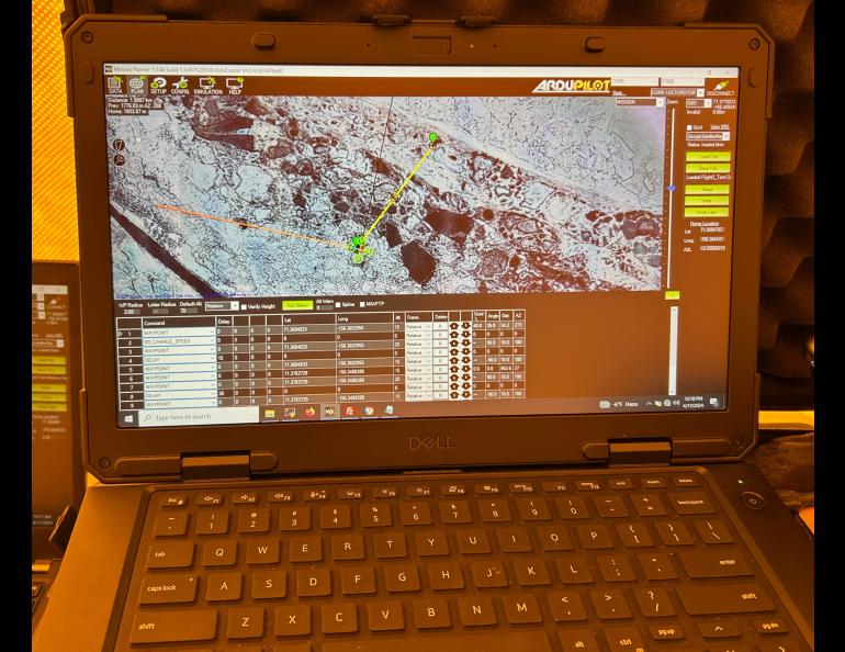
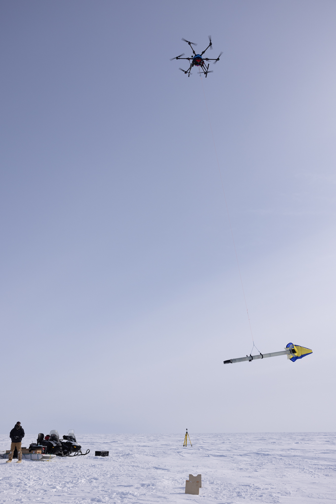
The long-term goal is to get ice thickness and snow depth data from a single drone payload. At this development stage one drone carries an electromagnetic induction instrument hanging from a 10-foot tether and another drone carries the snow radar.
The drone carrying the induction instrument belongs to the Alaska Center for Unmanned Aircraft Systems Integration, a unit of the UAF Geophysical Institute.
The Boise State University team provided its own drone and pilot for the snow depth component.
“Over the last three years, we've been working with NASA,” Boise State Associate Professor Hans-Peter Marshall said. “This antenna was designed for spaceport applications, but the radar has been custom designed for snow.”
Boise State also provided a ground-level snow-penetrating radar attached to a snowmachine to capture additional data and to validate data acquired by the drone-borne radar.
•••
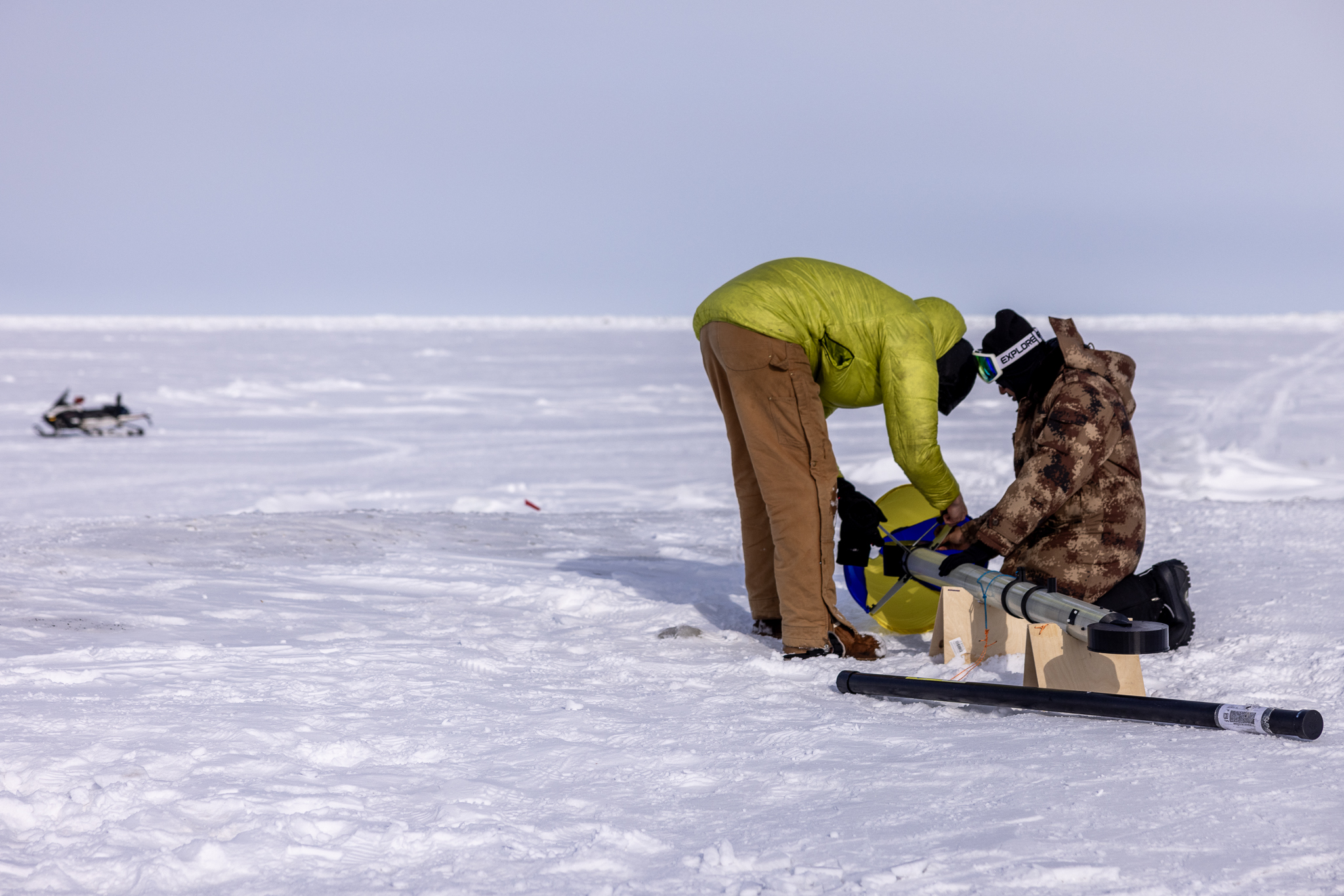
The electromagnetic induction instrument — dubbed LEM, for LASSITOS EM — was in its final testing on this mission to Alaska’s Arctic Ocean coast.
Achille Capelli, a postdoctoral fellow at the Geophysical Institute, designed and built the LEM over the past three years. Thimira Asurapmudalige, a Ph.D. student in electrical engineering at the UAF College of Engineering and Mines, has been assisting.
How does it work?
“The instrument is an electromagnetic sounder that uses induction,” Capelli said after Tuesday’s first test flight of the year. “It fires a magnetic field and induces currents in the conductive seawater.
“Those inductive currents induce a secondary magnetic field that tells us how far down the water surface is,” he said.
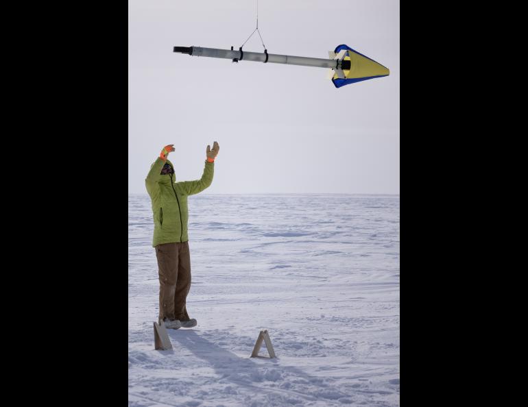
The components sit inside a 4-inch diameter 9-foot fiberglass tube, with other parts produced on a 3D printer in the Geophysical Institute Machine Shop. A stabilizing drag skirt at the tail — in UAF’s blue and yellow colors — helps keep the instrument level during flight.
The LEM consists of a signal generator with a transmitter antenna and a receiver with antenna, digitizer and data logger. This device measures the distance to the ice-water interface.
The LEM also contains a laser altimeter to measure the distance to the snow or ice surface. The difference between these two measurements corresponds to the total thickness of ice and snow. A microprocessor is used to coordinate the different sensors.
Total weight is about 10 pounds.
On Tuesday the tethered LEM flew 12 to 15 feet above the ice surface, which drill holes showed was about 3 to 5 feet thick. The drone flew out about three-tenths of a mile on a programmed route diagonally from the bermed-up and ice-jumbled coastline, then returned.
Wind buffeted the drone and its dangling instrument, pushing the aircraft and instrument to their performance limit. The team knew from forecasts predicting 20 to 30 mph winds that they would have only a short time to fly.
Capelli was nevertheless satisfied with the results.
“That’s good because it tells us what our limit is in the wind,” Capelli said. “I have to go back and look at the data, but what I have seen now looks good.”
“Hopefully we can have a few more flights this week and get to test all the possible combinations of settings,” he said.
The forecast was on everyone’s mind. High winds were expected Thursday. Wednesday, away from town and on the Beaufort Sea, was looking to be their best shot for another instrument test.
•••
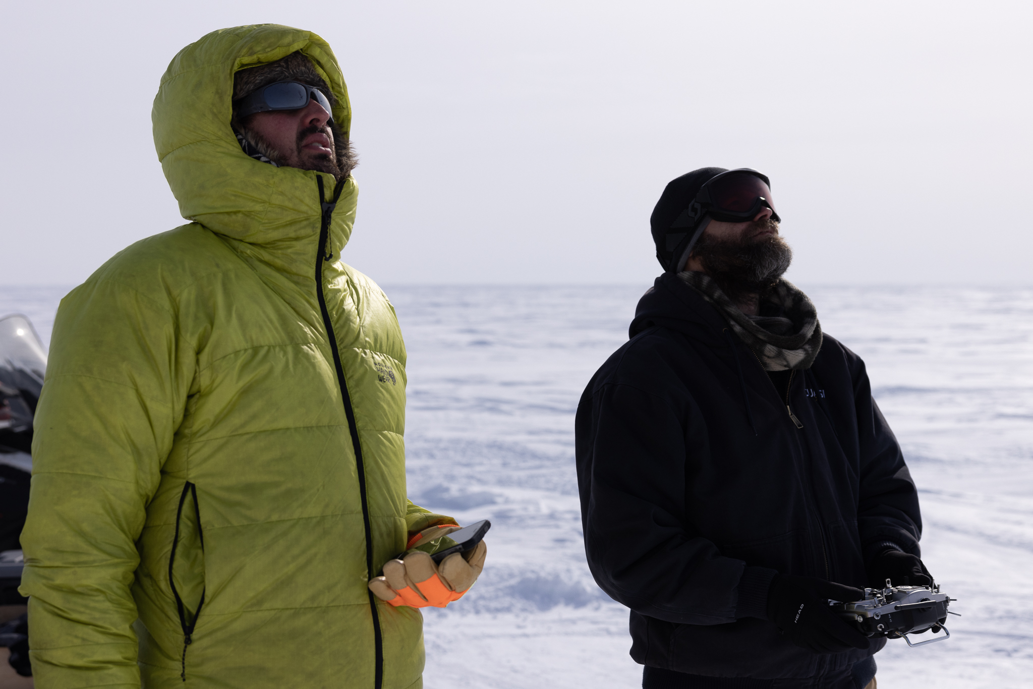
Capelli’s science device won’t get anywhere without a pilot.
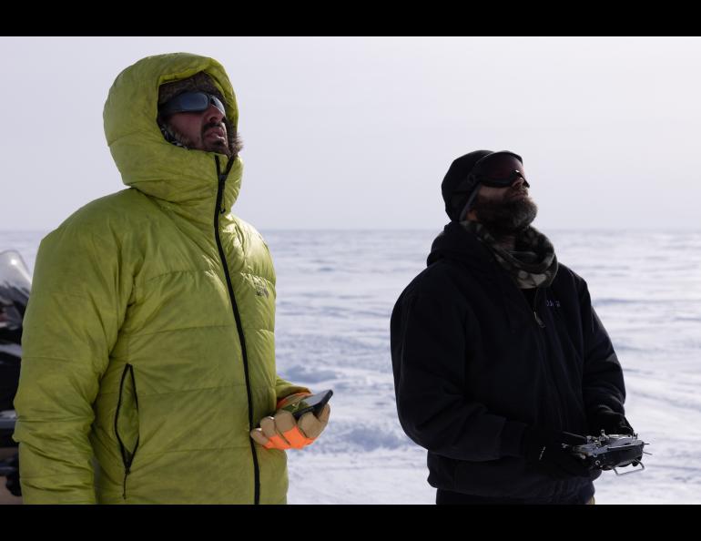
On these testing missions in and near Utqiagvik, that pilot is Matthew Westhoff, a UAF drone pilot veteran.
He’s also a veteran of piloting over Arctic sea ice.
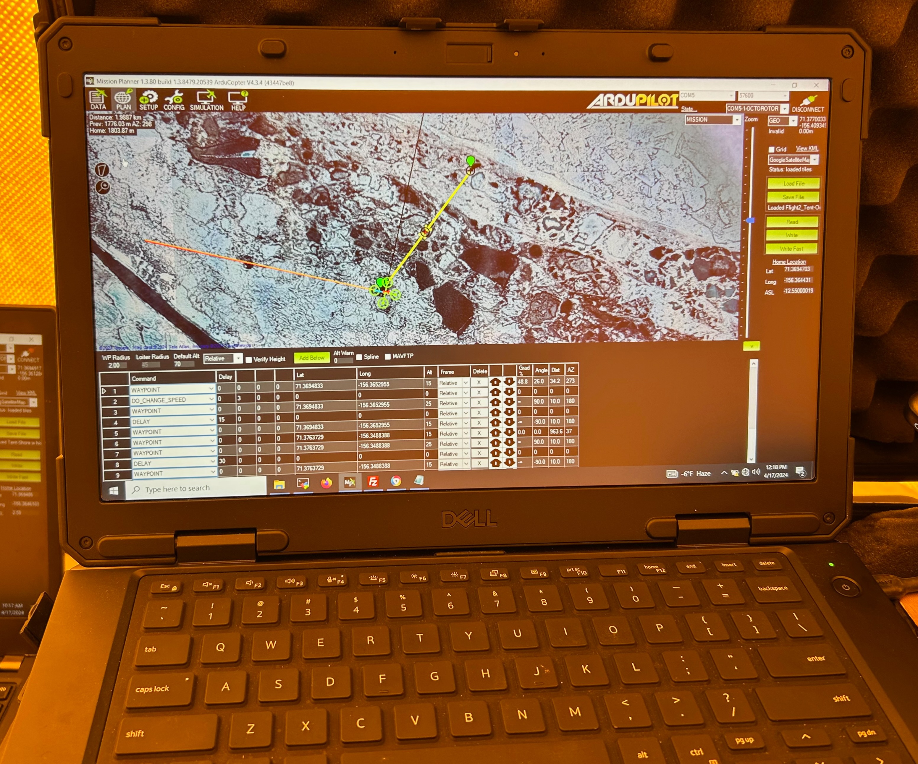
“Even though I've been out here doing similar missions, it’s not exactly the same location and same type of flying,” he said while entering some drone prepositioning data in a laptop sitting on a black collapsible shipping container.
“Even though the end goal of measuring snow depths or ice depths might be the same, flying-wise it’s always a bit different,” he said.
The aircraft was operating Tuesday at the edge of its capability in the wind, Westhoff said. It’s the occasional gusts of 5 to 10 miles per hour higher than the constant wind speed that are the challenge.
“Our main concern being where we are is the wind and the fact that I have a payload swinging around in significant wind,” he said.
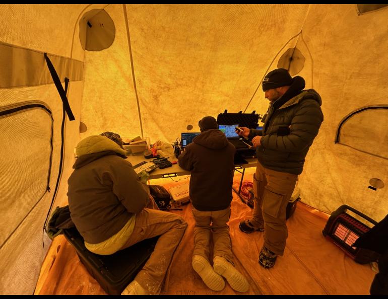
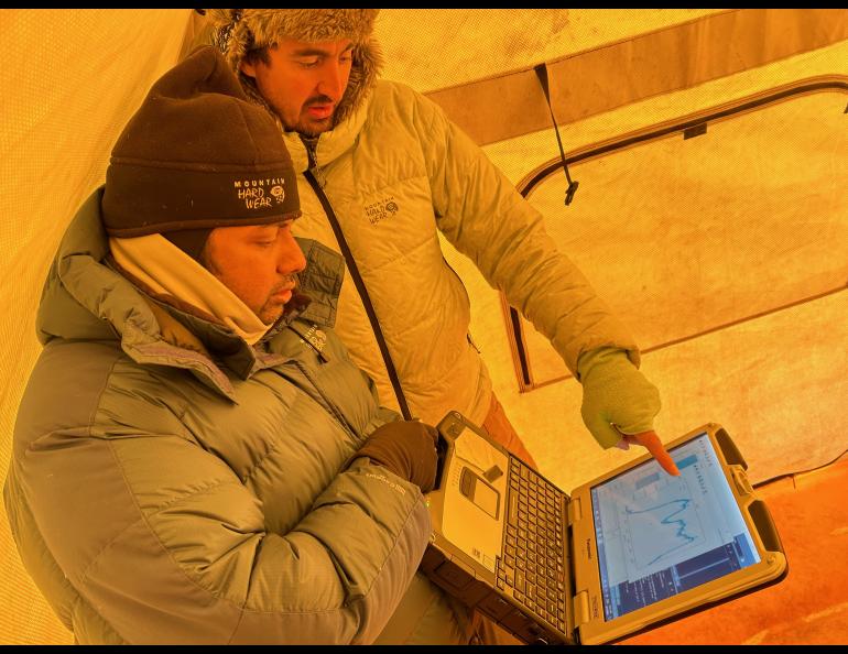
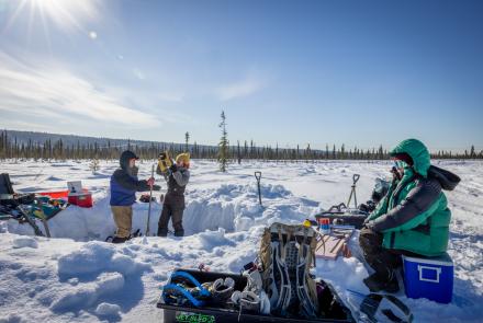
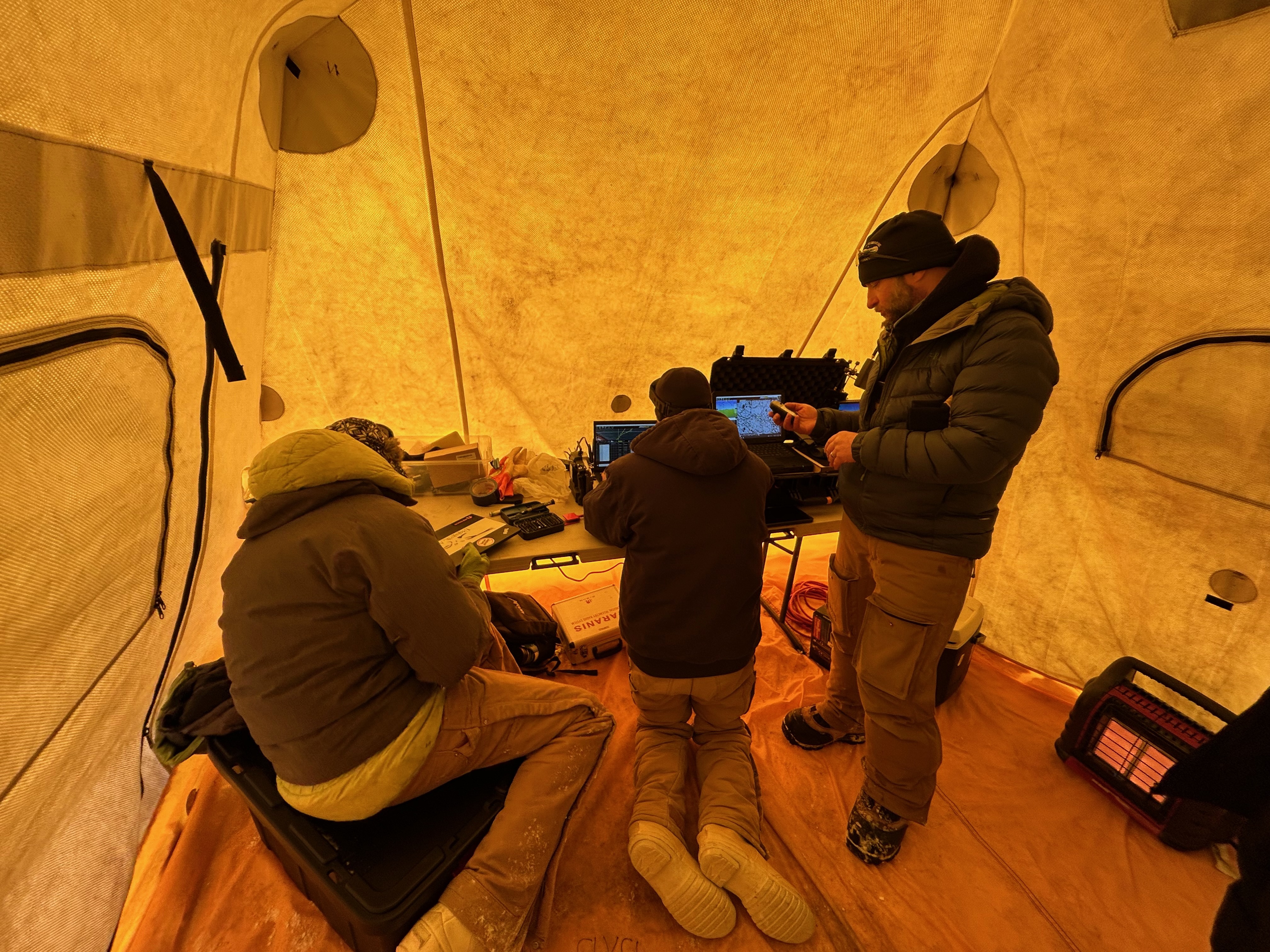
On Wednesday, out on the Beaufort Sea ice two-thirds of a mile north of a thin snow-covered spit above Elson Lagoon and 10 miles east of Utqiagvik, the two drone pilots set up a control area inside the yellow tent. A generator hummed steadily, providing power for equipment and to recharge batteries.
The two pilots — Westhoff from UAF and graduate research assistant Thomas Van Der Weide from Boise State — worked in tandem. When Westhoff was outside keeping visual contact with the UAF drone, the Van Der Weide was inside on the laptop and calling out altitude and battery charge. They reversed roles for the Boise State drone’s flight.
Westhoff is familiar with flying in the far north and the challenges that come with it. He’s flown at Utqiagvik a few times.
“I love coming out here to places like this,” he said. “There’s no other place in the world like it. It’s definitely challenging. It keeps you on your toes. You’re never really doing the same type of flying.”
•••
Mahoney is also simultaneously monitoring work for three other projects that are funded by the Army and part of the Integrated System for Operations in Polar Seas program. Mahoney is the lead investigator for these projects, which involve researchers from the Geophysical Institute and UAF College of Fisheries and Ocean Sciences:
• “Race track" experiments will use satellite imagery and other data to calculate optimum travel routes across sea ice.
• “Ice wave rider” will measure surface waves that may affect the stability of landfast ice, also known as shorefast ice. It is sea ice attached to the shore.
• A Gamma Portable Radar Interferometer will observe small-scale deformation when drifting pack ice interacts with landfast sea ice. This interferometric radar can quickly reveal small changes that could indicate imminent movement or detachment of the ice, which is important as climate change affects ice behavior. The capability could also be useful for near-coastal navigation.
“Those are all looking at the Arctic coastal environment through the lens of logistics-over-the-shore operations,” Mahoney said. “The U.S. Army Corps of Engineers is trying to understand what challenges or maybe advantages there are at different times of year in the event that we needed to move material and people across the shoreline from the ocean behind me to the land where we're standing or the other way around.”
•••
The mood was good Wednesday as the day unfolded on the Beaufort Sea. The sun was bright on the snow and ice. Team members wearing colorful protective eyewear and face coverings moved around trying to accomplish as much as possible while the weather was cooperating. Snow crunched underfoot, snowmachine engines came alive, drone motors whined, the tent entry zipped open and closed.
“Everyone's pretty upbeat,” Mahoney said. “We're cruising along. With the weather forecast, it looks like today may be our only day like this, so we're going to try to make the most of it.”
• Rod Boyce, University of Alaska Fairbanks Geophysical Institute, 907-474-7185, rcboyce@alaska.edu