West Antarctica’s largest glacier started retreating in 1940s
Pine Island Glacier — about the size of Florida and one of the largest ice streams in Antarctica — has been thinning and retreating at an alarming rate since 1992, when satellite images first began to document the change.
New evidence suggests that the thinning and retreat of Pine Island Glacier was underway as early as the 1940s, an international team reported Nov. 23 in the journal Nature. Ice lost from this glacier and its neighbors has added significantly to sea level rise.
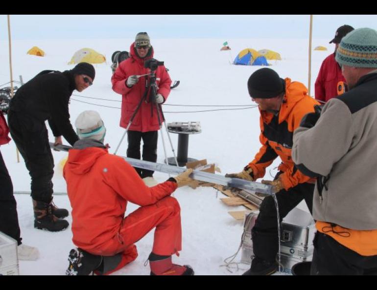
The team from the British Antarctic Survey and the U.S. Antarctic Program, including scientists and technicians from the University of Alaska Fairbanks Geophysical Institute, drilled through Pine Island Glacier to collect seabed sediment cores from beneath the floating part of the ice. The sediment samples revealed that a cavity started to form beneath the shelf before the mid-1940s, allowing warm seawater to flow under the shelf and causing it to lift off from a prominent sea-floor ridge that held it in place. This convincingly suggests that a decades-long retreat was initiated by strong warming of the region associated with El Niño activity in the early 1940s.
“We are very excited about this new finding as it provides the first direct evidence of the timing of glacier retreat even before we had satellites to measure them,” said James Smith, a marine geologist with the British Antarctic Survey and lead author of the paper.
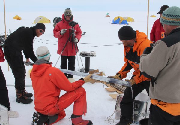
The sediment cores were obtained by first drilling an 8-inch hole through almost 1,500 feet of ice using a hot-water rig. The drillers then lowered a sediment sampling device through more than 1,600 feet of ocean. The sediment samples revealed evidence of climate events that started the thinning of Pine Island Glacier and show how weather cycles in the tropical Pacific, halfway across the planet, reached through the ocean to influence the Antarctic ice sheet.
Logistical challenges
The group responsible for running the drill rig was led by Martin Truffer of the GI’s Snow, Ice and Permafrost group and Dale Pomraning of the GI’s Instrument Development Services. They worked for six weeks in the Antarctic summer between December 2012 and January 2013.
“In order to do hot-water drilling, water must be heated to just below boiling, inserted into hoses at really high pressure, and carefully monitored as the drill head lowers into the bore hole in the ice,” Truffer said. All of this, including the infrastructure to make it possible and house and feed the research team, took place at a work camp on an ice shelf, hundreds of miles from the nearest support at a research station.
“There are only a handful of people in the world who know how to do that, and Dale Pomraning is one of them,” Truffer said. Truffer and Pomraning have both made multiple trips to Antarctica to participate in studies. In September they shipped equipment to Antarctica for their next trip, scheduled for departure in January.
Considering the challenges of this kind of research, Smith of the British Antarctic Survey was pleased the results revealed so much new information.
“Pine Island Glacier is one of the most inhospitable and remote areas of Antarctica, so to get all the equipment needed to hot-water drill through the ice shelf required a major effort from our collaborators at the US Antarctic Program,” Smith said. “It was a real team effort to lower the drill by hand to the seabed on nearly 1,000 meters (3,280 feet) of rope. After all that work, the fact that the cores show us something so unexpected and important is a great feeling.”
Implications for the long term
Co-author and principal scientist Bob Bindschadler of NASA said “A significant implication of our findings is that once an ice sheet retreat is set in motion it can continue for decades.”
Ice loss from that part of West Antarctica is already making a significant contribution to global sea level rise and is actually one of the largest drivers of uncertainty in global sea level predictions, said David Vaughan, co-author and director of science for the British Antarctic Survey.
“Understanding what initiated the current changes is one major piece of the jigsaw, and now we are already looking for the next — how long will these changes continue and how much ice will Pine Island Glacier and its neighbors lose in the coming century? These are big questions that need the international science community to work together,” Vaughan said.
A new joint program recently announced by the UK Natural Environment Research Council and US National Science Foundation will allow a more focused study of Pine Island Glacier and provide a new opportunity to understand West Antarctica and how much sea level rise it might cause in the coming century.
NOTE TO EDITORS: Title of the paper is “Sub-ice shelf sediments record 20th Century retreat history of Pine Island Glacier,” by Smith J.A, Anderson T.J, Shortt M, Gaffney A.M, Truffer M, Stanton T.P, Bindschadler R, Dutrieux P, Jenkins A, Hillenbrand C.D, Ehrmann W, Corr H.F.J, Farley N, Crowhust S, Vaughan D.G., published in Nature on Wednesday, Nov. 23.
DOWNLOAD A COPY OF THE PAPER: http://dx.doi.org/10.1038/nature20136
Sue Mitchell, University of Alaska Fairbanks Geophysical Institute, 907-474-5823, sue.mitchell@alaska.edu
Martin Truffer, University of Alaska Fairbanks Geophysical Institute, 907-474-5359, mtruffer2@alaska.edu
Athena Dinar, British Antarctic Survey senior public relations and communications manager, telephone +44 (0)1223 221 441, mobile +44 (0)7909 008516, amdi@bas.ac.uk


