
Recent Posts
Tsunami-causing slide was largest in decade, earthquake center finds
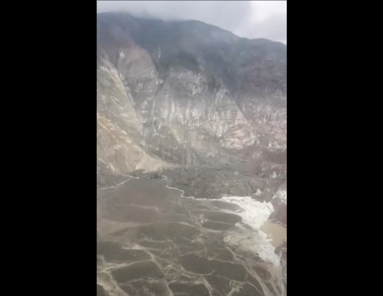
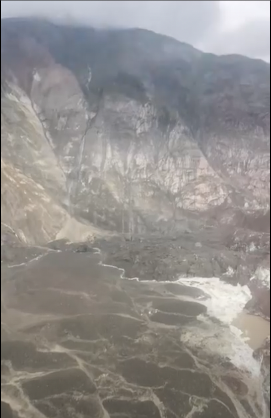
Sunday’s massive tsunami-causing landslide in Southeast Alaska likely sent more than 100 million cubic meters of debris into an icy fjord and onto a prominent glacier in one of the largest slides in at least 10 years, according to analysis by the Alaska Earthquake Center.
The center’s rapid characterization and pinpointing of the landslide demonstrates the center’s growing capability in a new area of real-time hazard analysis. The center, located at the University of Alaska Fairbanks Geophysical Institute, has been working for several years to advance its rapid characterization and detection of landslides.
The center’s preliminary analysis, using a method its team has been developing, estimates the landslide’s volume is likely larger than 100 million cubic meters, equivalent to the content of 40,000 Olympic-sized swimming pools.
“This is larger than anything in the past decade in Alaska,” Alaska Earthquake Center Director Michael West said. “It’s going to get a lot of attention from scientists.”
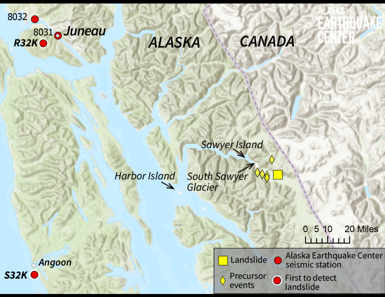
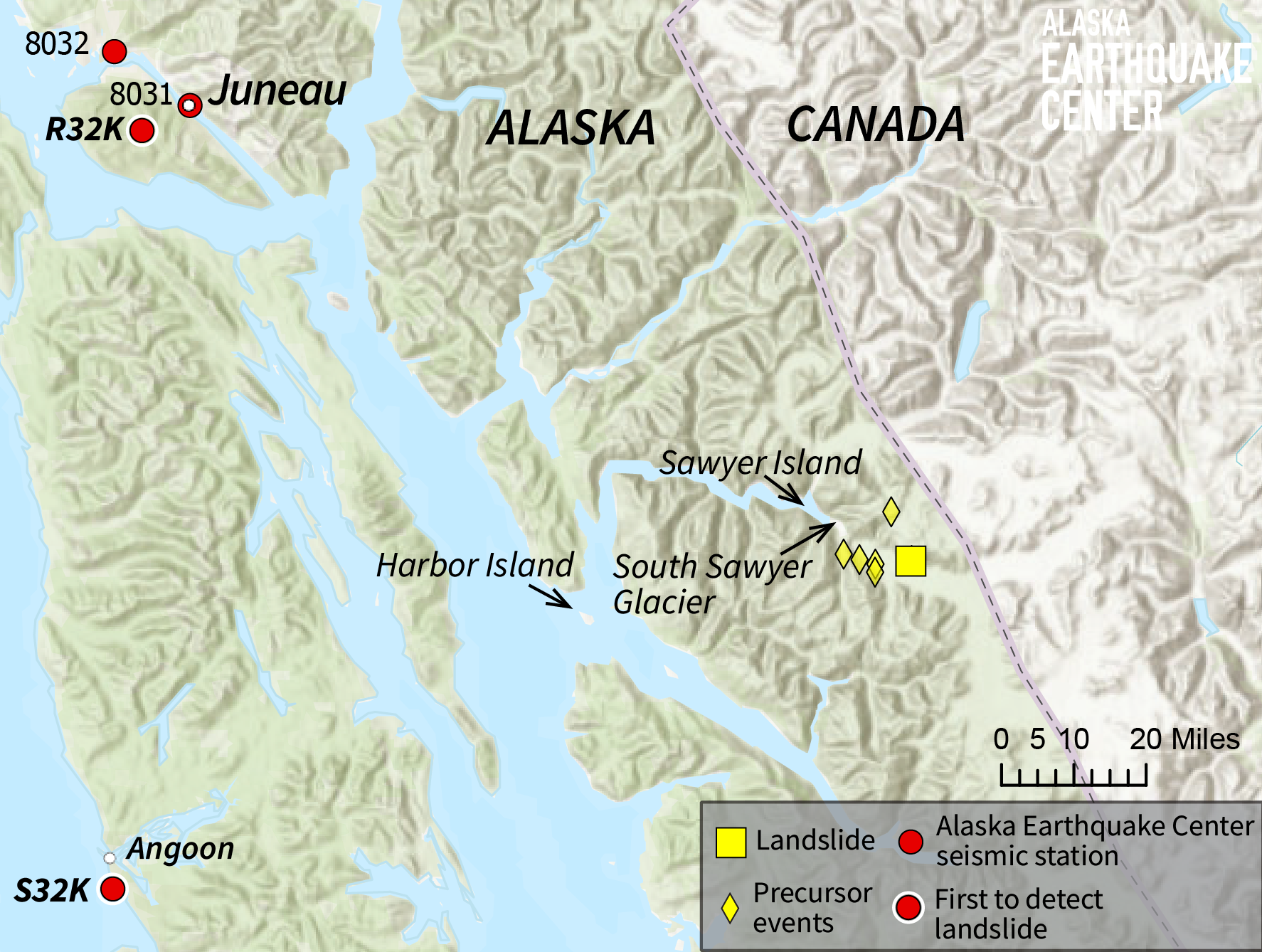
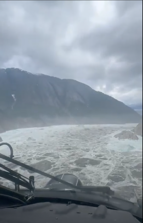
Sunday’s landslide occurred at about 5:30 a.m. at the head of Tracy Arm, where the South Sawyer Glacier reaches the water. Tracy Arm is a fjord located about 50 miles southeast of Juneau.
“We were able to produce a rapid location and volume estimate using seismic data as soon as we learned about the event,” said Ezgi Karasözen, a research seismologist at the center who began analyzing the event early Sunday.
Heather McFarlin, the center’s seismic data manager, said the landslide’s energy release was approximately equivalent to that from a magnitude 5 earthquake.
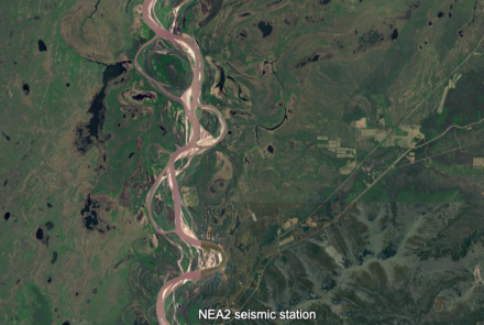
The slide was preceded by more than a day of precursor signals recorded by the state’s seismic stations, providing a rare scientific opportunity.
“This may be the best-documented example of such precursors, which gives us real motivation to explore precursor detection in addition to ongoing monitoring,” Karasözen said. “That will likely be a focus for us going forward.”
West said a possible signal that grows over hours and days before a major event would be the “Holy Grail of hazard monitoring.”
Why it matters
Tracy Arm is traveled regularly by cruise ships and other sightseeing vessels carrying thousands of passengers annually.
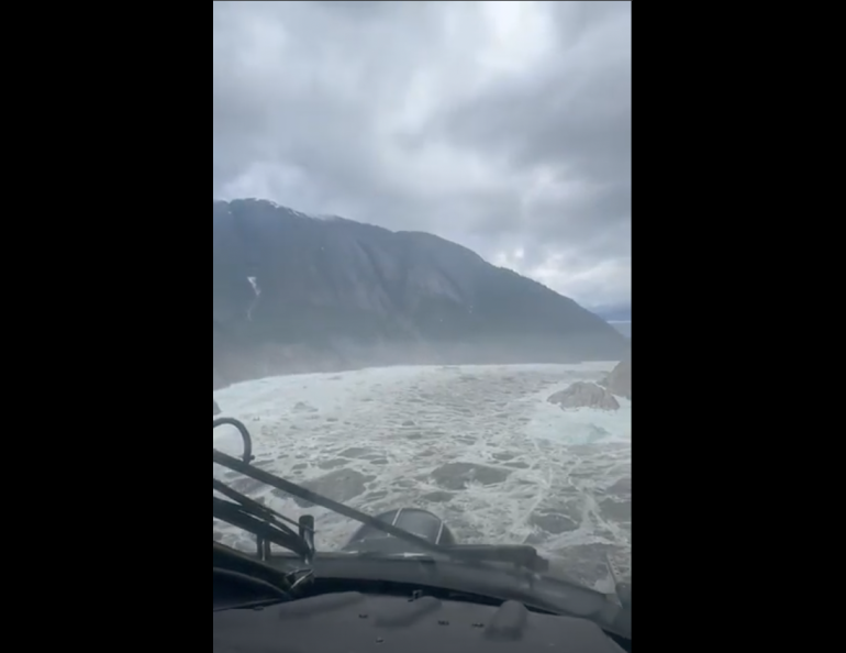
A portion of the landslide debris rolled onto Sawyer Glacier, but the rest tumbled into Tracy Arm and created a seiche, a trapped tsunami.
Tsunami waves reached about 100 feet up Sawyer Island, roughly 4 miles from the landslide. People at Harbor Island, at the mouth of Tracy Arm and about 36 miles from the landslide, reported 20-foot waves.
Karasözen and West had previously developed a method to remotely detect large landslides within minutes of occurrence and to quickly determine whether slides are close to open water and present a tsunami hazard.
“We now have the ability to quickly analyze and report the size, location and style of landslides,” West said. “That opens the door for building proper warning systems.”
The landslide analysis system worked.
“Our initial location was within 7 kilometers of the ground-truth location, which was confirmed Monday by Coast Guard reconnaissance,” Karasözen said. “It may take weeks or months to get a precise volume, but our early estimate, while uncertain, places this at the upper end of the landslides we’ve detected so far.”
The new system
Sunday’s landslide occurred outside of the center’s landslide detection study area, but the recently developed system of detection and characterization was used to quickly provide information about the event.
“There are two different events,” West said of Sunday’s slide and tsunami. “One is a big wave sloshing around in the fjord, and people want to know where that came from. What’s going on?”
Karasözen and West’s method, published in February 2024 in The Seismic Record, can quickly provide answers to those types of questions.
Their prototype system began operating in the Barry Arm of Prince William Sound in August 2023 and has since expanded to encompass most of southern Alaska, though not yet Southeast Alaska. It uses data from the more than 250 real-time seismic monitoring stations across the state.
The method consists of algorithms that identify a landslide’s long-period seismic waves among the many short-period waves created not only by a landslide but also by nearby earthquakes and glaciers and by human activity.
A landslide’s tell-tale long-period waves appear as the slide accelerates.
The algorithm continually scans seismic data from multiple seismic stations in their test region to look for a landslide wave signature. Finding a match, their system estimates a slide’s location and volume.
“This event is a strong reminder of why this work matters and how valuable it can be,” Karasözen said. “Once the dust settles, we’ll look at options for incorporating Southeast Alaska into our detection coverage.”
Format the contact(s) in this format. (Overwrite this text):
Rod Boyce, University of Alaska Fairbanks Geophysical Institute, 907-474-7185, rcboyce@alaska.edu
Mark Fahnestock, University of Alaska Fairbanks Geophysical Institute, 907-687-6371, mfahnestock@alaska.edu