Skip to main content
Shop
Donate
UA Directory
Intranet
Quick Links
Geophysical Institute
Main navigation
Home
About
Contact Information
Contact
UAF Directory
Visitor Information
About the GI
Community
GI Publications
Timeline
GI Quarterly
People
Leadership
Researchers
Graduate Student Researchers
Emeriti
Research
Atmospheric Sciences
Remote Sensing
Seismology & Geodesy
Snow, Ice & Permafrost
Space Physics & Aeronomy
Tectonics & Sedimentation
Volcanology
Facilities & Labs
Services
Design & Printing
GI Human Resources
Education Outreach
Instrument Development
Keith B. Mather Library
Research Computing Systems
News & Info
News
Alaska Science Forum
Alaska Science Pod
Science for Alaska
Aurora Forecast
Visitor Information & Tours
Events
Community
Student Info
Intranet
Search
Breadcrumb
Home
/
News
Filter By Year
- Any -
2026
2025
2024
2023
2022
2021
2020
2019
2018
2017
2016
2015
2014
2013
2012
2011
2010
Article Type
- Any -
Read
Explore
Research Group
- Any -
Atmospheric Sciences
Remote Sensing
Seismology & Geodesy
Snow, Ice & Permafrost
Space Physics & Aeronomy
Tectonics & Sedimentation
Volcanology
Facility/Lab
- Any -
Alaska Center for Unmanned Aircraft Systems Integration (ACUASI)
Alaska Climate Research Center (ACRC)
Alaska Critical Minerals Collaborative (ACMC)
Alaska Earthquake Center (AEC)
Alaska Satellite Facility (ASF)
Alaska Space Grant Program (ASGP)
Alaska Volcano Observatory (AVO)
Advanced Instrumentation Laboratory (AIL)
Arctic Coastal Geoscience Lab (ACGL)
College International Geophysical Observatory (CIGO)
Geochronology Laboratory (Geochron Lab)
Geographic Information Network of Alaska (GINA)
Geophysical Institute Permafrost Laboratory (GIPL)
High-frequency Active Auroral Research Program (HAARP)
Hyperspectral Imaging Laboratory (HyLab)
Poker Flat Research Range (PFRR)
Wilson Alaska Technical Center (WATC)
UAF space engineering program director wins NASA prize
March 19, 2024
The advisor of the University of Alaska Fairbanks space engineering program is one of 20 winners of a NASA prize to expand the agency’s...
Read more
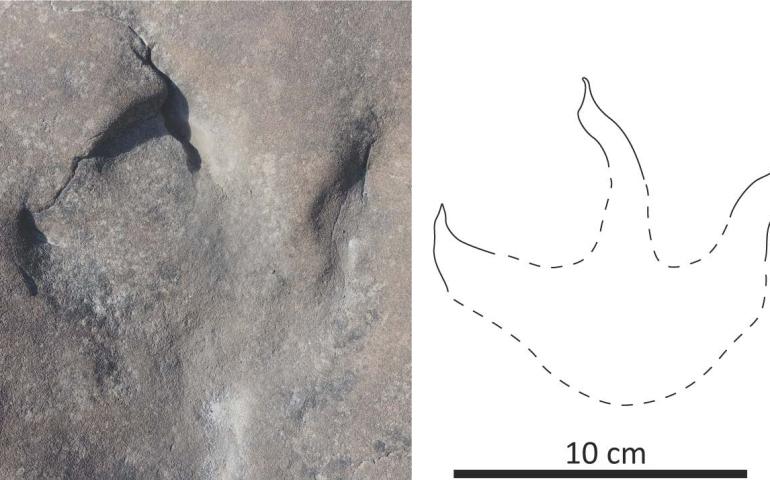
Alaska dinosaur tracks reveal a lush, wet environment
March 8, 2024
A large find of dinosaur tracks and fossilized plants and tree stumps in far northwestern Alaska provides new information about the climate and...
Read more
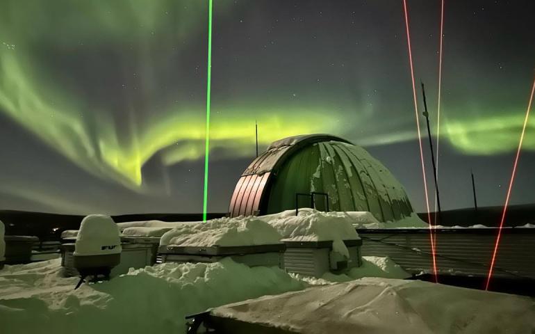
New UAF lidar will add to space weather research capability
March 4, 2024
University of Alaska Fairbanks scientists are developing a new light detection and ranging instrument to help gain a better understanding of...
Read more
New detection method aims to warn of landslide tsunamis
February 21, 2024
University of Alaska Fairbanks researchers have devised a way to remotely detect large landslides within minutes of occurrence and to quickly...
Read more
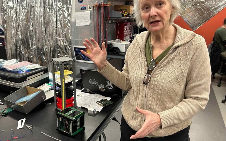
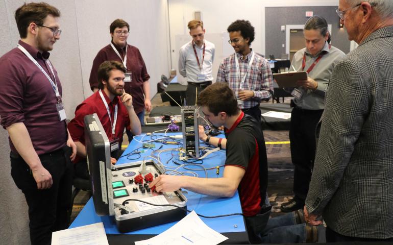
UAF students win funds from Air Force to build a nanosatellite
February 20, 2024
A team of University of Alaska Fairbanks students will build the Air Force a nanosatellite roughly the size of an ordinary loaf of sliced bread...
Read more
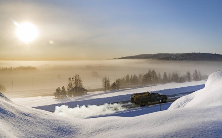
Study finds home heating fuel is direct source of sulfate in Fairbanks winter air
February 19, 2024
Use of residential heating fuel is the main contributor of primary sulfate pollution in Fairbanks’ wintertime air, according to research...
Read more
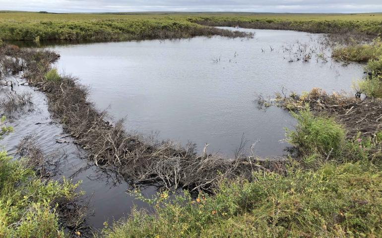
Scientists, others to discuss impact of beaver movement into Arctic
February 16, 2024
Scientists and others from remote communities across western Alaska and northern Canada concerned about the migration of beavers into the Arctic...
Read more
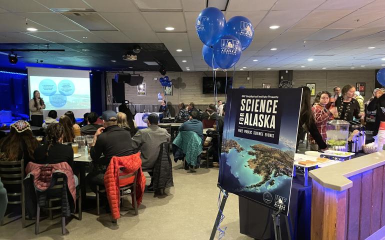
UAF announces 32nd annual Science for Alaska series
January 26, 2024
Free public talks in the next few weeks will explore Mount Edgecumbe volcano, the peaking sun cycle’s boost to aurora viewing, Alaska’s role in...
Read more
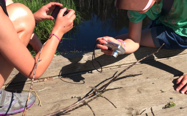
Local items boost students’ connection to science
January 26, 2024
Using local items in science lessons for K-12 students is especially important for teaching science in the North, according to new research...
Read more
Load More