Skip to main content
Shop
Donate
UA Directory
Intranet
Quick Links
Geophysical Institute
Main navigation
Home
About
Contact Information
Contact
UAF Directory
Visitor Information
About the GI
Community
GI Publications
Timeline
GI Quarterly
People
Leadership
Researchers
Graduate Student Researchers
Emeriti
Research
Atmospheric Sciences
Remote Sensing
Seismology & Geodesy
Snow, Ice & Permafrost
Space Physics & Aeronomy
Tectonics & Sedimentation
Volcanology
Facilities & Labs
Services
Design & Printing
GI Human Resources
Education Outreach
Instrument Development
Keith B. Mather Library
Research Computing Systems
News & Info
News
Alaska Science Forum
Alaska Science Pod
Science for Alaska
Aurora Forecast
Visitor Information & Tours
Events
Community
Student Info
Intranet
Search
Breadcrumb
Home
/
News
Filter By Year
- Any -
2026
2025
2024
2023
2022
2021
2020
2019
2018
2017
2016
2015
2014
2013
2012
2011
2010
Article Type
- Any -
Read
Explore
Research Group
- Any -
Atmospheric Sciences
Remote Sensing
Seismology & Geodesy
Snow, Ice & Permafrost
Space Physics & Aeronomy
Tectonics & Sedimentation
Volcanology
Facility/Lab
- Any -
Alaska Center for Unmanned Aircraft Systems Integration (ACUASI)
Alaska Climate Research Center (ACRC)
Alaska Critical Minerals Collaborative (ACMC)
Alaska Earthquake Center (AEC)
Alaska Satellite Facility (ASF)
Alaska Space Grant Program (ASGP)
Alaska Volcano Observatory (AVO)
Advanced Instrumentation Laboratory (AIL)
Arctic Coastal Geoscience Lab (ACGL)
College International Geophysical Observatory (CIGO)
Geochronology Laboratory (Geochron Lab)
Geographic Information Network of Alaska (GINA)
Geophysical Institute Permafrost Laboratory (GIPL)
High-frequency Active Auroral Research Program (HAARP)
Hyperspectral Imaging Laboratory (HyLab)
Poker Flat Research Range (PFRR)
Wilson Alaska Technical Center (WATC)
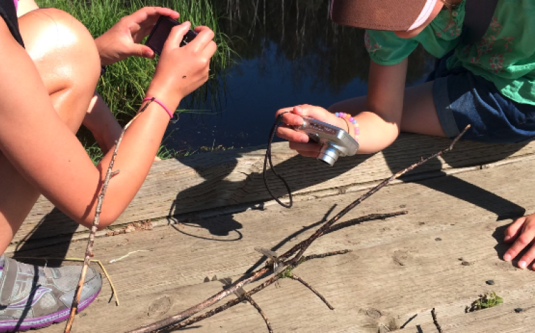
Local items boost students’ connection to science
January 26, 2024
Using local items in science lessons for K-12 students is especially important for teaching science in the North, according to new research...
Read more
International Arctic weather workshop to be held at UAF
January 12, 2024
An international group of nearly 140 military personnel and civilians with an interest in improving Arctic weather forecasting will gather at the...
Read more
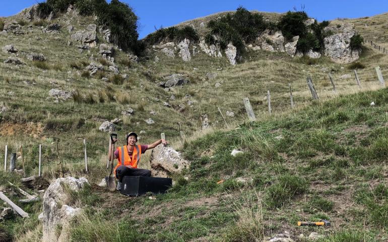
UAF scientist receives top honor from New Zealand geoscience society
January 11, 2024
Assistant Professor Bryant Chow of the University of Alaska Fairbanks has received the Geoscience Society of New Zealand's top honor for his...
Read more
2023: A year of continued research leadership by the UAF Geophysical Institute
December 21, 2023
2023, like the years and decades before it, showed the strength and significance of the University of Alaska Fairbanks Geophysical Institute as a...
Read more
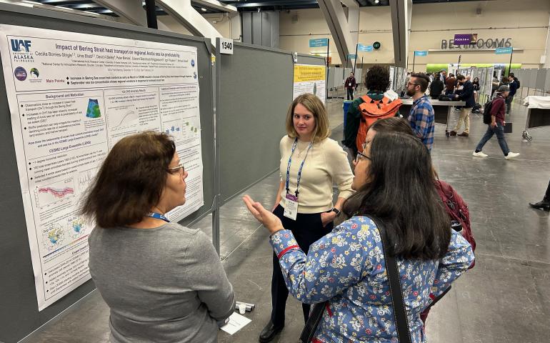
AGU research spotlight: New research benefits Arctic sea ice forecasting
December 14, 2023
Ocean temperatures in the Bering Strait and heat transport through the region have increased over the past 20 years. New modeling using a range...
Read more
AGU research spotlight: New research helps detect elusive volcanic tremors
December 13, 2023
Earthquakes have a well-known and easily recognizable connection to volcanoes. The sudden onset of ground shaking can indicate near-term or...
Read more
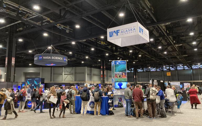
More than 100 UAF researchers presenting work at national science conference
December 11, 2023
About 130 University of Alaska Fairbanks researchers will be presenting their work at the annual meeting of the nation's leading geosciences...
Read more
Geophysical Institute research at the American Geophysical Union 2023 Fall Meeting
December 11, 2023
Geophysical Institute researchers and students are attending the American Geophysical Union Fall Meeting 2023 from Dec. 11–15 in San Francisco...
Read more
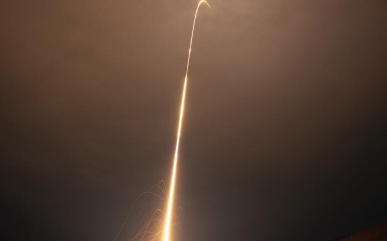
Second NASA sounding rocket launches from Poker Flat Research Range
November 9, 2023
The second NASA sounding rocket of the season headed into Earth’s upper atmosphere from Poker Flat Research Range shortly after midnight Thursday...
Read more
Load More