Skip to main content
Shop
Donate
UA Directory
Intranet
Quick Links
Geophysical Institute
Main navigation
Home
About
Contact Information
Contact
UAF Directory
Visitor Information
About the GI
Community
GI Publications
Timeline
GI Quarterly
People
Leadership
Researchers
Graduate Student Researchers
Emeriti
Research
Atmospheric Sciences
Remote Sensing
Seismology & Geodesy
Snow, Ice & Permafrost
Space Physics & Aeronomy
Tectonics & Sedimentation
Volcanology
Facilities & Labs
Services
Design & Printing
GI Human Resources
Education Outreach
Instrument Development
Keith B. Mather Library
Research Computing Systems
News & Info
News
Alaska Science Forum
Alaska Science Pod
Science for Alaska
Aurora Forecast
Visitor Information & Tours
Events
Community
Student Info
Intranet
Search
Breadcrumb
Home
/
News
Filter By Year
- Any -
2026
2025
2024
2023
2022
2021
2020
2019
2018
2017
2016
2015
2014
2013
2012
2011
2010
Article Type
- Any -
Read
Explore
Research Group
- Any -
Atmospheric Sciences
Remote Sensing
Seismology & Geodesy
Snow, Ice & Permafrost
Space Physics & Aeronomy
Tectonics & Sedimentation
Volcanology
Facility/Lab
- Any -
Alaska Center for Unmanned Aircraft Systems Integration (ACUASI)
Alaska Climate Research Center (ACRC)
Alaska Critical Minerals Collaborative (ACMC)
Alaska Earthquake Center (AEC)
Alaska Satellite Facility (ASF)
Alaska Space Grant Program (ASGP)
Alaska Volcano Observatory (AVO)
Advanced Instrumentation Laboratory (AIL)
Arctic Coastal Geoscience Lab (ACGL)
College International Geophysical Observatory (CIGO)
Geochronology Laboratory (Geochron Lab)
Geographic Information Network of Alaska (GINA)
Geophysical Institute Permafrost Laboratory (GIPL)
High-frequency Active Auroral Research Program (HAARP)
Hyperspectral Imaging Laboratory (HyLab)
Poker Flat Research Range (PFRR)
Wilson Alaska Technical Center (WATC)
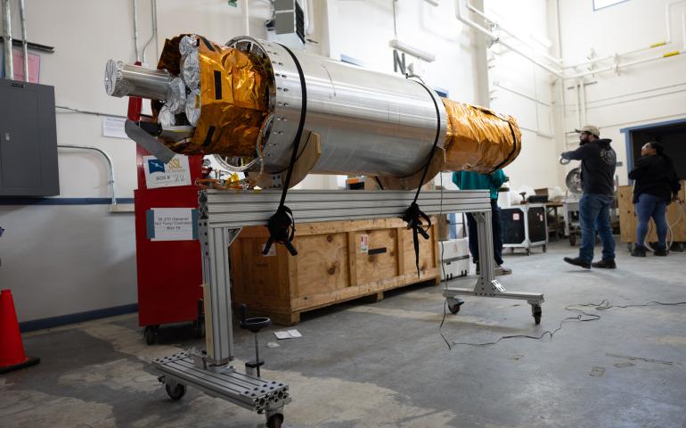
Poker Flat to launch rocket to image solar flares
April 30, 2026
The fifth flight of a NASA-led mission using X-rays to learn more about the sun is scheduled for a daytime launch from Poker Flat Research Range...
Read more
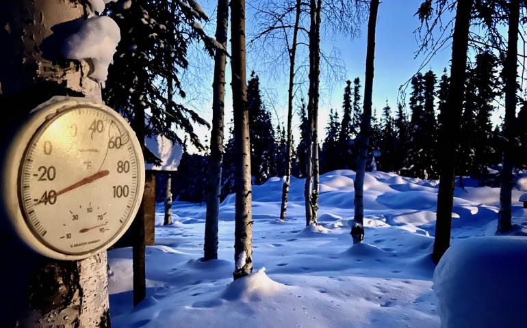
Alaska climate report: March 2026 saw dangerous weather
April 21, 2026
March brought a series of dangerous and disruptive weather events across Alaska. Severe cold combined with powerful storms to affect communities...
Read more
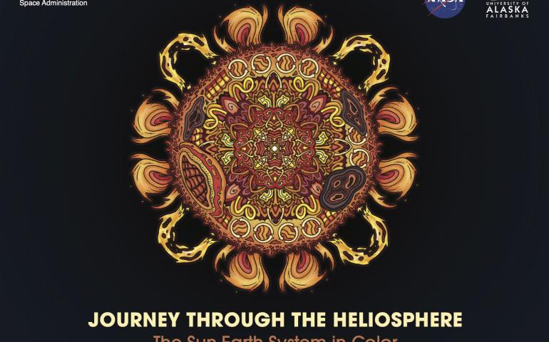
UAF, NASA create fact-filled coloring book about the sun
April 20, 2026
A new sun-based and science-focused coloring book produced by the University of Alaska Fairbanks in collaboration with NASA is now available. The...
Read more
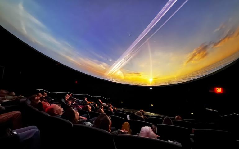
Let the show begin! New planetarium at UAF ready to open
April 14, 2026
The stars finally aligned to bring a planetarium to the University of Alaska Fairbanks. Now it’s ready for the public. The Walt and Marita Babula...
Read more
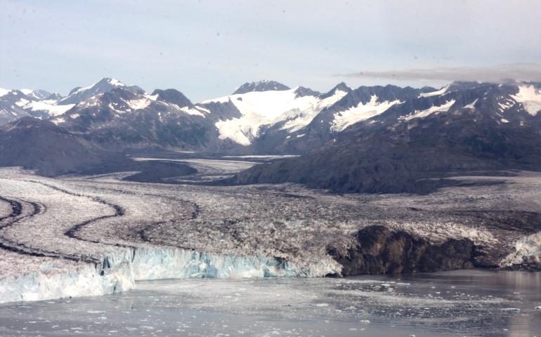
Seismic record analysis can reveal a glacier’s past
April 10, 2026
The history of earthquake-like signals created by the crashing of glacial ice into the ocean can reveal how a glacier has changed over time...
Read more
Project will use air pressure waves to remotely detect vehicles, aircraft
April 9, 2026
Researchers at the University of Alaska Fairbanks have launched a three-year effort to develop a new system to remotely detect and assess ground...
Read more
Your browser does not support the video tag.
Explore
Poker Flat Research Range cleans up what comes down
March 25, 2026
The launch site’s recovery program goes to great lengths to retrieve payloads and rocket parts — or as many as can be found in its expansive...
Read more
New funding advances earthquake early warning for Alaska
March 24, 2026
Alaskans are closer to having critical seconds of warning that shaking from a major earthquake is about to occur. Federal funding approved...
Read more
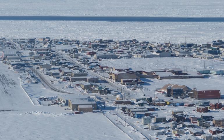
New analysis shows continued loss of Arctic landfast sea ice
March 20, 2026
Sea ice is sticking to Alaska’s northern coast for less time each year, according to 27 years of data analyzed by University of Alaska Fairbanks...
Read more
Load More