


Alaska climate report: December’s deep cold, deep snow
The title page of the Alaska Climate Research Center’s monthly summary for December crisply explained what a busy weather month it was across the state.
• Almost a month-long cold spell.
• Snowiest December on record in Juneau.
• Ice storm on the west coast, multiple severe wind events in the Mat-Su Valley.
• Wettest December on record in Utqiaġvik.
• Arctic sea ice extent still very low.
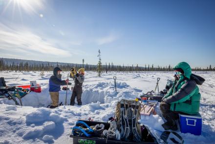
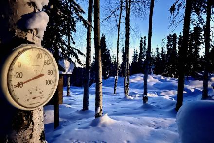
The unusual cold across Alaska proved to be the main event, according to the ACRC, which is part of the University of Alaska Fairbanks Geophysical Institute.
Temperatures in Interior, Southcentral and Southeast Alaska remained continuously below normal for over three weeks and dropped to “impressively low values,” the summary reads. Juneau fell to 10 degrees below zero, and multiple Interior stations recorded 50 degrees below and lower.
Most reporting stations had a colder-than-average December.
What caused it? An occurrence known as an “omega block,” named for its shape on weather maps. It’s basically a traffic jam in the atmosphere, slowing the normal west-to-east movement of weather systems.
“What makes this cold spell stand out is not just how cold it has been, but how long it has persisted,” said ACRC Director Martin Stuefer, who is also the Alaska state climatologist. “An omega blocking pattern locked the atmosphere into place for weeks, allowing Arctic air to repeatedly flood Alaska and produce temperature anomalies rarely seen for such an extended period.”
A strong area of high pressure settled over the Bering Sea in early December, while a deep low-pressure system formed over Siberia. Together, they steered frigid Arctic air southward into mainland Alaska and Canada’s Yukon.
Other December highlights:
• Some regions had an exceptionally snowy month. Record snowfall occurred in Southeast Alaska. Several rounds of storms brought 50 inches of snow in Juneau, far above the December normal. Fairbanks also had more than double its normal December snowfall with a total of 23.7 inches.
• Sea ice extent across the Arctic continued its seasonal growth in December but remained at low levels. Sea ice extent was the fourth lowest in the satellite-era time series, ahead of 2016, 2017 and 2024.
• December 2025 precipitation measurements in Utqiaġvik indicate the wettest December on record, with a total water-equivalent of 1.4 inches, approximately six times the long-term monthly average. The measurements had not yet been confirmed, according to the summary, but would “represent a remarkable record.”
• Martin Stuefer, director, Alaska Climate Research Center, mstuefer@alaska.edu
• Rod Boyce, University of Alaska Fairbanks Geophysical Institute, 907-474-7185, rcboyce@alaska.edu