Asia’s glaciers are big seasonal factor in river flow
University of Alaska Fairbanks scientists presented their work at the American Geophysical Union’s fall meeting in Washington D.C. last week. Here are some research highlights from the world’s largest Earth and space science meeting.
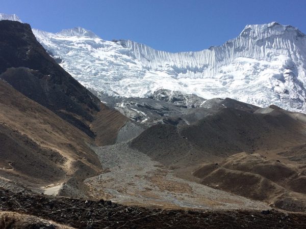
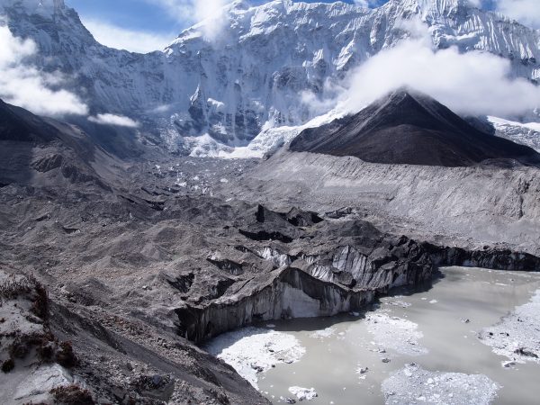
New data from University of Alaska Fairbanks scientists at the Geophysical Institute suggests glaciers in the high mountains of central Asia will shrink more slowly than predicted by some other research. However, as glaciers lose mass, the eventual decline of available ice to melt may affect rivers more than anticipated.
David Rounce, a research associate with the Geophysical Institute, presented data during the American Geophysical Union showing 20-50 percent glacier mass loss by the end of the century for glaciers surrounding the Tibetan plateau and neighboring regions.
He said this is less than what some other models project but no cause for celebration. Glaciers are an important source of water for many rivers. High rates of glacier melt initially bring high runoff but, as glaciers shrink, ultimately mean less water.
“You’re still talking about less runoff downstream by the end of the century,” he said. “However you spin it, it’s not a good thing for people downstream.”
Rounce is part of a team of researchers at the university who presented work on modeling this loss in the region. The lead on the project, Regine Hock, said the data she presented at the meeting suggests the loss will affect these rivers more than originally thought.
Glaciers in the region researchers call High Mountain Asia feed water into some of the largest rivers in the world, such as the Indus, Ganges and Brahmaputra. In the Indus, the smallest of these, water flows at an average annual rate of over 200,000 cubic feet per second; the Brahmaputra, the largest, runs at over three times that.
Hock wondered at first if the rivers and basins were too large to be affected by glacial runoff and eventual water depletion. These rivers are largely fed by other weather and climate patterns, and glacier water is only a part of their source.
“So maybe even if glacier runoff increases, or doubles, maybe that doesn’t really matter because the river is so big. And that’s what everybody assumes,” Hock said. “Everybody said, ‘No it doesn’t matter because the river is so big.’ That’s where it’s sort of our most striking results: In some months and some river basins, it does matter.”
Hock, and a colleague, Matthias Huss from the Swiss university ETH Zurich, found that in more than 40 percent of the largest basins in High Mountain Asia, runoff will decrease by more than 20 percent due to glacier mass loss in at least one month of the year by 2100. So even if the decline in runoff will be minimal across a full year, the drop will be substantial in a particular month.
Earlier this year, Huss and Hock reported significant change in the projected annual volume of water by the end of this century in 56 large glaciated basins. They found that almost half of these basins have already passed their maximum annual runoff — or “peak water” — which means that their runoff is already decreasing.
During warmer and drier periods, runoff from a glacier can provide water to compensate for lower amounts of precipitation or higher amounts of evaporation.
“But when it’s gone, it can’t compensate anymore,” Hock said.
This could have implications for areas downstream of these glaciers, where they provide fresh water to over one billion people.
To collect more detailed data, Rounce modeled over 70,000 glaciers in the region to calibrate the model to a level he said has not been done before. Aided by another member of the team, Tushar Khurana, who worked as a National Science Foundation Research Experiences for Undergraduates student, the group developed new methods for calibration to further constrain the model.
Rounce modeled the projected change in a range of climate scenarios. These scenarios are based on alternative trajectories for greenhouse gas concentrations and atmospheric conditions adopted by the Intergovernmental Panel on Climate Change, called the Representative Concentration Pathway.
Around present day, he found that glaciers in the region are losing mass at a rate of about 11 to 13 metric gigatons per year. By the end of the century, that rate of loss is projected to rise around 18 to 44 metric gigatons per year for scenarios with higher concentrations of greenhouse gases. For the lowest projection, the one where humans manage to limit greenhouse gas emissions the most, that rate drops to 0.8 metric gigatons per year, as the rate of mass loss slows down because the glaciers reach a new equilibrium.
With such a high level of detail thanks to the number of glaciers modeled, Rounce was also able to find that glaciers in the region were behaving quite differently from each other. He projected the greatest loss in the southeast in areas like the Himalayas. However, in the interior part of his research area, such as the Kunlun Mountains and Karakoram, glaciers are relatively stable, and, in some scenarios, glaciers are actually projected to grow.
He said this could be explained by a greater amount of precipitation in this region from climate change, but more research needs to be done to figure out why.
“The next step is applying this method to all the glaciers in the world. We’re hoping to do that over the next year,” Rounce said. “We’ve received a lot of calibration data for High Mountain Asia, covering 98 percent of the glaciers. There’s been significant improvements in the calibration data available for the Arctic, Alaska, Canada and Svalbard, Iceland. So that’s kind of our goal.”
Fritz Freudenberger, University of Alaska Fairbanks Geophysical Institute, 907-474-7185, ffreudenberger@alaska.edu

