

Recent Posts
First seismic network installed on Mount Edgecumbe volcano
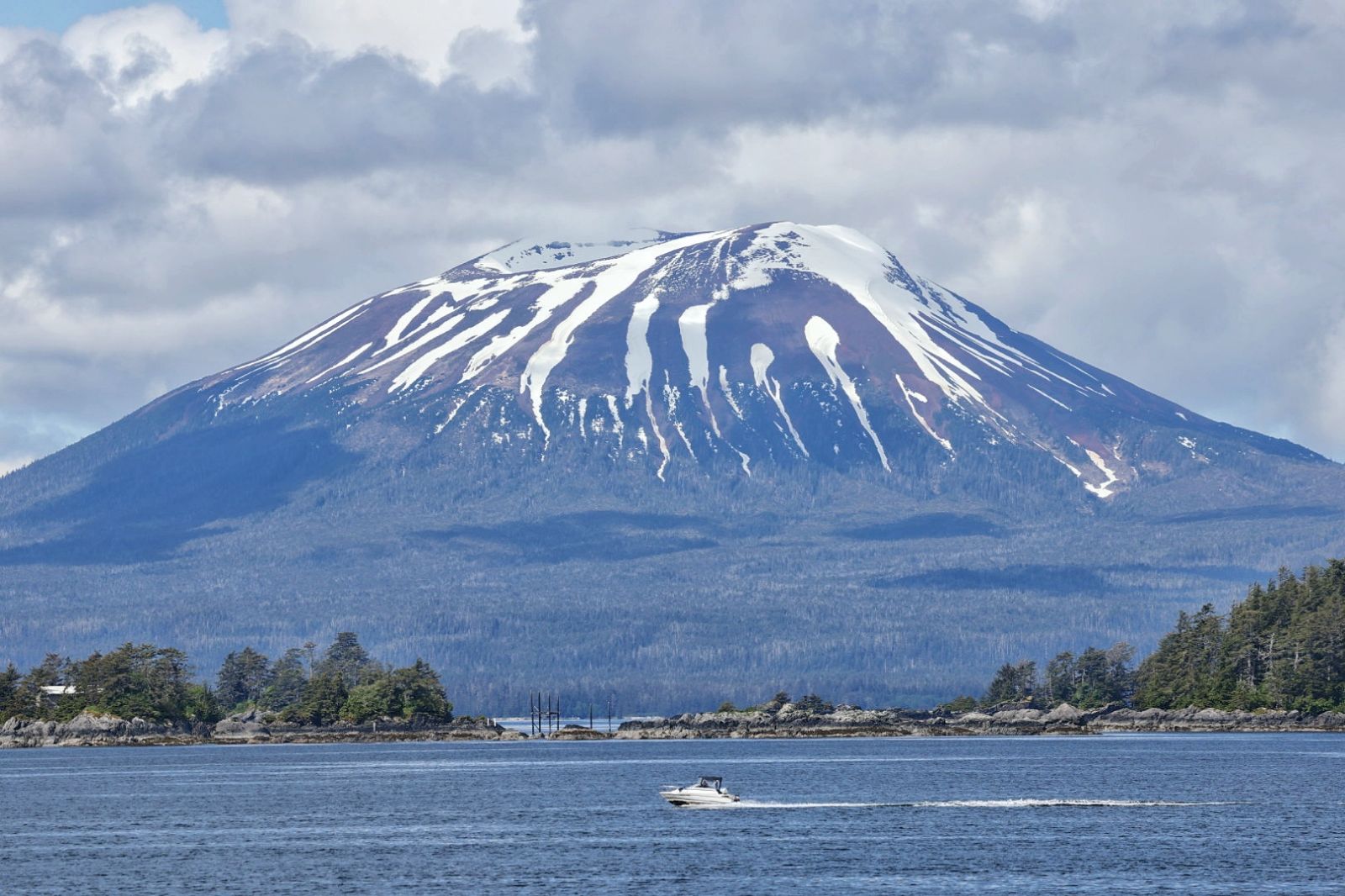
Mount Edgecumbe volcano in Southeast Alaska has become the latest addition to the Alaska Volcano Observatory’s ground-based monitoring network.
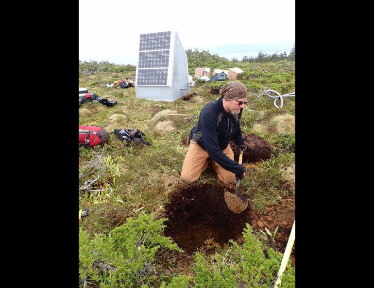
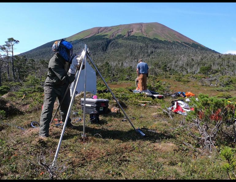
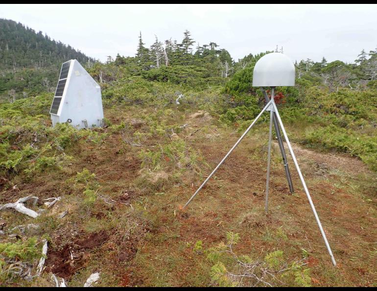
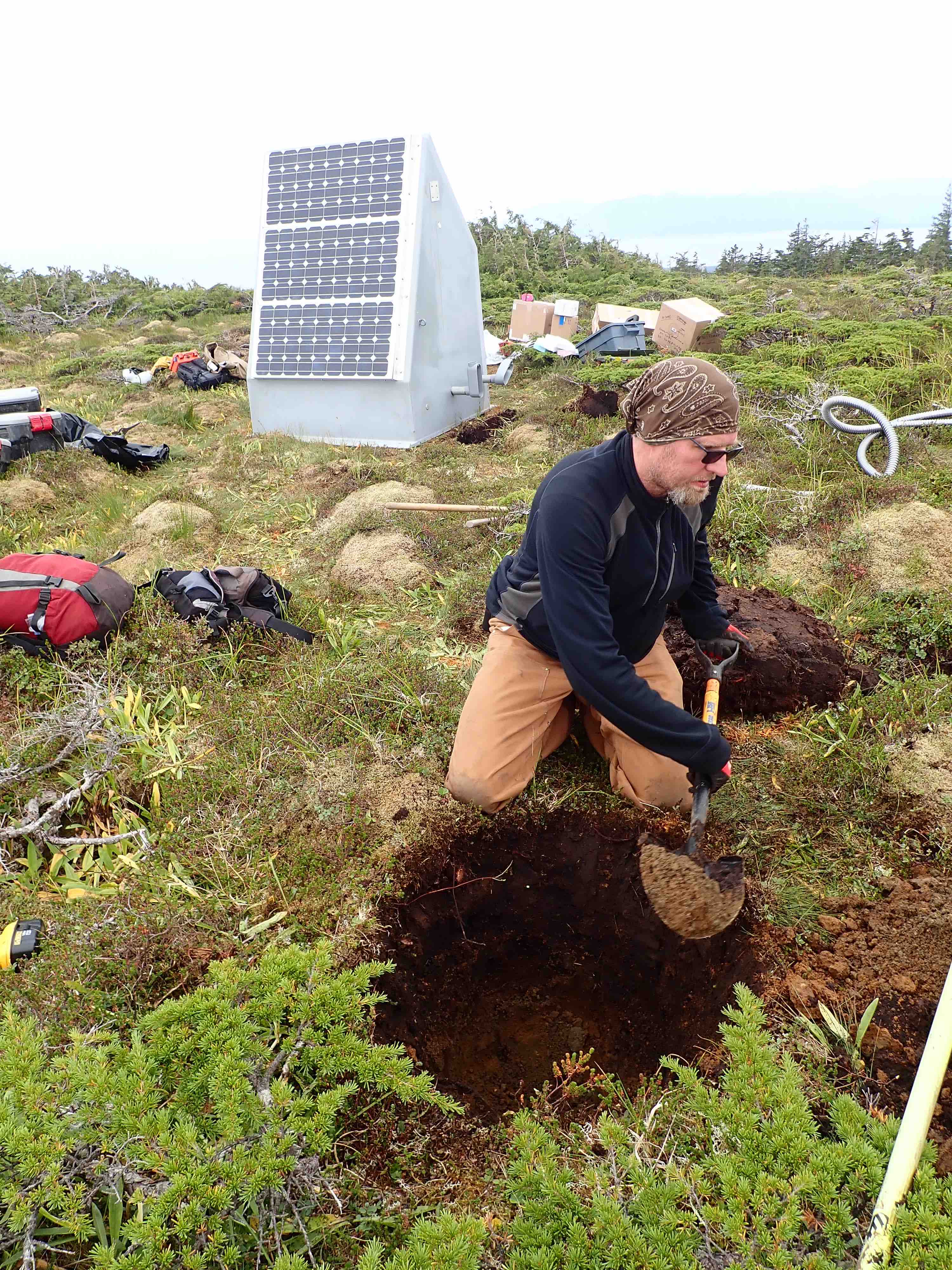
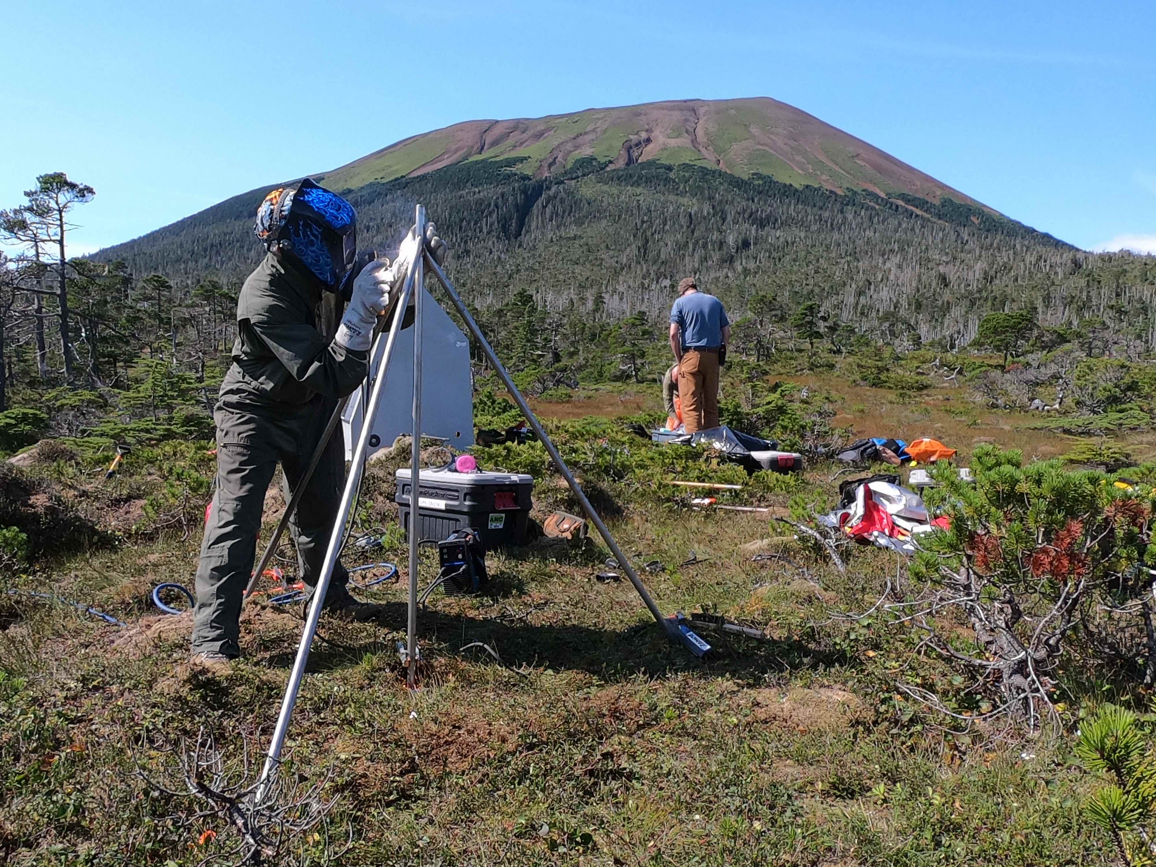
An observatory team in early September installed three seismic and Global Navigation Satellite System stations on the reawakened volcano and upgraded the only existing station in the vicinity, a temporary one on nearby Crater Ridge.
“This feels like the closing of the loop,” said Ronni Grapenthin, a geodesist with the Alaska Volcano Observatory who helped with the installation. He is affiliated with the University of Alaska Fairbanks Geophysical Institute and is an associate professor at the UAF College of Natural Science and Mathematics.
“The initial part was the detection of unrest in April of last year and then trying to understand the cause of unrest, which we linked to the inflation of the volcano,” he said. “Then we worked with the community of Sitka to inform them about our understanding of the volcano and its current activity and to cooperate with them on permitting for a ground-based monitoring network.”
The Alaska Volcano Observatory is a joint program of the UAF Geophysical Institute, the Alaska Division of Geological and Geophysical Surveys and the U.S. Geological Survey. The USGS funds the observatory, part of which is based at the Geophysical Institute.
Max Enders at the USGS led the network installation, with assistance from Grapenthin and research technician Max Kaufman of the Alaska Volcano Observatory. The three were at the volcano Aug. 20-29.
Mount Edgecumbe, known as L’ux Shaa in the Lingít language, woke up in April 2022 with a series of earthquakes. Computer analysis based on satellite imagery showed magma had risen to about 6 miles from a depth of about 12 miles and caused the earthquakes and surface deformation, according to 2022 research by the Alaska Volcano Observatory.
The nearest seismic station to Mount Edgecumbe was installed in August 2022 on nearby Crater Ridge, a part of the Edgecumbe Volcanic Field.
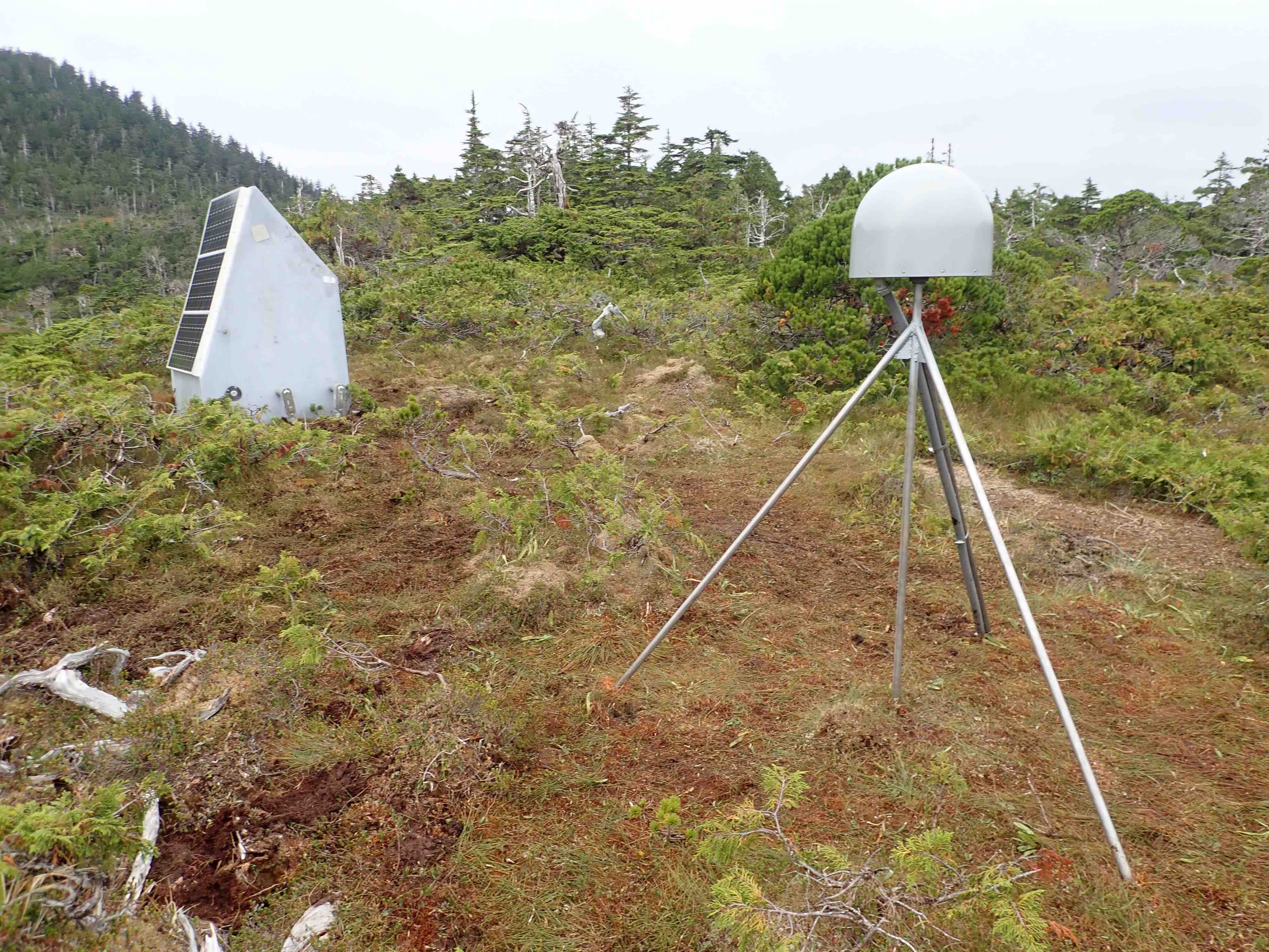
The volcano’s three new seismic and GNSS stations have been placed around the flanks of the volcano at roughly the 4, 7 and 10 o’clock positions of an analog clock. The lone station on adjacent Crater Ridge has been upgraded to replace a temporary GPS antenna mast with a reinforced steel tripod.
The Alaska Volcano Observatory will now be able to learn a lot more about Mount Edgecumbe. First, however, scientists need to determine the volcano’s normal condition.
“When you go to a place and start recording data, you don't know whether it shows an anomaly or whether this is the normal state of the volcano,” Grapenthin said. “So we start by getting a feel for how the volcano works.”
Mount Edgecumbe will be assigned a color code when scientists have a fuller understanding of the volcano. The observatory uses green, yellow, orange and red to denote a volcano’s status. Green denotes typical background activity, and red warns that an eruption is underway or imminent.
The new and upgraded stations have had an immediate impact. Of the 34 earthquakes recorded in the vicinity of Mount Edgecumbe in the past year, 24 have been recorded in the two weeks since completion of the installation Aug. 29.
The lone seismic station on Crater Ridge helped AVO detect smaller earthquakes but didn’t substantially increase AVO’s ability to locate those events using the regional seismic network. The absence of that information meant less was known about the volcano’s activity.
“Having three new seismic stations makes all the difference for locating small earthquakes,” Kaufman said.
The observatory will now be able to create a catalog of Mount Edgecumbe’s seismicity, he said. Changes in seismicity can then be tracked over time and related to data from other geophysical methods like measurements of ground deformation from radar satellites and on-the-ground GNSS receivers.
Data from the new and upgraded stations will be integrated into AVO’s public website about Mount Edgecumbe in the coming weeks.
With the addition of Mount Edgecumbe, the observatory now has monitors on 31 of Alaska’s 54 active or historically active volcanoes.
The Mount Edgecumbe data will also feed into the Alaska Geophysical Network, the statewide network of seismic, weather and infrasound stations operated and maintained by the Alaska Earthquake Center at the Geophysical Institute.
“These stations will be a nice addition to the larger efforts in Southeast Alaska to track seismic activity along the Queen Charlotte Fault and across the region,” said Michael West, the state’s seismologist and the Alaska Earthquake Center’s director.
• Ronni Grapenthin, Alaska Volcano Observatory, rgrapenthin@alaska.edu.
• Rod Boyce, University of Alaska Fairbanks Geophysical Institute, 907-474-7185, rcboyce@alaska.edu