
Recent Posts

New funding advances earthquake early warning for Alaska
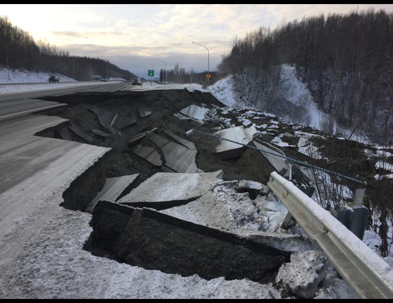
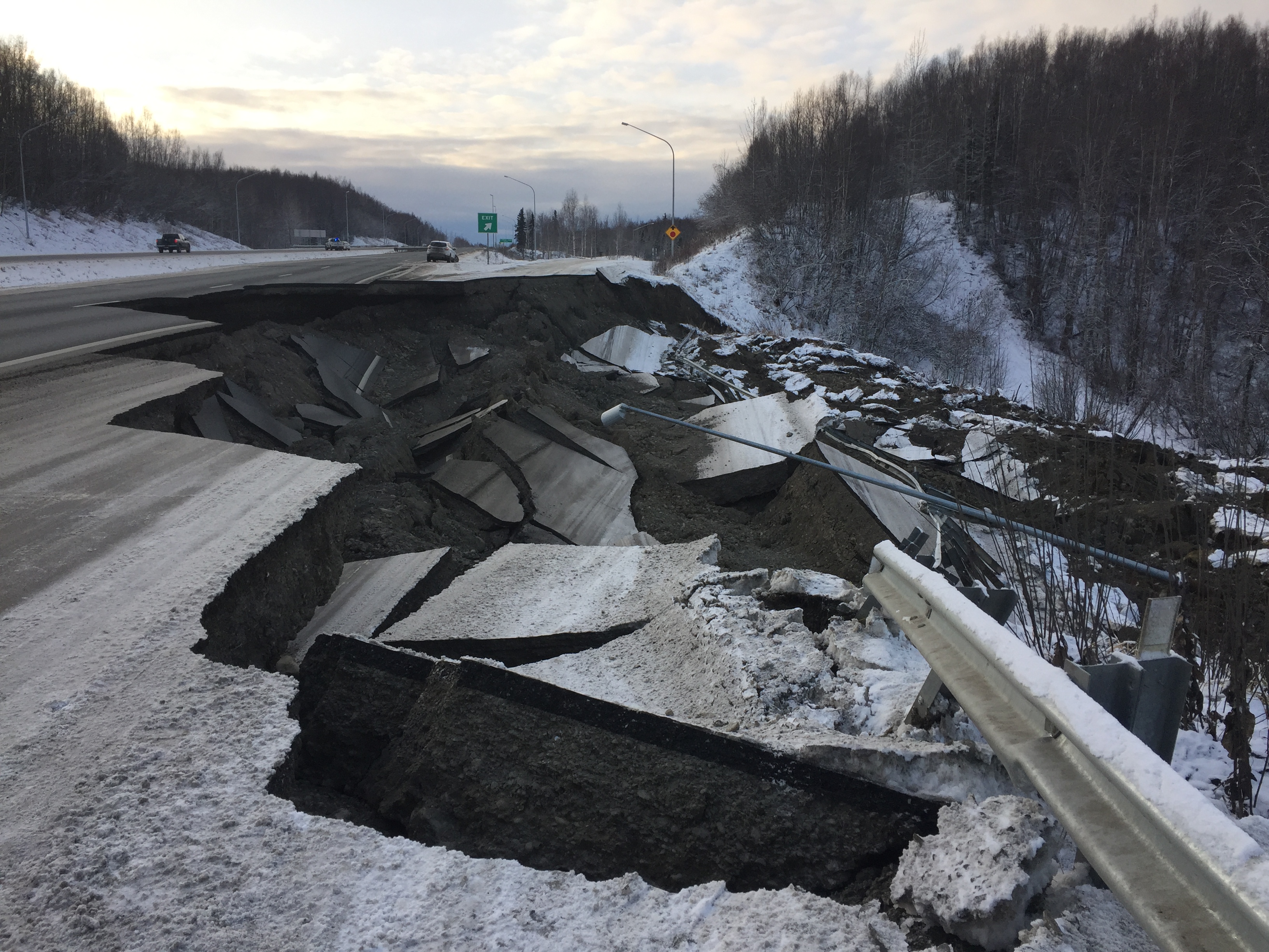
Alaskans are closer to having critical seconds of warning that shaking from a major earthquake is about to occur.
Federal funding approved earlier this year will allow for the first implementation steps of the ShakeAlert system to begin, though its operation is not expected for several years and is contingent on continued financial support. The system can provide several seconds to a minute or more of warning and is being used in California, Oregon and Washington.
The Alaska Earthquake Center at the University of Alaska Fairbanks Geophysical Institute will work on implementation with the U.S. Geological Survey. The USGS published its technical implementation plan for Alaska in February 2025.
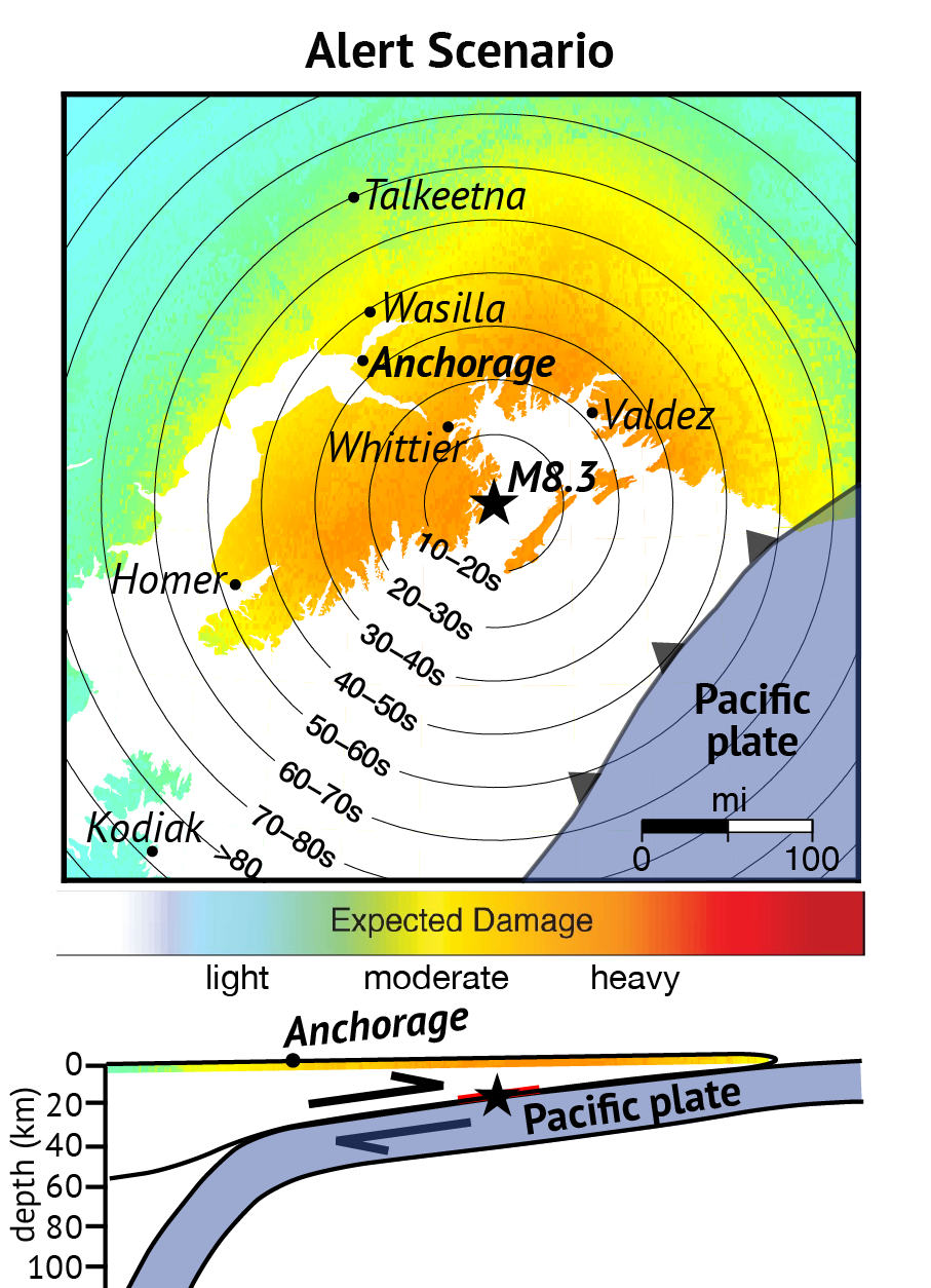
At least $2 million of the $34.9 million allocated by Congress to the USGS for continued development and expansion of ShakeAlert will go toward adding Alaska to the system. The effort will first focus on the Anchorage, Fairbanks, Kodiak and Prince William Sound regions, which include about 90% of the state’s population.
“This is outstanding news for Alaska,” said Michael West, state seismologist and director of the Alaska Earthquake Center. “Bringing earthquake early warning to Alaska has been a lengthy joint effort of the Alaska Earthquake Center and our partners at the U.S. Geological Survey.”
West said Alaska Sen. Lisa Murkowski helped obtain the funding.
“I thank Sen. Murkowski for her years of effort that have gotten us to this starting point,” West said. “It is past time to build this capability that exists in other West Coast states.”
Murkowski is a senior member of the Senate Appropriations Committee. She is chair of that committee’s subcommittee with jurisdiction over the USGS.
“When earthquakes hit, seconds matter,” Murkowski said. “The ShakeAlert Earthquake Early Warning System provides lifesaving tools that detect earthquakes in real time and issue alerts throughout the hazard zone.”
The USGS developed ShakeAlert in partnership with researchers at the University of California, Berkeley; the California Institute of Technology; and the University of Washington.
“Earthquake early warning is predominantly an engineering problem,” said UAF professor Ronni Grapenthin, who has been involved with earthquake early warning for several years. “We take what we can learn about earthquakes, and we try to speed it up.”
Grapenthin, as a postdoctoral researcher at UC Berkeley, helped integrate real-time GPS into a prototype system, parts of which evolved into ShakeAlert.
“There has been a lot of development, and new developments are still being made,” he said.
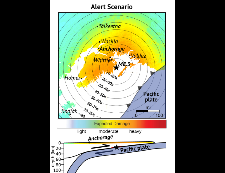
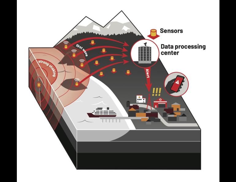
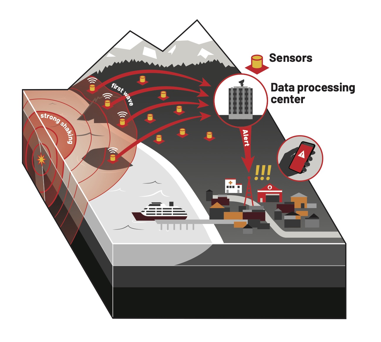
Most early warning systems use a network of seismic sensors to detect an earthquake’s fast-moving primary waves, or P-waves. Those P-wave signals get automatically grouped when their arrival times at sensors form a pattern consistent with a single earthquake.
The system then quickly estimates the quake’s location and magnitude. That allows alerts to be sent before the slower, more-damaging secondary waves, or S-waves, arrive.
P-waves are fast-moving waves that push and pull the ground in the same direction as the wave travels, allowing them to move through solids, liquids and gases. The slower S-waves move the ground perpendicular to the waves’ path.
Earthquake early warning systems also include Global Navigation Satellite System receivers to rapidly characterize large earthquakes and their extent. GNSS, which includes GPS, uses satellites to measure surface displacements, which are often many meters for the largest earthquakes.
How and when ShakeAlert will arrive in Alaska and what it will look like isn’t yet clear. Those involved will weigh cost, population and infrastructure at risk, desired warning times, logistics and maintenance, and a region’s seismological environment.
“We won't be starting from scratch,” Grapenthin said. “We have a lot of geophysical instrumentation in the field already that sends data in real time, but the demand for robust data transfer is far higher for an earthquake warning system than for a system that locates earthquakes after the fact.”
Alaska’s system will consist of 450 real-time Advanced National Seismic System stations. Of those, 20 exist in the state, 270 would be new stations and 160 would be upgrades to existing stations.
Completing that phase is estimated to cost about $66 million in 2024 dollars. Operation is estimated to cost about $12 million annually.
“Moving forward, state investment is critical,” West said. “States are best positioned to lead public awareness campaigns and the integration of earthquake alerts with state and local emergency management systems.”
• Michael West, Alaska Earthquake Center, mewest@alaska.edu
• Ronni Grapenthin, Alaska Earthquake Center, rgrapenthin@alaska.edu
• Rod Boyce, University of Alaska Fairbanks Geophysical Institute, 907-474-7185, rcboyce@alaska.edu