
Recent Posts
Coring for permafrost insights in the Goldstream Valley
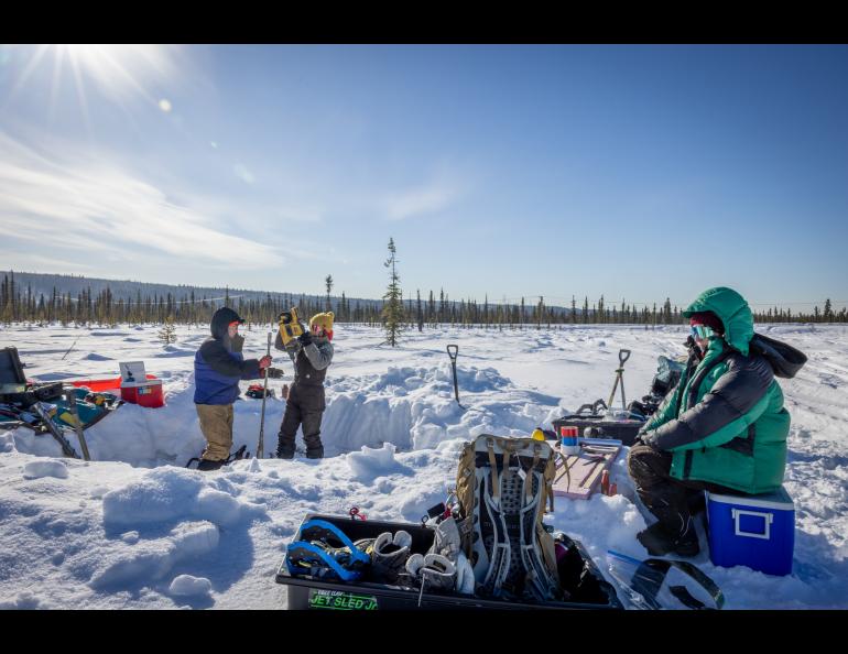
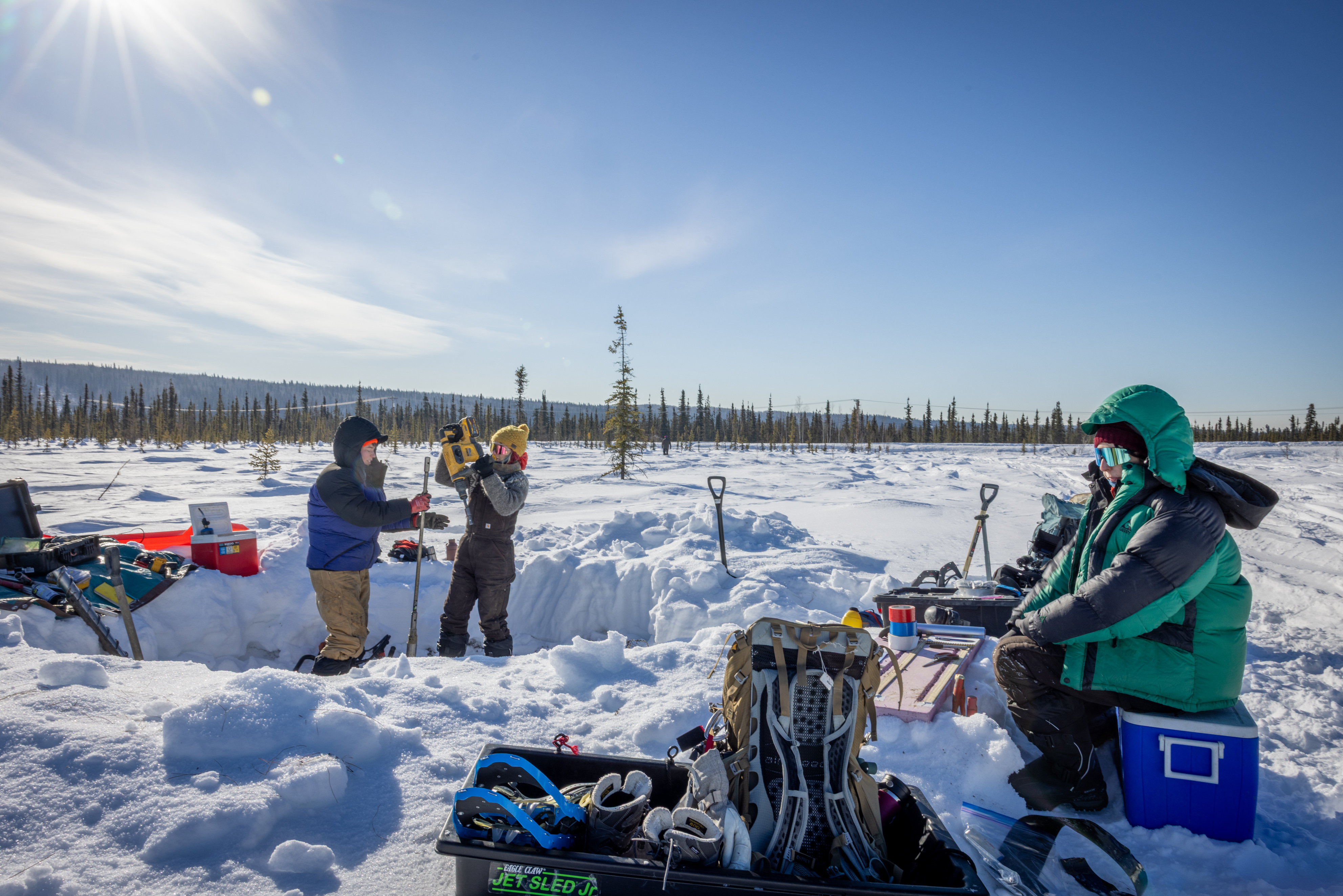
GOLDSTREAM CREEK, Fairbanks — Drilling for a permafrost core on this late-March day first required creation of a workspace.
At this site low in the Goldstream Valley near Fairbanks, that meant moving about 100 cubic feet of snow. The result was a snow pit about 8 feet in diameter and 2 feet deep.
That’s enough snow to fill two pickup truck beds. And it made a workable site for three permafrost scientists.
Their target: the frozen boggy taiga and the permafrost beneath it.
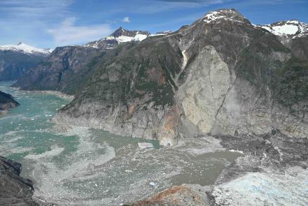
“We are interested in this valley system because it’s fairly representative of a much broader region, like the boreal forest region with small river floodplain systems,” said research assistant professor Louise Farquharson of the University of Alaska Fairbanks Geophysical Institute.
“We can take observations from here and upscale them to other kinds of boreal areas, other areas in Interior Alaska and other parts of the Arctic,” she said from within the pit.
A gas-powered coring drill with a 2-inch hollow-center bit was driven into the frozen ground late that morning. Farquharson held a handle on one side of the motor, and assistant research professor Shannon Hibbard of the Desert Research Institute held the opposite. The goal was a depth of 2 meters, about 6 ½ feet.
It’s difficult work at one of the coldest places in the Fairbanks region. The temperature hung around 15 to 20 degrees Fahrenheit below zero on this clear morning in the valley bottom.
Sometimes tools freeze. Sometimes the ground can be reluctant to give up much.
Several hammer strokes on a core extractor, usually a metal rod that pushes out the sample, are sometimes needed. That won’t always do it in deep cold, however, so a propane blowtorch is used to gently warm the core barrel.
It’s a risky task: Heat from the torch can damage the sample if used for too long.
When those samples did slide into waiting hands, they were placed in a holding tray to keep the segments intact. Then they were immediately photographed, described and packaged.
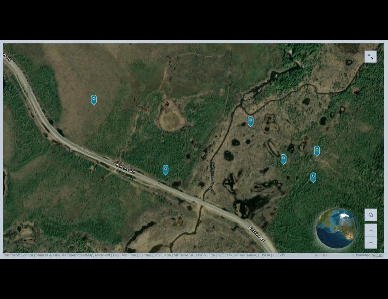
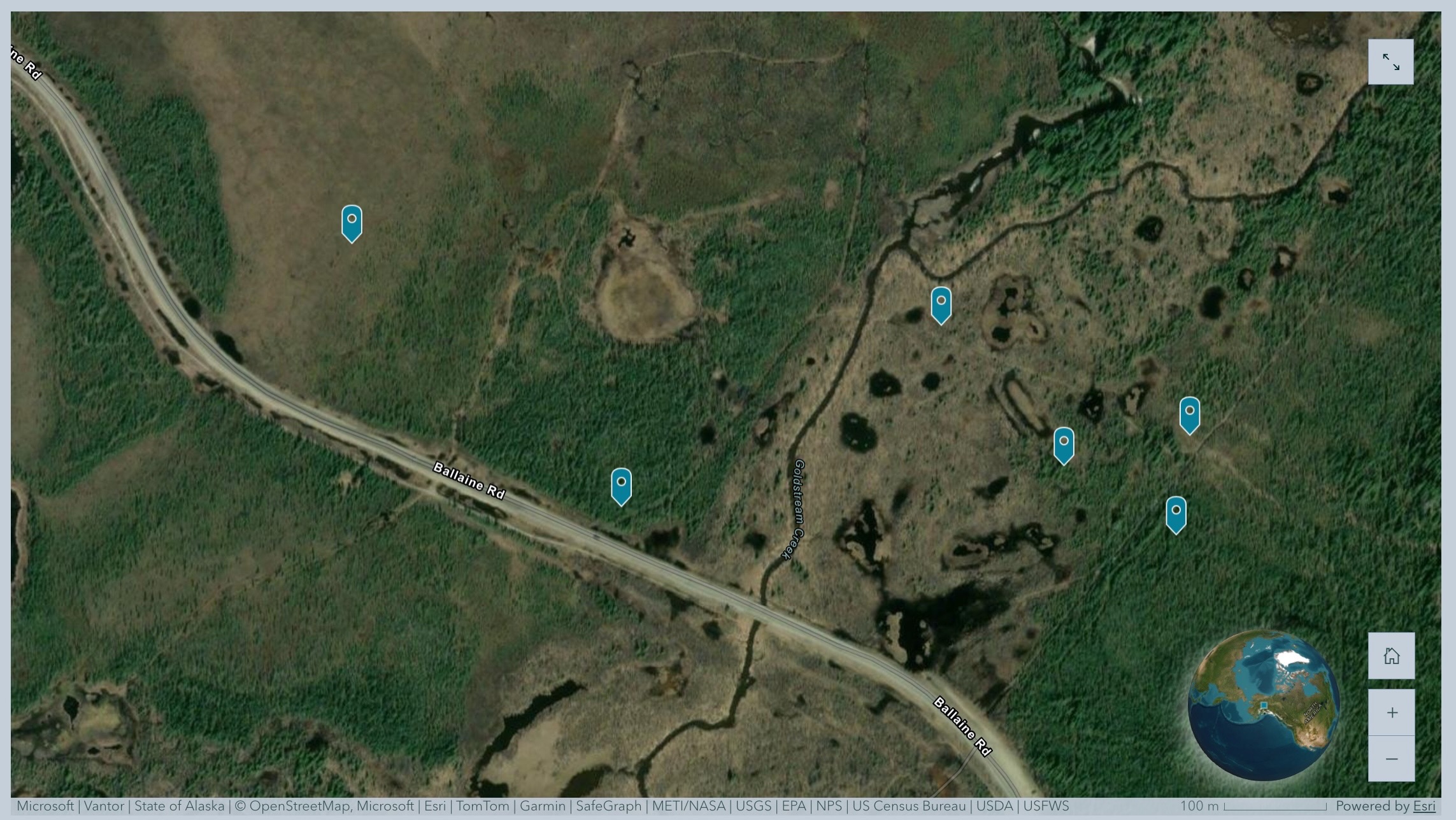
That work also occurred over the preceding several days at four other sites, each with a different vegetation profile, below the confluence of Goldstream and Big Eldorado creeks. The researchers obtained access permits from the landowners — the state Department of Natural Resources and the Interior Alaska Land Trust.
The project is one of many efforts to understand how people can adapt to, and plan for, a warming Arctic.
Drilling for insights
Hibbard leads the federally funded Goldstream Creek project, which is co-led by Farquharson and assistant research professor Jennifer Kielhofer of the Desert Research Institute. Research associate professor Dmitry Nicolsky, research professional Colby Wright and technician Jordan Campbell of the UAF Geophysical Institute are also participating.
It is part of the larger Integrated Terrain Analysis Program, led by Brad Sion at the Desert Research Institute. The program provides terrain analysis for various federally funded projects examining interactions between the natural environment and infrastructure.
Desert Research Institute is a Nevada-based nonprofit that studies environmental systems such as water resources, climate and weather, air quality, wildfires, and more.
The Goldstream Creek project aims to better understand how plants, landforms and the overall landscape are connected to frozen ground and how those relationships shape the waterway environment.
“We’re looking at how landscape, elevation, and vegetation types or ecotypes change along and across valley gradients and how that influences permafrost distribution, active layer thickness, and talik presence in the subsurface,” Kielhofer said.
Taliks are volumes of unfrozen ground within areas of permafrost.
“Do we see white spruce? Do we see black spruce? Do we see tussocks?” she said. “Does permafrost exist under each vegetation type and for how much longer? How much ground ice is associated with each vegetation type? And how much will the ground subside when it melts?”
From field to lab
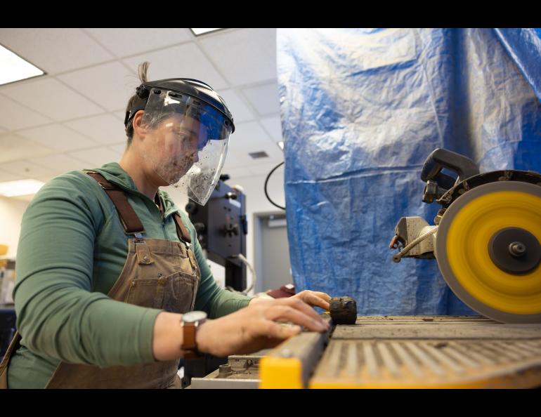
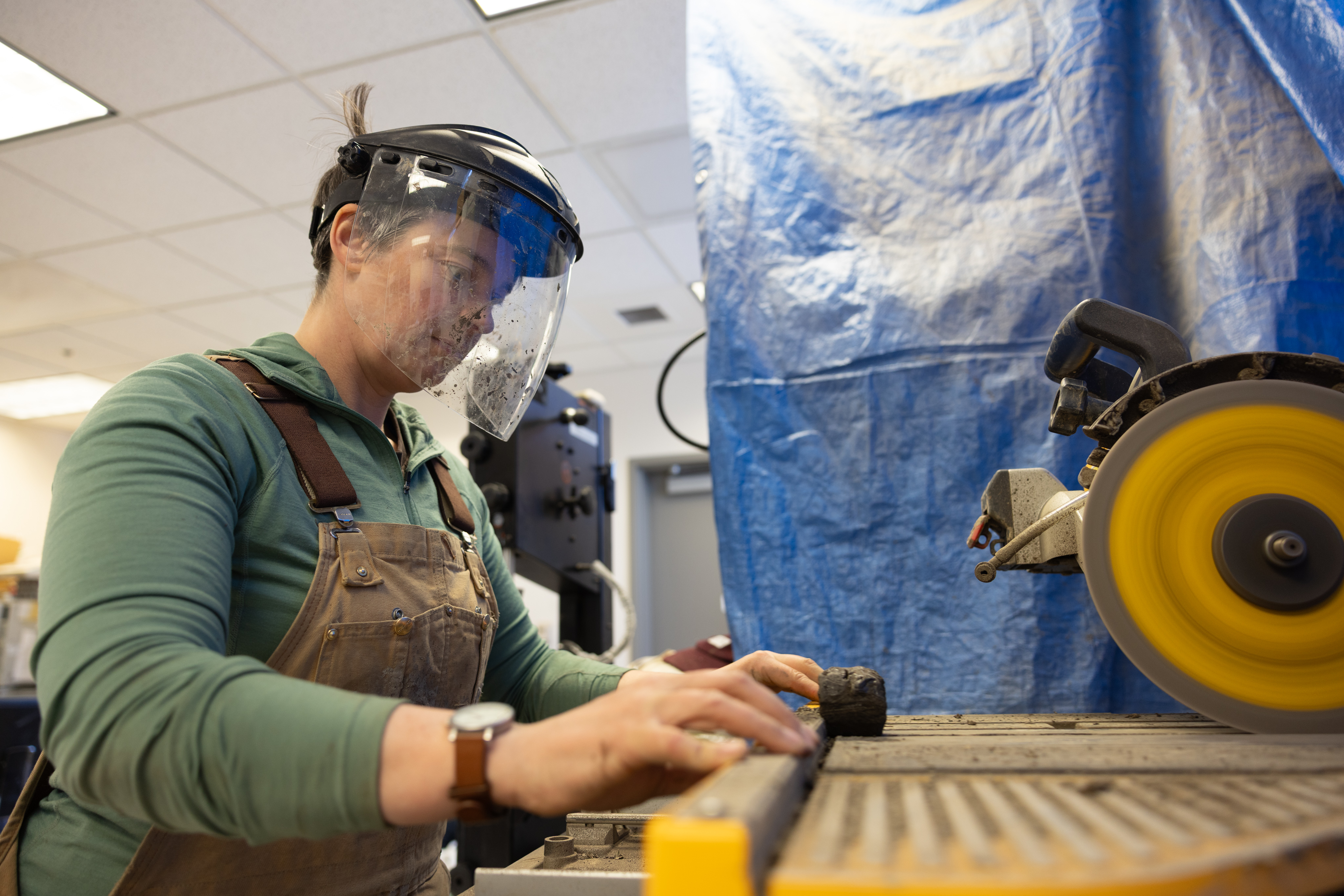
The frozen core samples met a laboratory saw blade the next day at the lab of research associate professor Go Iwahana at the UAF International Arctic Research Center.
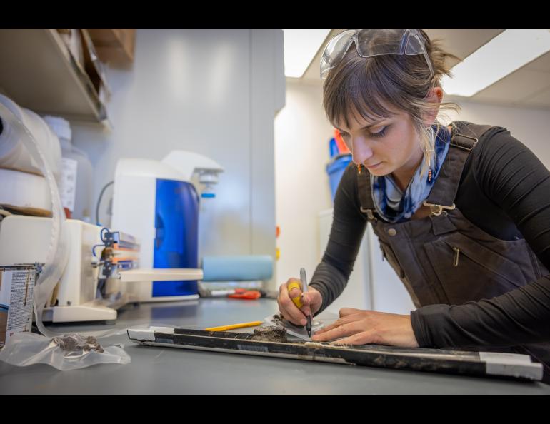
They then had a good scrape before being put under bright lights in a small photo booth for analysis by Hibbard and Kielhofer.
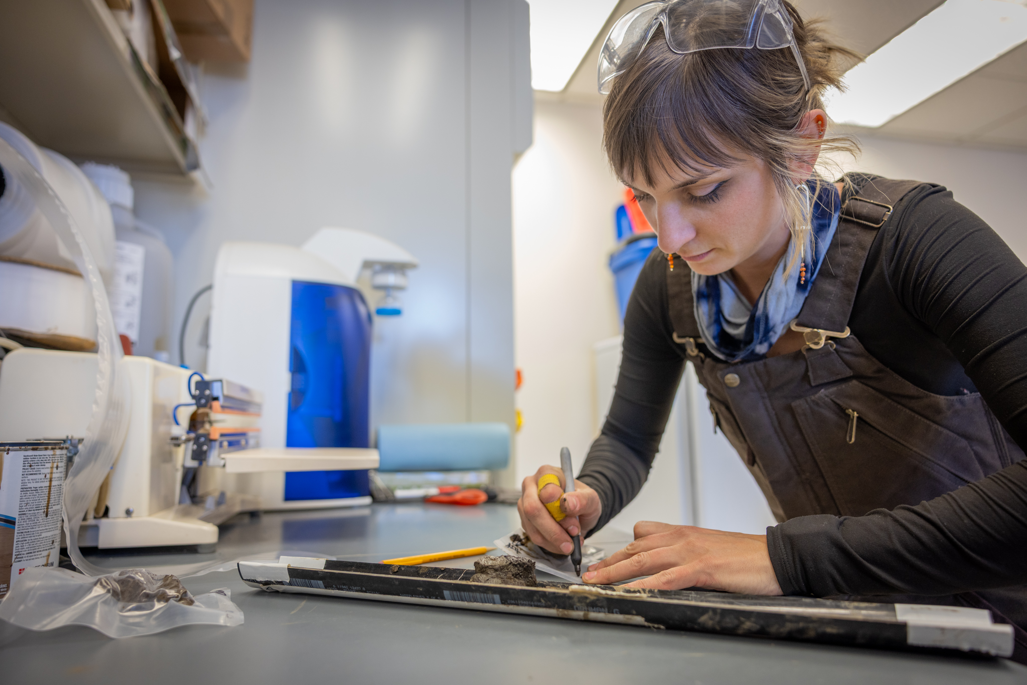
With 15 centimeters of sample, about 6 inches, settled on a half-pipe holder, Kielhofer began giving Hibbard the initial assessment. This sample came from a depth of 84 to 99 centimeters (33 to 39 inches).
The sample consisted of sandy silt with lenses and layers of ice. Some ice formed diagonal bands a few centimeters long and a couple of millimeters thick. Other ice ran horizontally and was slightly thicker.
Near the sample’s upper end, ice layers appeared wavy and loosely spaced but became denser, thinner and a slightly different color at the lower end.
“We’re trying to get some detail while in the lab, but it’s not meant to be super laborious, as these cores thaw quickly and we have our photos that we can refer to later, along with the laboratory analysis we will do,” Kielhofer said.
The abundance of ice lenses and veins results in ice-rich ground that stores water and carbon and helps structurally support Arctic landscapes. When the ice melts, the terrain of Goldstream Valley will subside, potentially by several feet.
Reading the permafrost
Permafrost coring is looking into the past to project the future.
“It’s like a jigsaw puzzle,” Hibbard said. “It's rewarding because we’re putting a lot of gear together and picking sites based on the variability we see on the surface, all to see what is happening in the subsurface.”
“When we collect cores of permafrost, it’s really cool to finally see what’s underneath and how much ice there is and how it varies across sites,” she said. “It’s the unknown that we’re exposing, and that gets us excited about what comes next.”
Next up in the Goldstream Valley project is a full analysis of those hard-won cores. That will take some time.
“How much ground ice is there? What's the temperature of the ground ice? And how rapidly is that warming and changing?” Hibbard said.
“We want to know how this landscape is going to change with a warming climate and how it might affect infrastructure like roads and homes as well as how it might impact recreation,” she said. “People go dog mushing, cross-country skiing, hiking and hunting in these areas.”
“We want to know, can they still do that? And for how much longer?”
That’s something Farquharson is interested in, beyond the science. She has been skiing and biking in the Goldstream area for almost 20 years.
“It was very cool,” she said, “to finally get a peek at the subsurface to see what I'd been traveling over during that time.”
• Louise Farquharson, University of Alaska Fairbanks Geophysical Institute, lmfarquharson@alaska.edu
• Elyse DeFranco, DRI, Elyse.DeFranco@dri.edu , 775-673-7336
• Rod Boyce, University of Alaska Fairbanks Geophysical Institute, 907-474-7185, rcboyce@alaska.edu