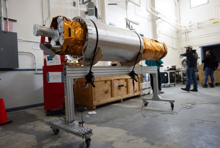
Sensors that detect changes in atmospheric pressure due to ground shaking can also obtain data about large earthquakes and explosions that exceed the upper limit of many seismometers, according to new research.
The sensors, which detect inaudible infrasounds carried through the air, could improve tsunami warnings and other emergency responses while also lowering costs.
Research by University of Alaska Fairbanks Geophysical Institute scientists shows that infrasound sensors can improve magnitude determinations. An initial tsunami warning is based solely on estimated magnitude and location.
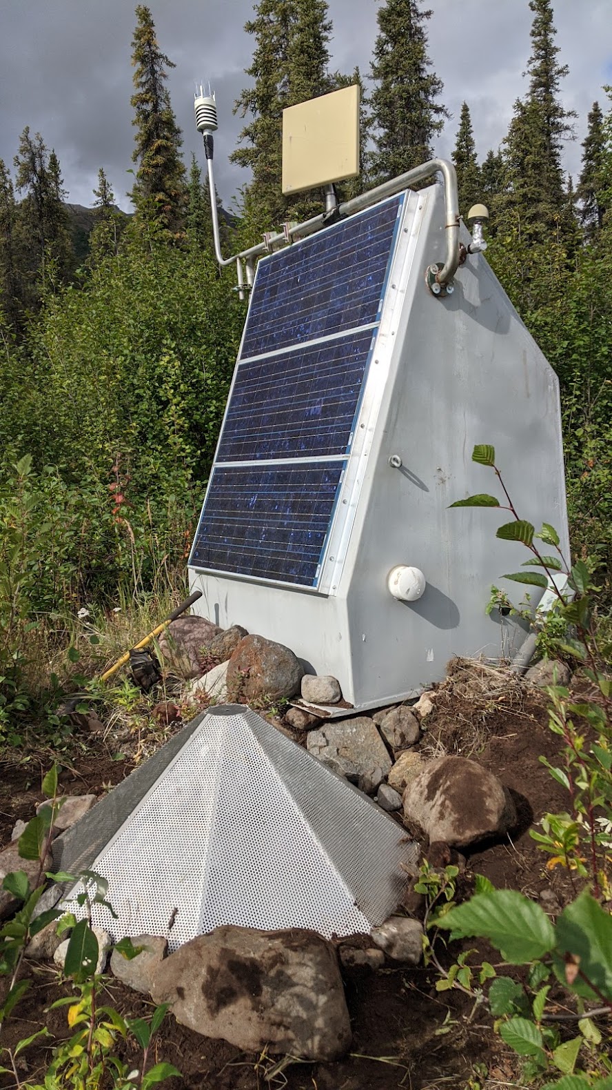
Infrasound sensors cost less than seismometers, are reliable and exist in large numbers in Alaska for other uses.
“What we’ve done is use infrasound for a purpose it wasn’t really intended for,” said Ken Macpherson at the Geophysical Institute’s Wilson Alaska Technical Center. “We’ve found that it works well for providing complete data about strong earthquakes.”
These pressure-sensing infrasound instruments are generally used for non-seismic purposes such as the detection of mining explosions or nuclear detonations. They also record landslides, erupting volcanoes or meteors entering Earth’s atmosphere.
Macpherson details the use of infrasound sensors for seismology in a research paper published April 21 in the Bulletin of the Seismological Society of America.
Macpherson is a seismo-acoustic research and operations scientist. Others from the Wilson Alaska Technical Center involved in the research include Director David Fee, data specialist Juliann Coffey and machine-learning specialist Alex Witsil, now working in the private sector.
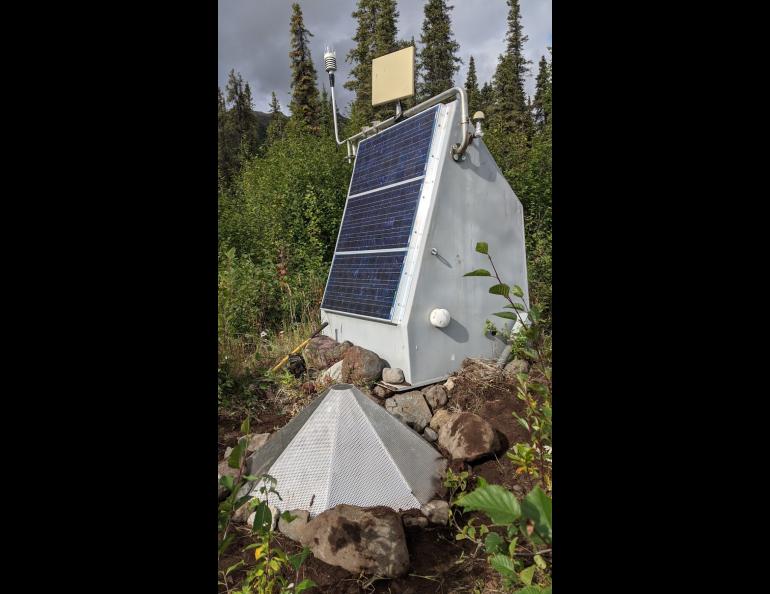
Infrasound sensors record changes in air pressure caused by infrasound waves, which are at a frequency below what humans can hear.
Infrasound sensors can register the full range of an earthquake’s ground motion by detecting air pressure changes caused by the ground’s up and down movement during an earthquake.
Upward movement of the ground compresses the air, increasing air pressure much like a piston does. Downward movement reduces the pressure.
Pressure changes from even the largest earthquakes are far below infrasound sensors’ upper limit.
In contrast, seismometers, which record the actual movement of the ground, have an upper limit, meaning top-end data can be absent for large earthquakes. They can also miss data of smaller earthquakes if those occur too close to a seismometer.
Seismologists call that data loss “clipping.”
“If you crank up your stereo too high, you get a horrible sound,” Macpherson said. “That means you’ve exceeded the dynamic range of the speaker. That can happen to a seismometer.”
Seismologists can overcome clipping by deploying strong-motion detectors, which are different from infrasound sensors. These motion sensors won’t go off scale during intense shaking but are costly and aren’t accurate for smaller quakes. About 130 are located around Alaska, mostly in urban areas and near known faults.
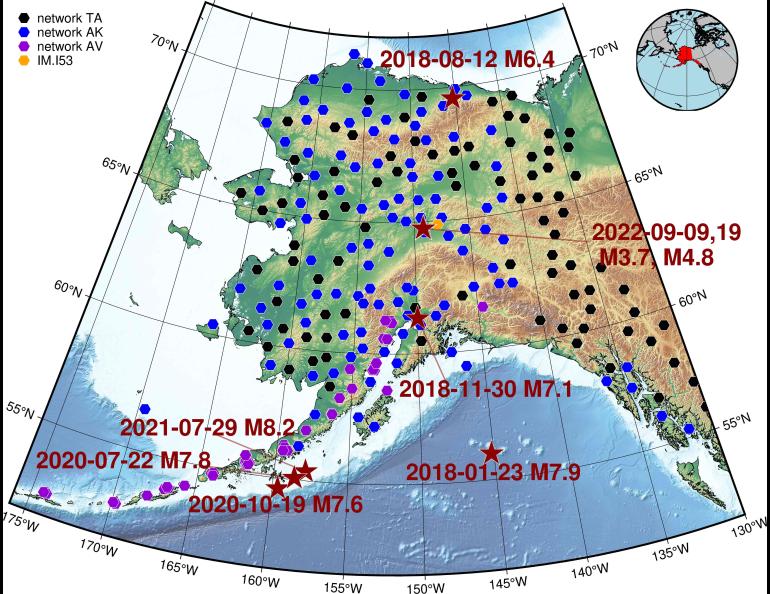
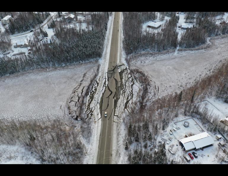
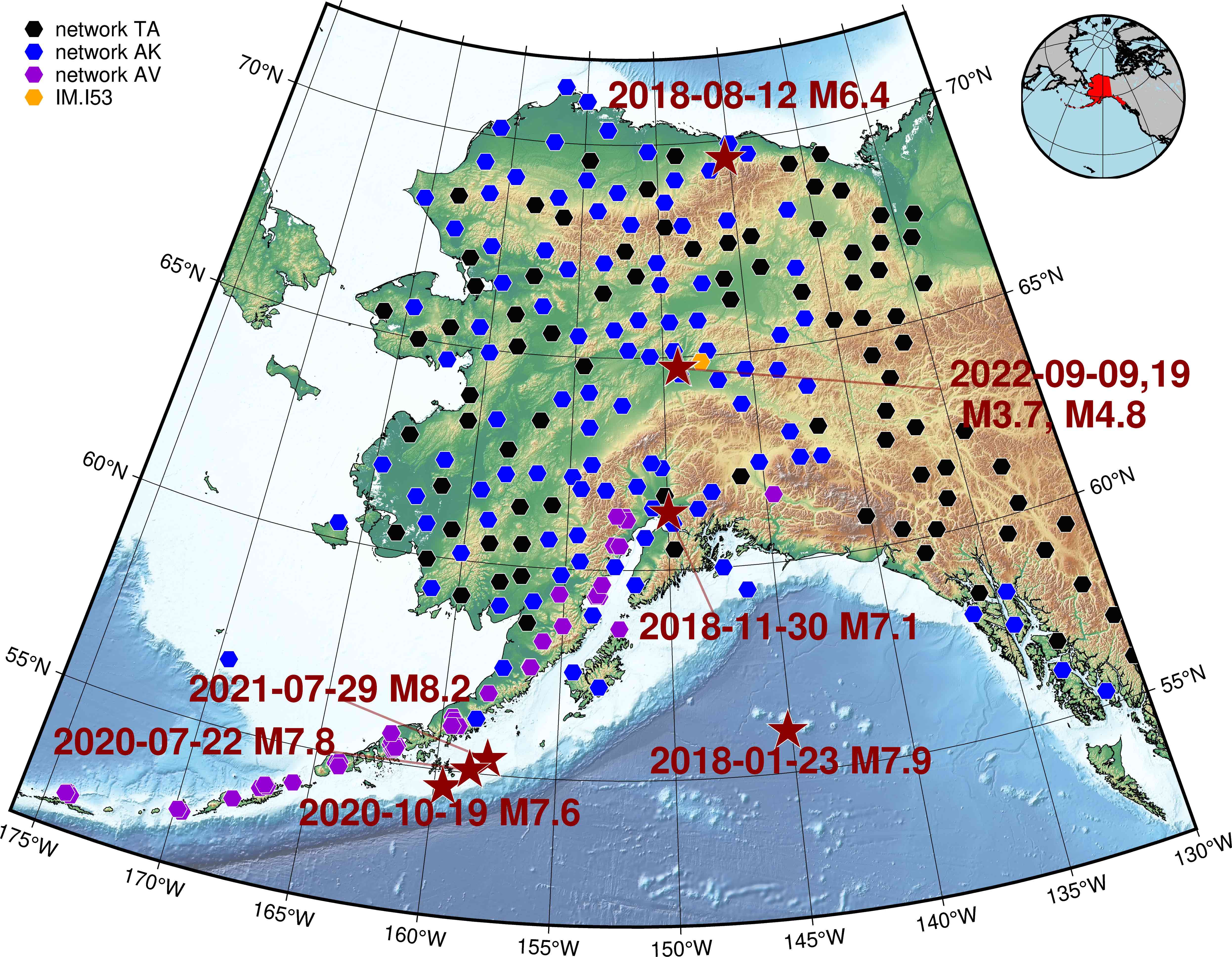
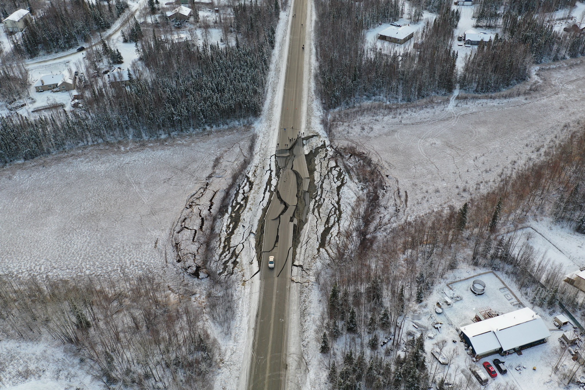
As one example, Macpherson and his colleagues compared infrasound data of the magnitude 7.1 Anchorage earthquake of Nov. 30, 2018, to data from a seismometer. Both instruments were in the same location 18.6 miles from the epicenter.
“The seismometer recording of that earthquake went right to the dynamic range of the instrument and stopped,” Macpherson said. “So there’s a loss of amplitude information.”
The seismometer was one of several in the Southcentral Alaska region missing top-end data from that earthquake. Data from the infrasound sensor was not clipped.
To check the accuracy of the infrasound monitor’s top-end data, Macpherson matched it against the data from a strong-motion seismometer at the same location. They matched.
Infrasound sensors can also provide data just as timely as seismometers. That’s especially important if a tsunami is possible. The National Tsunami Warning Center has just four minutes to issue a warning from the time of a quake’s occurrence.
“If all of the close seismometers clip, and the Tsunami Warning Center is trying to get an accurate magnitude for warning of a tsunami, they could quickly compute magnitudes from a nearby infrasound station that’s colocated with a seismometer,” Coffey said.
Alaska has about 150 infrasound sensors alongside seismic monitors throughout the state.
Some of these were part of the EarthScope Transportable Array, a project funded by the National Science Foundation to map Earth’s crust and upper mantle. The temporary array moved gradually across the nation, reaching Alaska in 2014. Ninety-six of these stations are now part of the Alaska Earthquake Center’s permanent monitoring network.
“We have this unique resource in Alaska, and we’re pushing the science to get the most out of it that we can,” Macpherson said. “We’re looking to utilize it in novel ways.”