


A year after MOSAiC: Arctic melt ponds hold climate clues for UAF scientist
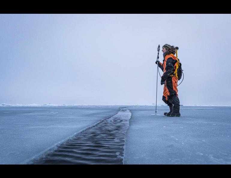
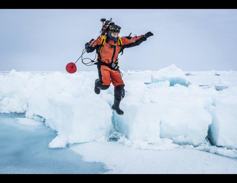
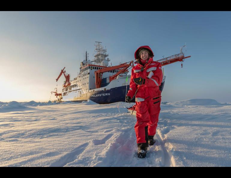
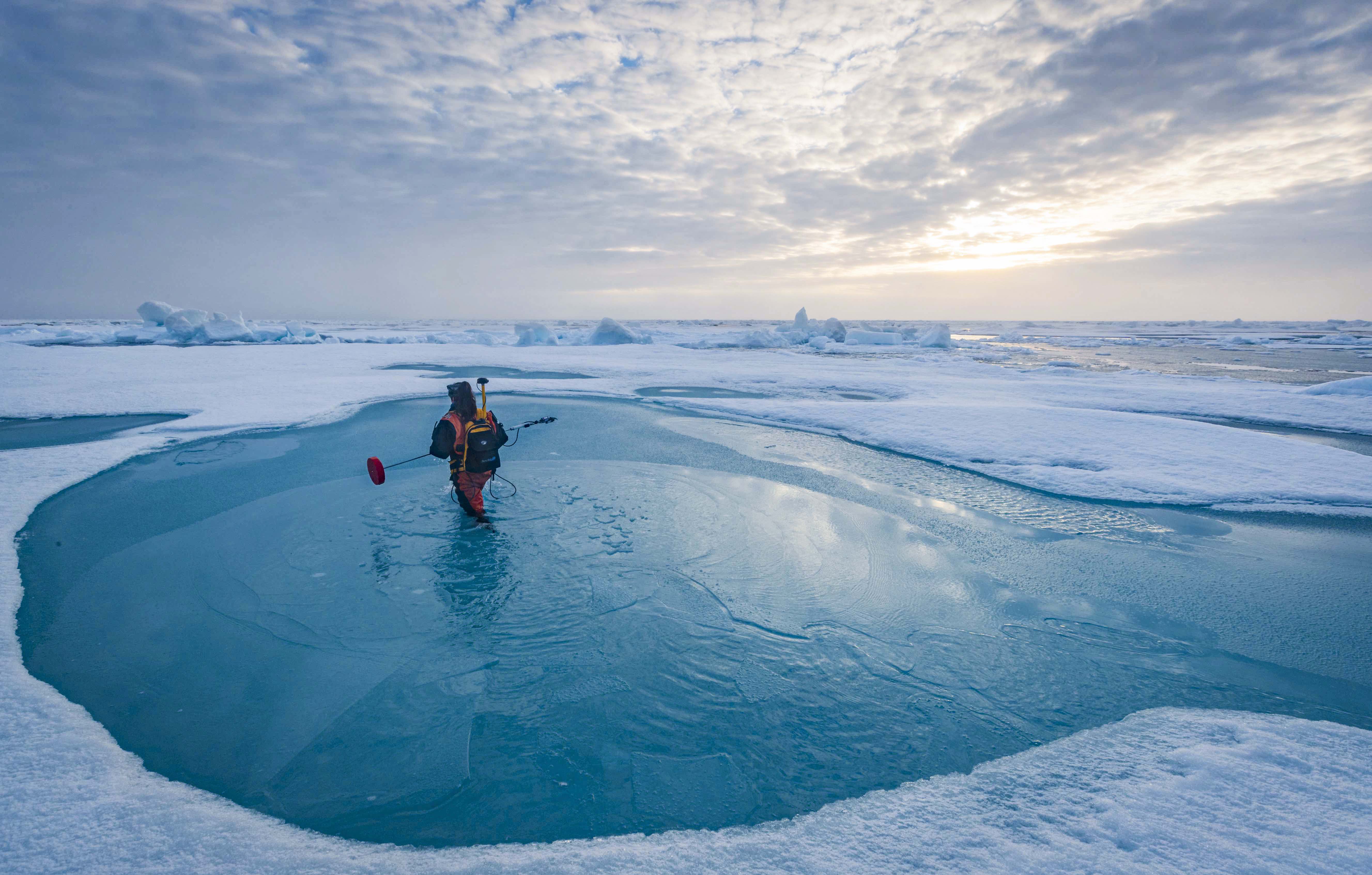
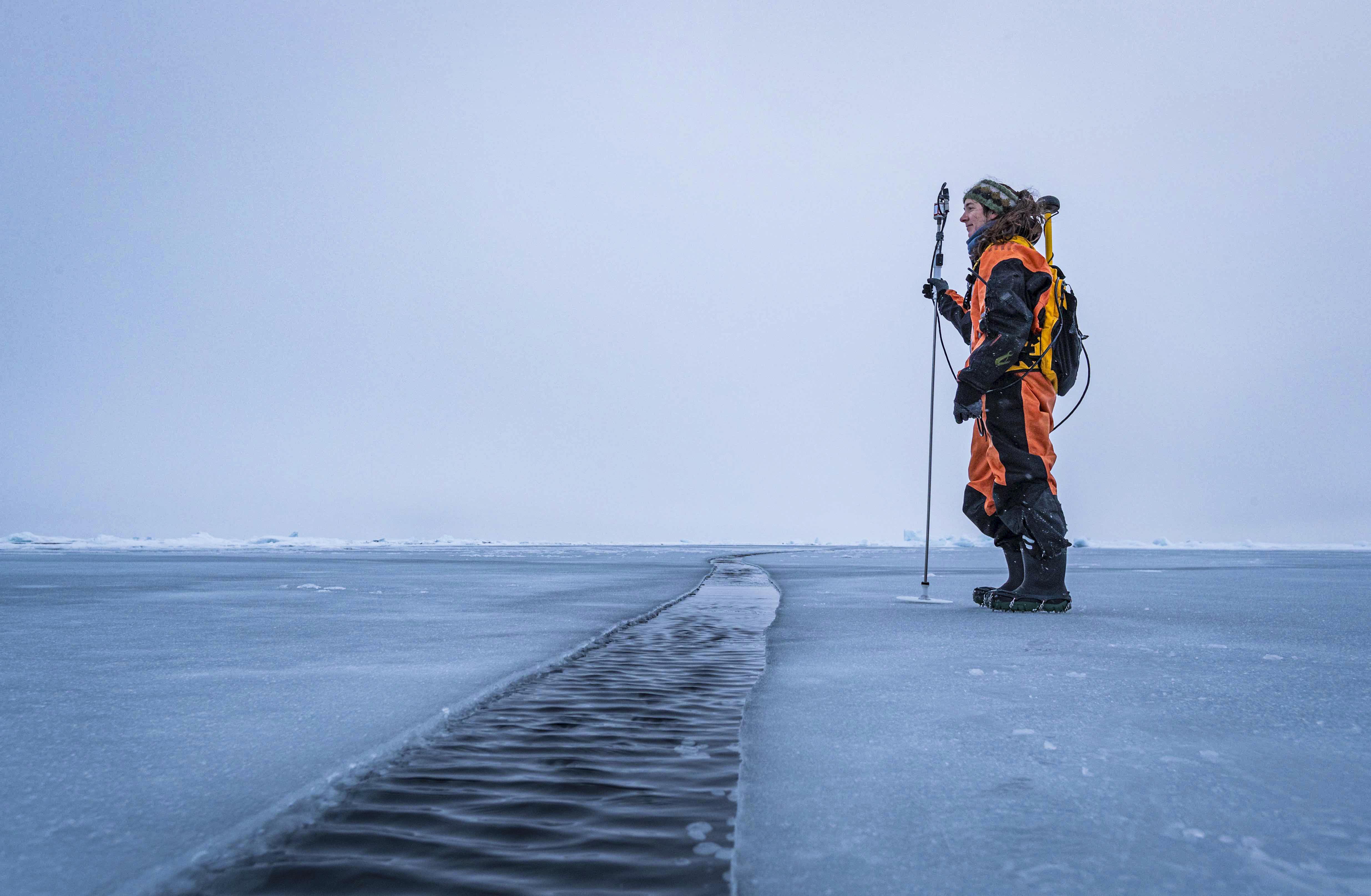
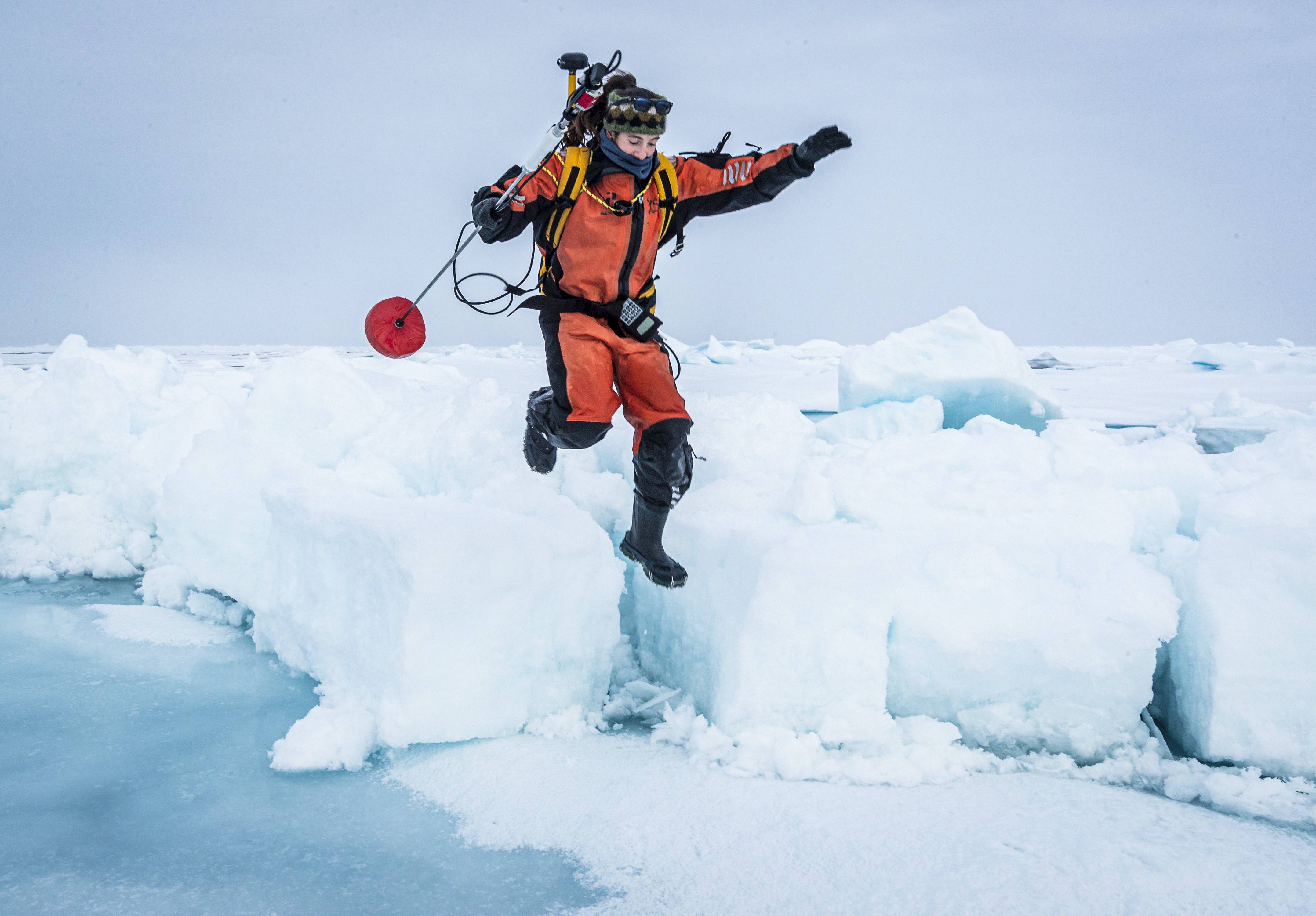
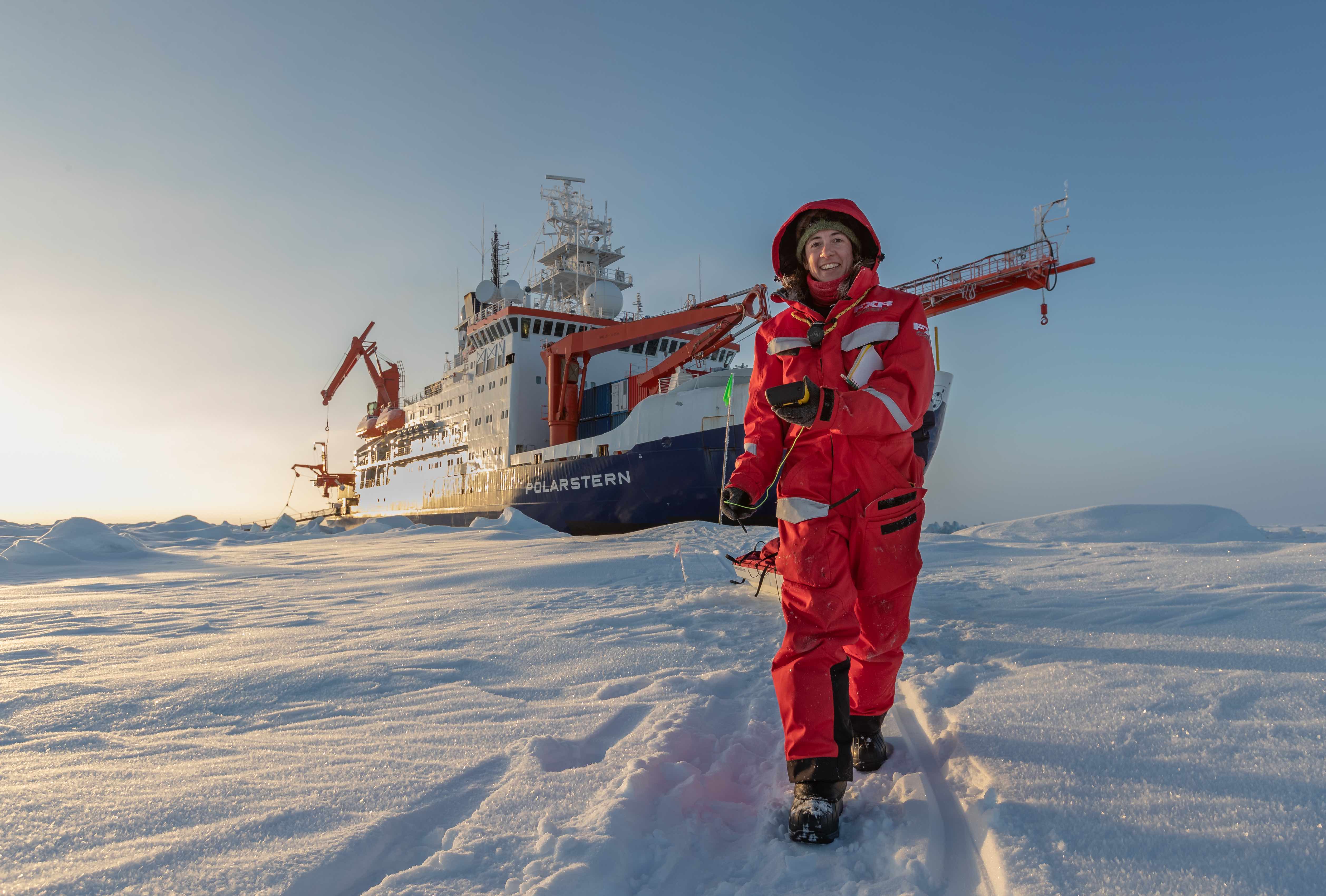
Melinda Webster splashed daily through the clear water of Arctic melt ponds to measure the depth of the water cradled in pockets dotting the polar sea ice. She was a common sight in the white and blue icescape in which the research vessel Polarstern, her home for 126 days last year, had been deliberately left to freeze in place.
The snow, ice and water measurements she obtained will help her and others understand what’s happening on the surface of the sea ice and to the ocean beyond as the climate warms.
The German research vessel returned to its homeport of Bremerhaven on the North Sea coast on Oct. 12, 2020, ending the year-long international Multidisciplinary drifting Observatory for the Study of Arctic Climate expedition. Webster and nearly 300 other scientists participated in MOSAiC.
Since then, Webster, a research assistant professor at the University of Alaska Fairbanks Geophysical Institute, and others who spent months aboard the icebound Polarstern as it drifted across the central Arctic have been busy reporting the outcomes of numerous climate projects.
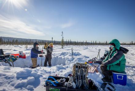
The MOSAiC expedition included scientists from more than 80 research institutions and nearly 40 countries. It had five duration legs and included several designated research groups; Webster was leader of the sea ice group on one of the two legs in which she participated. Her research is funded by NASA’s New Investigator Program in Earth Science.
“What we saw out there — extremely low ice concentration in an area that used to have year-round sea ice — is becoming the norm,” Webster said. “This is becoming the new Arctic.”
“It’s hard to appreciate the magnitude of the impact these things will have on our climate and in our societies,” she said.
Webster focuses on melt ponds, which serve as the skylights of the Arctic sea ice cover. Sea ice is a powerful reflector, sending up to 12 times as much sunlight back into space than the open ocean does. Melt ponds diminish that high reflectivity by allowing more sunlight into the sea ice and underlying ocean.
And because they allow more light into the upper ocean, melt ponds also affect the timing of blooms of phytoplankton, tiny plant-like organisms that form the base of the marine food web.
Scientists know little, however, about how melt pond coverage changes seasonally in different sea ice conditions and what controls their individual depths and sizes.
Webster gathered data by using a modified magnaprobe, a snow-measuring device created and patented in the late 1990s by Geophysical Institute colleague Matthew Sturm and Jon Holmgren while the two of them were at the Army’s Cold Regions Research and Engineering Laboratory in Fairbanks. The probe, which Webster modified for use in ponds, determines depth by measuring the travel time of a sonic pulse to a float that slides on a steel rod. The probe determines position through use of an attached GPS.
Webster’s MOSAiC research on the formation of melt ponds from spring melt to autumn freeze-up in 2020 provides valuable information for ways to represent melt ponds in climate models. The result may be improved projections about Arctic sea ice.
Webster has authored a post-MOSAiC research paper, now in review at the journal Elementa: Science of the Anthropocene, about the evolution of melt ponds.
“We would walk around this floe for 3 kilometers on a near-daily basis, taking repeat measurements to track the changes in surface conditions, snow thickness, melt pond depth and sea ice thickness,” she said.
Webster is also co-author on several other research papers from the MOSAiC expedition. Among them:
• Research about airborne observations of the annual cycle of the sea ice thickness distribution in the Transpolar Drift, which is the movement of ice from Russia’s Siberian coast, across the Arctic to where it enters the North Atlantic off of Greenland;
• A critical look at a widely used computer model for assessing when the Arctic might become ice-free;
• Sea-ice melt and its contribution to the freshwater budget from a sea-ice perspective.
• The winter evolution of snow depth and sea ice thickness.
• The albedo — the amount of light reflected from a surface — evolution of Arctic sea ice from MOSAiC observations and climate model simulations.
“What is really quite wonderful about these MOSAiC observations is that they're a comprehensive time series that captures the interactions between the atmosphere, sea ice, ocean and ecosystem. We can really nail down the physics and try to better represent those physics in the models,” she said.
Webster said much remains to be learned about the changing Arctic environment. By bringing field observations and modeling together, the science behind the MOSAiC voyage can help shape climate policy.
“It’s important to convey optimism, because humans have the capacity to work together to move forward through these challenges. Yes, we sometimes find glaring results, but that doesn't mean we should give up,” she said. “It’s better to keep moving forward together, report our findings to the best of our abilities and inform policymakers of what's actually happening there. That's our job — to deliver the facts to society.”
Melinda Webster, University of Alaska Fairbanks Geophysical Institute, mwebster3@alaska.edu
Rod Boyce University of Alaska Fairbanks Geophysical Institute, 907-474-7185, rcboyce@alaska.edu