Skip to main content
Shop
Donate
UA Directory
Intranet
Quick Links
Geophysical Institute
Main navigation
Home
About
Contact Information
Contact
UAF Directory
Visitor Information
About the GI
Community
GI Publications
Timeline
GI Quarterly
People
Leadership
Researchers
Graduate Student Researchers
Emeriti
Research
Atmospheric Sciences
Remote Sensing
Seismology & Geodesy
Snow, Ice & Permafrost
Space Physics & Aeronomy
Tectonics & Sedimentation
Volcanology
Facilities & Labs
Services
Design & Printing
GI Human Resources
Education Outreach
Instrument Development
Keith B. Mather Library
Research Computing Systems
News & Info
News
Alaska Science Forum
Alaska Science Pod
Science for Alaska
Aurora Forecast
Visitor Information & Tours
Events
Community
Student Info
Intranet
Search
Breadcrumb
Home
/
News
Filter By Year
- Any -
2026
2025
2024
2023
2022
2021
2020
2019
2018
2017
2016
2015
2014
2013
2012
2011
2010
Article Type
- Any -
Read
Explore
Research Group
- Any -
Atmospheric Sciences
Remote Sensing
Seismology & Geodesy
Snow, Ice & Permafrost
Space Physics & Aeronomy
Tectonics & Sedimentation
Volcanology
Facility/Lab
- Any -
Alaska Center for Unmanned Aircraft Systems Integration (ACUASI)
Alaska Climate Research Center (ACRC)
Alaska Critical Minerals Collaborative (ACMC)
Alaska Earthquake Center (AEC)
Alaska Satellite Facility (ASF)
Alaska Space Grant Program (ASGP)
Alaska Volcano Observatory (AVO)
Advanced Instrumentation Laboratory (AIL)
Arctic Coastal Geoscience Lab (ACGL)
College International Geophysical Observatory (CIGO)
Geochronology Laboratory (Geochron Lab)
Geographic Information Network of Alaska (GINA)
Geophysical Institute Permafrost Laboratory (GIPL)
High-frequency Active Auroral Research Program (HAARP)
Hyperspectral Imaging Laboratory (HyLab)
Poker Flat Research Range (PFRR)
Wilson Alaska Technical Center (WATC)
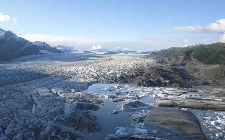
Geophysical Institute researchers involved in international sea level study
May 5, 2021
Three researchers at the University of Alaska Fairbanks Geophysical Institute are among the participants in an international paper that states...
Read more
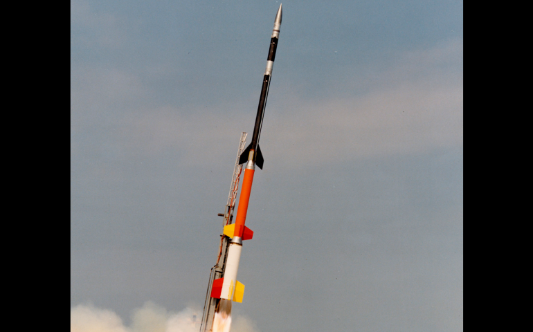
Rocket launch could help answer big aurora mystery
April 23, 2021
Our sun’s impact on the solar system continues to present mysteries for researchers. Now, four University of Alaska Fairbanks Geophysical...
Read more
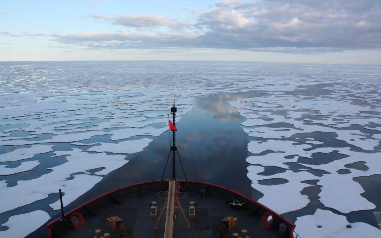
Emissions research tracks effects of increased Arctic shipping
April 15, 2021
The March blockage of the Suez Canal by a grounded massive cargo ship and the ensuing backlog of more than 300 other vessels brought attention...
Read more
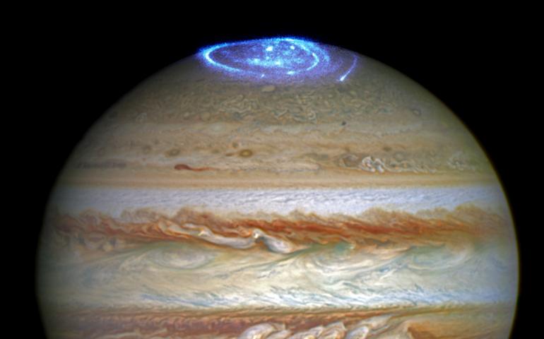
New research reveals secret to Jupiter’s curious aurora activity
April 9, 2021
Auroral displays continue to intrigue scientists, whether the bright lights shine over Earth or over another planet. The lights hold clues to the...
Read more
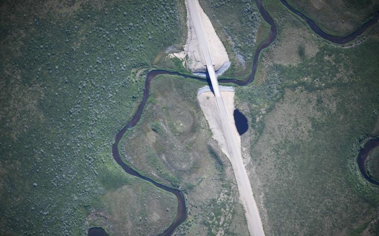
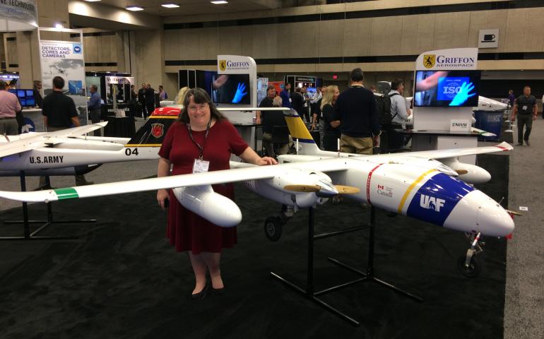
ACUASI completes remote sensing map of Canada’s first highway to the Arctic
April 7, 2021
Members of the Alaska Center for Unmanned Aircraft Systems Integration (ACUASI) recently completed a high resolution map of the Inuvik...
Read more
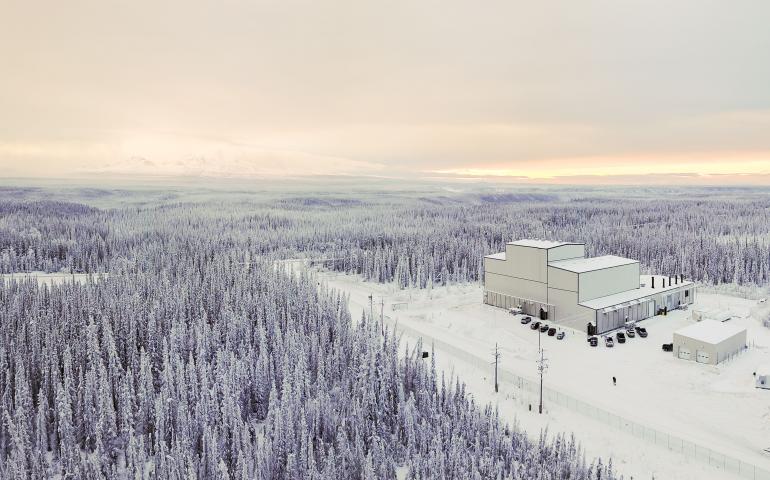
National Science Foundation funds creation of research observatory at Gakona
April 6, 2021
A five-year, $9.3 million National Science Foundation grant will allow the University of Alaska Fairbanks Geophysical Institute to establish a...
Read more
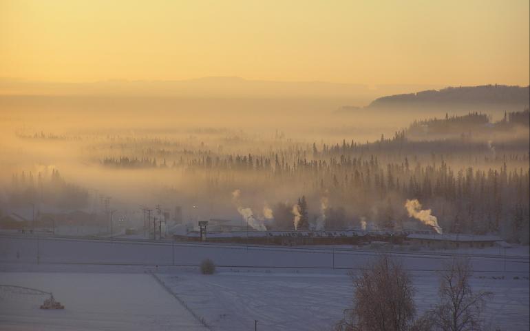
Research targets chemical compound discovered in Fairbanks winter air
April 2, 2021
Research underway at the University of Alaska Fairbanks Geophysical Institute and two other universities into Fairbanks wintertime air pollution...
Read more
Tsunami awareness a priority nearly 60 years after last major Alaska event
March 25, 2021
It has been more than half a century since a major tsunami washed itself upon Alaska. The magnitude 9.2 earthquake of March 27, 1964, in Prince...
Read more
UAF’s unmanned aircraft and research highlighted for Alaska Senate
March 19, 2021
Leaders at the Geophysical Institute at the University of Alaska Fairbanks delivered strong support of Alaska as an aerospace state in remarks...
Read more
Load More