Skip to main content
Shop
Donate
UA Directory
Intranet
Quick Links
Geophysical Institute
Main navigation
Home
About
Contact Information
Contact
UAF Directory
Visitor Information
About the GI
Community
GI Publications
Timeline
GI Quarterly
People
Leadership
Researchers
Graduate Student Researchers
Emeriti
Research
Atmospheric Sciences
Remote Sensing
Seismology & Geodesy
Snow, Ice & Permafrost
Space Physics & Aeronomy
Tectonics & Sedimentation
Volcanology
Facilities & Labs
Services
Design & Printing
GI Human Resources
Education Outreach
Instrument Development
Keith B. Mather Library
Research Computing Systems
News & Info
News
Alaska Science Forum
Alaska Science Pod
Science for Alaska
Aurora Forecast
Visitor Information & Tours
Events
Community
Student Info
Intranet
Search
Breadcrumb
Home
/
News
Filter By Year
- Any -
2026
2025
2024
2023
2022
2021
2020
2019
2018
2017
2016
2015
2014
2013
2012
2011
2010
Article Type
- Any -
Read
Explore
Research Group
- Any -
Atmospheric Sciences
Remote Sensing
Seismology & Geodesy
Snow, Ice & Permafrost
Space Physics & Aeronomy
Tectonics & Sedimentation
Volcanology
Facility/Lab
- Any -
Alaska Center for Unmanned Aircraft Systems Integration (ACUASI)
Alaska Climate Research Center (ACRC)
Alaska Critical Minerals Collaborative (ACMC)
Alaska Earthquake Center (AEC)
Alaska Satellite Facility (ASF)
Alaska Space Grant Program (ASGP)
Alaska Volcano Observatory (AVO)
Advanced Instrumentation Laboratory (AIL)
Arctic Coastal Geoscience Lab (ACGL)
College International Geophysical Observatory (CIGO)
Geochronology Laboratory (Geochron Lab)
Geographic Information Network of Alaska (GINA)
Geophysical Institute Permafrost Laboratory (GIPL)
High-frequency Active Auroral Research Program (HAARP)
Hyperspectral Imaging Laboratory (HyLab)
Poker Flat Research Range (PFRR)
Wilson Alaska Technical Center (WATC)
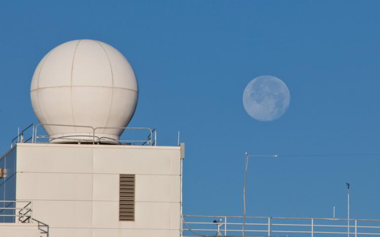
GINA group provides the big picture in wildfire season
June 25, 2021
Fire season is underway in Alaska, and the University of Alaska Fairbanks Geophysical Institute is helping — as it does every year — in the...
Read more
Research shows Alaska infrastructure at risk of earlier failure
June 23, 2021
Roads, bridges, pipelines and other types of infrastructure in Alaska and elsewhere in the Arctic will deteriorate faster than expected due to a...
Read more
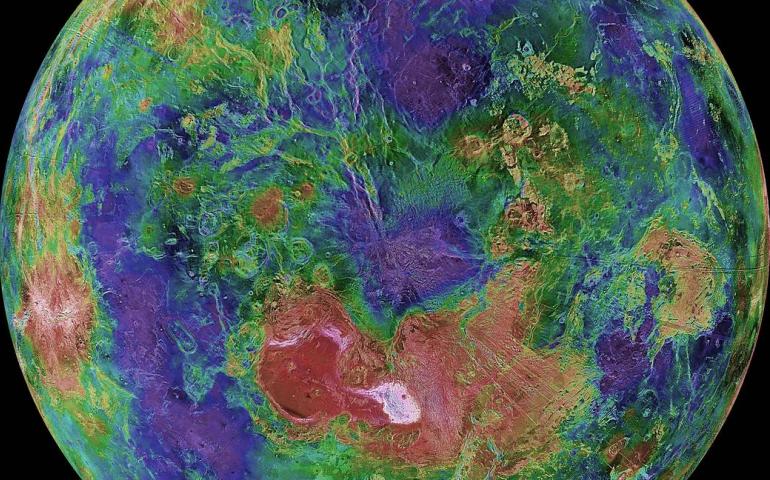
UAF professor on science team for new NASA mission to Venus
June 2, 2021
NASA has approved two missions to Venus, and that means University of Alaska Fairbanks Geophysical Institute research professor Robert Herrick is...
Read more
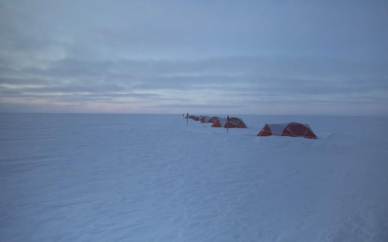
Film shows Geophysical Institute research in harsh Greenland landscape
May 28, 2021
The wind’s low, rumbling howl fills the ears for 89 seconds before a human voice is heard. The ice and snow of Greenland’s expanse passes below...
Read more
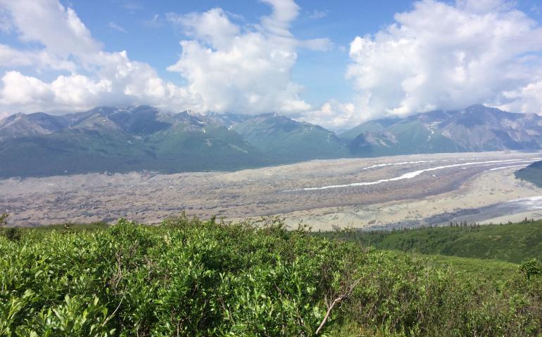
Global study of glacier debris shows impact on melt rate
May 19, 2021
A large-scale research project at the University of Alaska Fairbanks Geophysical Institute has revealed insight into the relationship between...
Read more
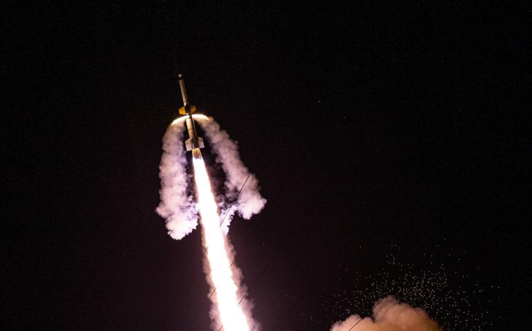
NASA launches rocket in search of aurora answers
May 17, 2021
NASA launched one of its largest sounding rockets Sunday from an East Coast facility in an experiment led by a University of Alaska Fairbanks...
Read more
Geophysical Institute's HyLab is ready for the minerals hunt
May 7, 2021
Alaska contains minerals essential to the national defense, renewable energy and electronics industries. Finding those minerals, however, can be...
Read more
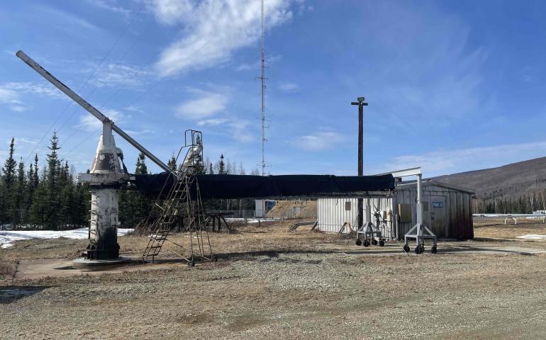
NASA crews plan busy summer at Poker Flat Research Range
May 6, 2021
NASA’s annual maintenance visits to Poker Flat Research Range have resumed after a year off due to the COVID-19 pandemic, with big projects this...
Read more
New podcast highlights science and natural history in Alaska
May 5, 2021
The Alaska Science Pod was created to give voice to the people tackling big scientific questions in the Last Frontier. Through a series of...
Read more
Load More